


Berryessa Peak Trail
AVAILABILITY
- Fitness: DIFFICULT
- Visible Signage: YES
- Parking: YES
- Horses: NO
- Pets: YES
- Restrooms: NO
- Mountain Biking: NO
- Overnight Camping: YES
Additional Resources
OVERSIGHT INFORMATION
- This trail is overseen in by the Bureau of Land Management (BLM)'s Ukiah Field Office, the California Department of Fish and Wildlife (DFW) and private property owners (easements).
- Camp fires are permitted ONLY on BLM portions of the trail. Contact the BLM for specific information.
- Camping is allowed on the peak.
HOW TO GET THERE
From Yolo County (Winters), take Highway 128 toward Lake Berryessa. At the intersection of Highways 128 and 121, stay on Highway 128 (to the right). At the Turtle Rock Bar, turn right onto the Berryessa Knoxville Road. Continue on the Berryessa Knoxville Road all the way past Lake Berryessa, over both the Pope Creek and Putah Creek bridges, and head up into the mountains. The road will narrow and roughen after you pass Lake Berryessa; you’re now driving on Knoxville Road. At mile marker 20.00 on Knoxville Road, pull off to the side of the road and park. The trail begins on the east side of the road.
This hike starts within a 12,575-acre part of the Knoxville State Wildlife Area and continues through a a public trail easement on private land, ending on Bureau of Land Management (BLM) public land.
THE HIKE ITSELF
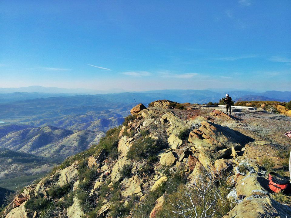
This is a hard one! To reach the summit of Berryessa Peak, you will hike approximately 7.25 miles, one way, with 3500-feet of elevation gain. There is only one way in and one way out of the public lands this trail provides access to, so bring enough water, food, and emergency medical supplies.
If you pass off the public land, you will be trespassing, so use your map and GPS and stay on the trail! The downloadable map (below) shows property boundaries and the trail location, as well as images from along the trail to use as reference. Only those in excellent physical shape should attempt to reach the summit of Berryessa Peak!
You will start from Knoxville Road, at mile marker 20.00. The trail is on the east side of the road.
Cross over the smooth-wire fence and head east, up the canyon on an old ranch road (now a trail).
After 1.6 miles, you will see a 4×4 trail marker at an intersection of the ranch road you are on, and another road that climbs up a hill to the south. Turn and take the old road to the south. Continue on this road. After approximately 1 mile you will see the last 4×4 trail marker that marks the transition to the beginning of a steeper climb. After an additional half-mile, which includes the steepest sections of the entire trail, you will arrive at a fence. To the east (the direction of the ridge) you will see a sign that says, ‘Hartwig Ranch – Keep Out’. Cross over the fence south of the sign, using the wooden stile. Stay on the trail! The rest of the property is privately owned, and access over the stile was granted by a conservation easement.
The trail continues past this point as a foot path. If you opt to only go halfway, there is a nice picnic spot on the ridge slightly less than one mile from the easement fence crossing. You can get to the ridge by climbing up a small draw. Look for a grove of oaks and pines to mark the site. This is as high as this section of trail will get to the ridge proper.
Continue on the trail as it begins to drop, slowly, into Green Canyon. Along the way you will see some gorgeous palisades. These are on private property so, once again, stay on the trail. Once you are at the bottom of Green Canyon you will have passed onto Bureau of Land Management (BLM) public lands and will remain on BLM land for the rest of the hike.
The trail climbs out of Green Canyon, crosses another small drainage, then begins to again climb to the ridge. After 1.5 miles you will find the end of the hiking portion of the route at an intersection with a gravel service road. Continue south on the service road for another 1.2 miles to the summit of Berryessa Peak and the transmitter towers.