Tuleyome Adventures Education Program- How the Land is Continuously Changing

If you reside in California, you’ve likely heard of the San Andreas Fault. But did you know that the San Andreas is just one of a series of faults created by the convergence of the North American plate and the Pacific Plate? The Earth’s Crust, broken into many pieces called tectonic plates, are constantly moving, shifting, and colliding. But their borders rarely make straight lines as often portrayed on tectonic maps. Rather, the crust fractures and creates multiple fault lines. At each of these fault lines, pressure can build up and be released in many different ways.
We happen to reside at the center of one of the most interesting geological areas in the world. From an educational standpoint, this is an amazing opportunity! Our nation-wide science standards, the NGSS, ask 4th grade students to understand the geological processes that have helped shape the Earth. That’s a big ask! It can be difficult for a lot of us to wrap our heads around the vast amounts of time and slow, grand processes that go into creating the features of the Earth including mountains, valleys, and volcanoes. So, if you can stand in a place and actually see the results of that process and place your hands on a simulation that replicates the geological space around you, that can be a profound experience. This is exactly what we are doing with the Land Trail at Woodland Regional Park Preserve (WRPP).
When 4th and 5th grade students visit WRPP to attend the land trail, they will not only see the effects from various geological processes, they will get to simulate them using a number of different demonstration tools. Students begin the trail by looking at a geological process that tends to have more immediate effects, specifically erosion. Making predictions beforehand, students will experiment with different soil types and vegetation coverage to see how each is affected by the forces of wind and water. The landscape of WRPP is comprised mostly of clay soils and as students will discover, water tends to pool up on clay soils which lends itself to the wetlands we have at the preserve. They will also find, however, that without the protective cover of vegetation, wind and water are powerful and sometimes destructive forces that can drastically change the landscape of the land.
After the first simulation, students will move out in both space and time to consider how the region in which we live has formed over millennia. Students will use topographical maps of the region, specifically of the Berryessa Snow Mountain National Monument, along with their binoculars to identify many of the features in our area. Berryessa Snow Mountain National Monument is a fascinating geological wonder, home to a lesser-known fault that resides along the border of the 2 plates, the Bartlett Springs Fault. The mountains in this region, which students will be able to spot with their binoculars, were formed hundreds of millions of years ago, during the Jurassic period. And it was formed under the sea.
To gain an understanding of what this process would look like, students will engage in another simulation- a sea mountain creation demonstration table. The activity will allow students to fast-forward through geologic time and watch a simulated version of the plates converging, one submerging under the other, with cooling magma and crust rising out of the sea to form mountains. In the Bartlett Springs area, this phenomenon has led to sea-life fossils dating back to the Jurassic Period and a special type of rock called the Serpentinite rock. Over time, the Serpentinite rock has experienced the same weathering and erosion process students already learned about, leading to a unique soil composition in this region of the monument- Serpentine soils.
Along with locating the features of the region both on the map and through their binoculars, students on this trail will have the opportunity to see sample Serpentinite rocks and soil from the area. The rock type is just one piece of evidence of the geologic history of our region. Another clue is fossil evidence. Finding fossil evidence in a region provides important information about what took place before our time. Students will get to experience this during their simulated excavation dig in which they unearth clues like those found in the Bartlett Springs region.
At the end of trail we will circle back to our first simulation in which we looked at the process of erosion. Throughout our time on the trail we will be focusing on the question: “how has the land changed over time?” What students will ultimately discover during our time at WRPP is that the land has changed significantly and that some of these changes have occurred slowly while others occur quite quickly and have great impact on our daily lives. But humans can have a large amount of influence over some of these changes by choosing how we manage our land.
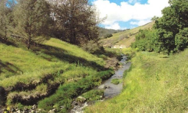
(Photo from "Remarkable geology sets new Berryessa Snow Mountain National Monument apart" by EldridgeM. Moores and Judth E. Moores, Earth Magazine 11/12/15)
-Kara Green (kgreen@tuleyome.org)
Education Associate
RECENT ARTICLES


