Monumental Questions - What is the Bartlett Springs Fault Zone?

Bartlett Springs Fault location (USGS)
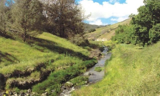
Within the Berryessa Snow Mountain National Monument (BSMNM) boundaries lies the Bartlett Springs Fault zone. The Bartlett Springs Fault is part of a larger southeasterly trending fault system that also includes the Green Valley Fault and the Calaveras Fault. The Bartlett Springs Fault runs approximately 100 miles through Lake County beginning at the Round Valley Indian Reservation and then south ending east of Clear Lake after crossing Bartlett Springs Road.
The Bartlett Springs Fault was acknowledged decades ago but it was not determined to be regionally seismically significant until the 1980’s. Geologists have found that the Bartlett Springs Fault slips approximately a quarter of an inch a year compared to the much larger San Andreas Fault which is estimated to move approximately two full inches a year. Despite being a relatively small fault, the Bartlett Springs Fault is seismically active and over time geologists have followed a series of microearthquakes with epicenters along the fault line. A relatively strong 5.1 earthquake occurred along the fault as recently as 2016, the most significant quake in 50 years and was felt from the coast east into the Central Valley of northern California.
Most of California’s faults are part of a wide zone formed as the edges of the Pacific and the North American plates rub and slide against each other. The Bartlett Hot Springs which are located along the fault line and within BSMNM boundary are a result of this tectonic activity. Hot springs occur when rain or groundwater is heated by the Earth’s geothermic energy beneath the surface. The temperature of the heated water causes it to seep to the surface. The region around the fault line also has geologic outliers; areas of younger rock surrounded by older rock. An outlier forms when some of the surrounding older rock is eroded leaving a section or “island” of younger rock that is no longer contiguous with the remaining layer of younger rock. The geologic outliers in the Bartlett Hot Springs area contain marine invertebrate fossils that date back to the Cretaceous Period which began 145 million years ago as well as fossils from our current (Cenozoic) era. Landslides in the area also presumably created two tension-crack caves that support habitat for Townsend’s big-eared bat (Corynorhinus townsendii), a special-status species. The serpentine soils in the region are a result of long-past frequent seismic activity and support several endemic plant species including the Adobe lily (Fritillaria pluriflora).
-Kristie Ehrhardt (kehrhardt@tuleyome.org)
Tuleyome Land Conservation Program Manager
RECENT ARTICLES


