Monumental Questions - Tell me More About Cache Creek

Kristie Ehrhardt • May 11, 2022

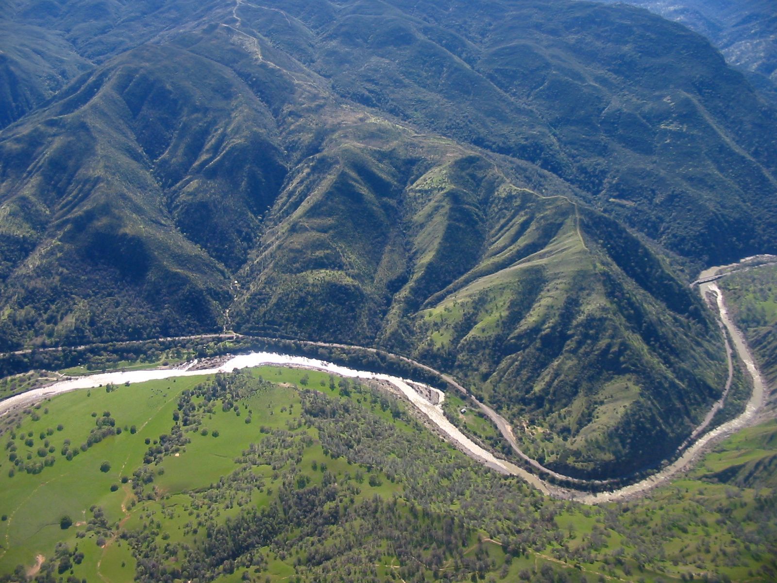
Cache Creek flows past Valley Vista Regional Park as it enters Capay Valley

Cache Creek begins at Clear Lake and is the only outlet for the Lake. The Cache Creek watershed flows east through Lake, Colusa and Yolo Counties and eventually into a settling basin near Woodland where the sediments are allowed to settle out and the water is then released into the Yolo Bypass and eventually into the Sacramento River through a series of flood control channels.


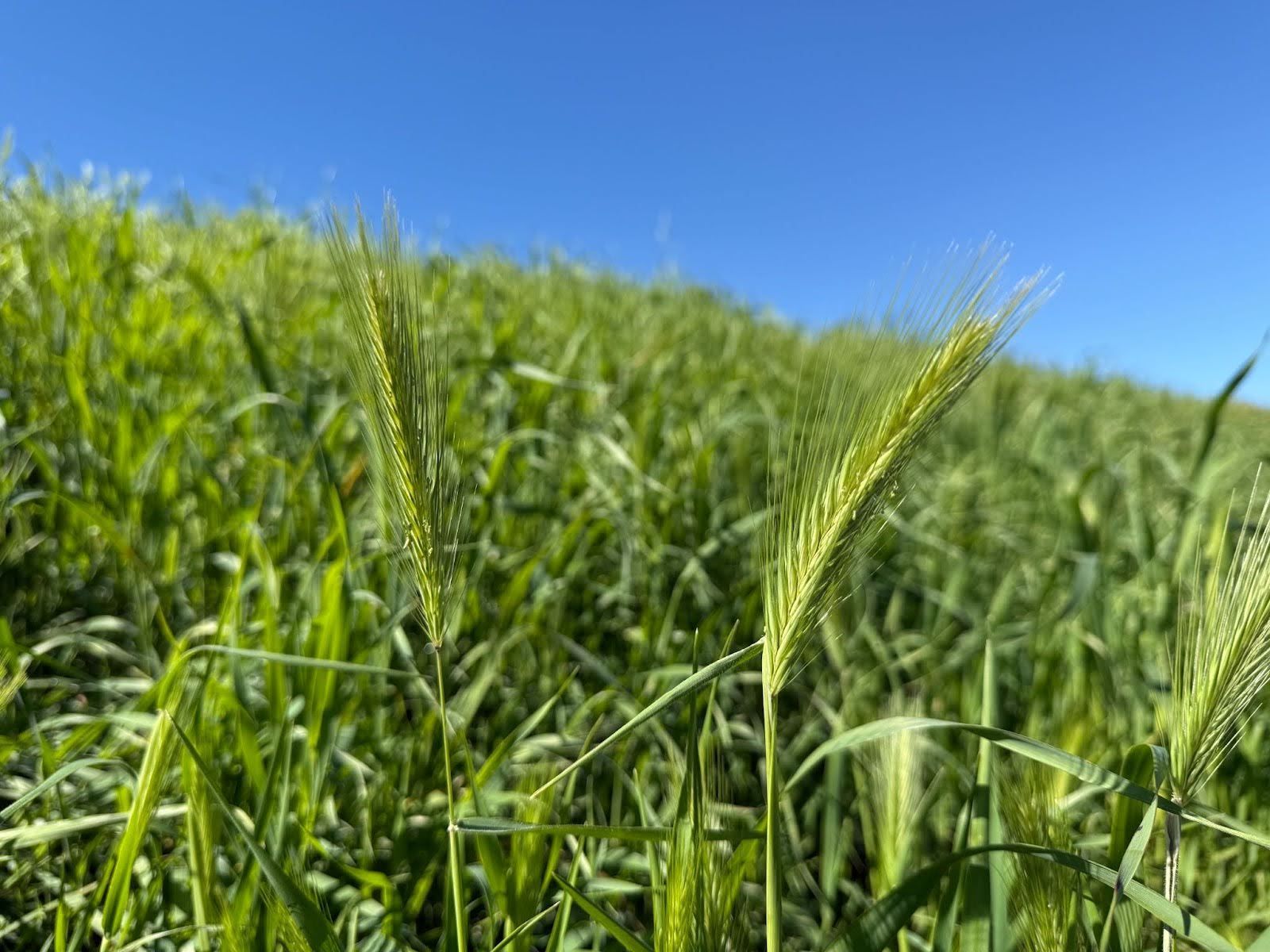
Upper Cache Creek courses through a canyon vegetated mainly with chaparral and is generally inaccessible. There are a few tributaries that flow into Cache Creek but the two major tributaries are the North Fork and Bear Creek. The North Fork begins north of Clear Lake on the slopes of Goat Mountain in the Mendocino National Forest, through the Indian Valley Reservoir and into Cache Creek below Highway 20. Bear Creek flows through the wildflower hotspot of Bear Valley and joins Cache Creek in Colusa County, then progresses through Yolo County’s splendid Capay Valley.


The name “Cache Creek” comes from the then Canadian-owned Hudson Bay Company, which began exploring Northern California via the Siskiyou Trail between 1820 and 1830. In 1828 they began trapping along the Sacramento River and caching their furs and pelts along the river’s tributaries, including Cache Creek – and the name stuck.


A landslide that resulted from the 1906 San Francisco earthquake temporarily blocked Cache Creek north of the town of Rumsey. The blockage caused the creek level to drop drastically and, in some places, it went completely dry. Eventually the creek broke through the mud and caused severe flooding in Rumsey. A rock ledge, called the Grigsby Riffle, approximately a mile and a half downstream from Clear Lake restricts water flow and increases the chances of flooding for communities around the lake. In 1914, a dam was constructed on the main fork of Cache Creek a few miles downstream of Clear Lake. The dam, cleverly named Cache Creek Dam, was built to increase the lake’s capacity and to regulate the outflow but the narrow, shallow creek channel does not allow the water to flow as fast as the dam can release it. This causes the water in Clear Lake to rise rapidly after prolonged rain events and to decrease very slowly. If flows were increased by altering the creek channel, communities downstream in Yolo County would be subject to flooding. This has been a long-standing squabble between counties resulting in court decisions and ongoing negotiations. The Capay Diversion Dam was constructed approximately 50 miles downstream from the Cache Creek Dam to distribute water throughout Yolo County using a network of canals and water control structures. 


Beginning in the early 1800’s and for about the next 150 years, mercury (also called quicksilver) mining took place along Cache Creek and other waterways in California. Because there were no environmental regulations then, waste from mining activities made its way uncontrolled into Cache causing an increase in mercury in both the creek and eventually the Sacramento River. In 2004 the Environmental Protection Agency (EPA) stated that the mercury level was continuing to rise in Cache Creek and that the source was nearly forty old mines along the drainage. Several partners including the Bureau of Land Management (BLM), the Cache Creek Technical Advisory Committee, UC Davis, Tuleyome and others are working to monitor mercury levels and to organize and guide mine-remediation.


Although barriers exclude fall run chinook salmon and steelhead from migrating up Cache Creek, in years with very high flow conditions, some salmon may spawn in the lower regions of the creek. The portion of the creek above the Capay Dam provides one of the best native fisheries for pikeminnow, hitch California roach and Sacramento suckers on the west side of the Valley. Other species include large and smallmouth bass and catfish.


Tuleyome led the effort to have thirty-one miles of Cache Creek designated as a California Wild and Scenic River and the watershed includes the 27,245-acre Cache Creek Wilderness Area which is managed by the BLM. It is home to two herds of Tule Elk, Bald Eagles and many other species of plants and wildlife. Further downstream, the Cache Creek Conservancy has restored a 130-acre site known as the Cache Creek Nature Preserve. Cache Creek offers many recreational opportunities including whitewater rafting (spring and summer when water is released), kayaking, canoeing, tubing, hiking and camping and more.


-Kristie Ehrhardt; kehrhardt@tuleyome.org


Tuleyome Land Conservation Program Manager

RECENT ARTICLES

By Bryan Pride April 4, 2025
A lot has happened in the Public Lands space since our last Policy Corner. Doug Burgum took his role as the 55th Secretary of the Interior, and Kathleen Sgamma received confirmation to head the Bureau of Land Management (BLM). The House Natural Resources Committee has held several oversight hearings on topics ranging from selling off public lands to establish American Energy Dominance , defunding federal agencies such as BLM as a method to incentivize Multiple Land Use by private companies and undercutting the efficacy of the Endangered Species Act (ESA) and calling it a “needed reform”. Through questionable actions made by DOGE, we have also seen thousands of Forest Service, BLM and National Park employees fired and, through court order, rehired . With all this chaos happening far and near, the real question becomes: What does all this chaos mean for Californians? Bureau of Land Management (BLM) land is concentrated in 12 western states. California holds nearly 15 million acres of BLM lands. In addition to BLM land, California has land that is managed by other federal agencies such as the U.S. Forest Service, National Park Service, and U.S. Fish and Wildlife Service. The recent reductions to staff across all federal agencies directly impacts National Monuments, National Parks, and National Forests, that are located within California. Every year, Californians, residents from nearby states, as well as international tourists visit the public lands within California as a way to spend time with families, enjoy the great outdoors, and experience mental healing. The National Park Service reported that 36.2 million people visited the 28 national parks in California in 2023 . Those visitors spent roughly $3.2 billion dollars, which supported 39,678 California-based jobs and contributed $5.1 billion dollars to our state economy. While it may not be as visible, the presence of BLM and U.S Forest Service also creates jobs in California and positively contributes to the local economies of our communities and the overall economic strength of California as a whole. Public Lands are more than recreation; they create employment opportunities and contribute to economic prosperity. Despite National Monument and public lands holding immense value in the hearts and minds of Californians and the American people in general, our public lands are being threatened. It was announced earlier in the month that DOGE plans to close federal offices across the United States. One of the offices that has been targeted to close is the Ukiah BLM office . The Ukiah BLM office plays a significant role in coordinating protection for the federal lands in California ranging from the intercostal mountain range and Berryessa Snow Mountain National Monument, which includes the Mendocino forest. The Ukiah office assists with issuing permits for timber harvesting, livestock grazing, off highway vehicle recreation, and overseeing proper adherence to environmental preservation practices. Additionally, Ukiah is essential in coordinating CalFire dispatch and response to the wildfires that affect our forests and our communities. The Ukiah BLM office also houses the Berryessa Snow Mountain National Monument Manager. Without a Ukiah office, the Monument Manager's ability to respond to fires, guarantee safety, and ensure that conservation practices are taking place in and around the monument is reduced. This means that our public lands and forests are at heightened risk of wildfires and trails we love to hike become unsafe to those who use them. The closure of the physical office is not the only threat to Ukiah BLM operations. Many of the staff have been in their posts for years and have recently been promoted, meaning the invaluable staff is at risk of being terminated due to their probationary status. We run the risk of losing these public servants and the institutional knowledge they have of our public lands. 1.5 million Californians throughout the region will be affected if we lose the Ukiah office or staff. The Department of Interior (DOI) is also proposing selling an area of federal land larger than the city of Los Angeles as part of the agency's plan to use public lands to help solve the recently announced "housing and energy crisis." The DOI is looking to sell about 400,000 acres—625 square miles—of federal lands for housing. Federal lands that are within a radius of up to 10 miles of all cities and towns with a population greater than 5,000 people are at risk of being sold to private companies. This has the potential to affect communities that are near the Berryessa Snow Mountain Monument. When private companies have ownership of land that surrounds protected landscapes, public access to National Monuments is reduced, oversight on how once-public lands are managed is lost which has the potential to result in the destruction of monuments such as the Berryessa Snow Mountain. With so much going on in the Public Lands and Conservation space, Tuleyome is working hard within our networks to fight against policies that put our public lands at risk. For the past several weeks, we have connected with both Congressional Offices and members of the California State Legislature, asking our representatives to be advocates for our public lands and promote good land stewardship. On March 18th, Tuleyome joined the California Power in Nature Advocacy day, where we, along with 80 other organizations throughout California, gathered in Sacramento to advocate for policies that prioritize the protection of California Public Lands and Coastal Waters. This was an opportunity for Tuleyome to amplify the voices and concerns that many of us have regarding public lands and the importance of prioritizing land protection. We were well received by California Legislators and hope to see statewide initiatives that strengthen conservation practices and promote good land stewardship. Reaching beyond a state level, Tuleyome is partaking in a Conservation Lands Foundation advocacy Fly-in where I will be visiting Congressional Representatives in Washington D.C. and advocating for the importance of: public lands remaining public, the necessity to reinstate park rangers and other public servants in our U.S. Forest Service, and Bureau of Land Management offices. Our visit to Washington will feature stories and connections about how we enjoy our public lands as outdoor enthusiasts, community members, botanists, and individuals whose livelihoods are dependent on public lands. Each time we engage in these efforts, Tuleyome is representing our diverse community and advocating on behalf of the land we love, but we could still use more help in amplifying the importance and love of our public lands. I want to thank everyone who has been emailing and asking how to help advocate for our public lands. All of us have the ability to advocate for keeping our public lands in the hands of the public; together, we have strength, and we can amplify our voices. For those of you who are interested in getting involved, there are many ways to help out. Some of the most impactful efforts include calling your state and federal representatives. Elected officials want to hear from you. Calling elected officials leads to impact; each call is documented and reviewed. It is one of the best methods for elected officials to keep record of what their constituents care about. I want to urge our readers to call your representatives, and it's okay to call multiple times. Each time you call, it is documented and demonstrates the urgency associated with the cause. Even if you called once before, call again and keep calling. Reaching out to friends, family members, and community groups and encouraging them to call their representatives is a powerful way to advocate. Don't know who your representative is? No problem—use these links to find both state and federal representatives by using your zip code. You can also send letters to elected officials. Using this link , you have the chance to send a letter to your elected officials and customize what you want to say about public lands. We encourage folks to use these grassroots options and join the fight to keep our public lands public. All of us have the ability to advocate for our public lands and its resources – wildlife, flora, fauna, water and culture. If you're interested in learning more ways to help raise awareness and advocate for your public lands, feel free to reach out to me. Until then, Happy Hiking! -Bryan Pride ( bpride@tuleyome.org ) Policy Director
By Kristie Ehrhardt April 4, 2025
We know how special Molok Luyuk is; to the indigenous people that call it home, to those of us who visit it regularly and for posterity. With 500 different types of plants - 40 of them rare, Bald and Golden Eagles, Tule Elk, unique soils and fascinating geology, we already knew that Molok Luyuk deserved to be protected inside the Berryessa Snow Mountain National Monument boundaries. And now, it's getting some well-merited attention from BayNature.org . Check out what they have to say about one of our favorite places! -Kristie Ehrhardt ( kehrhardt@tuleyome.org ) Tuleyome Land Conservation Program Manager
By Kristie Ehrhardt April 4, 2025
You’ve probably enjoyed at least some portion of National Conservation Lands and may have not even known it. Primarily focused in the western United States, National Conservation Lands comprise over 38 million acres that includes California Desert, Conservation Areas, National Monuments, National Scenic and Historic Trails, Wilderness Areas, Wilderness Study Areas, and Wild and Scenic Rivers. With such a vast collection you can imagine the landscape and artifacts found in the National Conservation Lands program varies greatly ranging from brawny Alaskan tundra, dynamic coastlines, enchanting red-rock deserts, noble historic lighthouses, intricate waterways and serene mountains. National Conservation Lands provide public access to recreational and scientific research opportunities along with protected critical habitat for sensitive species and wildlife migration corridors. While some of the National Conservation Lands are remote, so much that for thousands of years they were protected just by their location or accessibility. Other National Conservation Lands are nearby and easily accessed, especially now that today one in six people live within 100 miles of federally protected public land. The National Conservation Lands program was created in 2000 by conservationists in response to mounting threats to cultural resources, waterways and public lands managed by the Bureau of Land Management (BLM). The BLM currently manages roughly 245 million acres of public land, more land than any other agency in the United States. But, only about 15%, around 37 million acres of those protected areas are designated as National Conservation Lands - lands that possess some of the last remaining wild, ecologically sensitive and culturally rich areas in the Western United States. They are often described as the landscape between more commonly known and familiar public lands such as National Parks and National Wildlife Refuges. Protecting these “in between areas” means safeguarding large, intact landscapes, ecosystems and culturally rich areas as one unit. These areas are managed to honor the ties that indigenous communities have to their lands while also embracing diverse interests and uses for future generations. The National Conservation Lands Foundation was formed in 2007 and combined a local grassroots network with a sophisticated national presence to permanently protect more land as well as offer support to other like-minded community-led organizations and advocates who all share a love of public lands. Today, the National Conservation Lands program includes 28 National Monuments (including our favorite, The Berryessa Snow Mountain National Monument), 25 National Conservation Areas, 21 million acres of Wilderness and Wilderness Study Areas, 2,700 miles of Wild and Scenic Rivers and 6,000 miles of Historic Trails. Not bad for only 25 years worth of work! To learn more about National Conservation Lands in California visit : https://www.blm.gov/programs/national-conservation-lands/california To learn more about our friends at Conservation Lands Foundation visit : https://www.conservationlands.org/ -Kristie Ehrhardt ( kehrhardt@tuleyome.org ) Tuleyome Land Conservation Program Manager