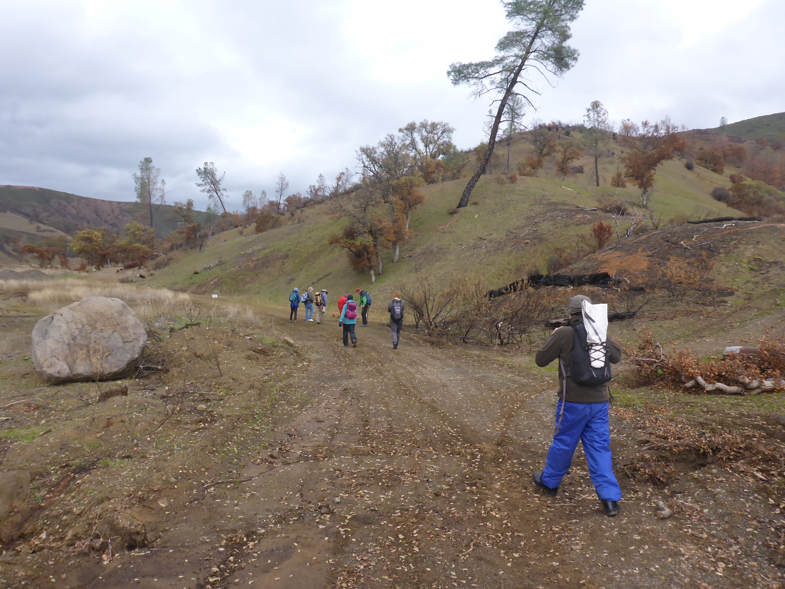
This is the Blog for the Sacramento Zoo Projects #18-022 and #Q4C19-008 for our in situ wildlife field studies and Post-Wildfire Restoration efforts in Lake County, California:
This blog will be used to track our progress with the projects funded in part by the Sacramento Zoo Conservation Fund and the zoo's Quarters for Conservation Program. Entries will appear with the most recent post first, and others following in reverse chronological order. For more information about these projects, to be added to the mailing list and to volunteer contact Nate at nlillge@tuleyome.org. or fill out the online form at the bottom of this page: http://tuleyome.org/projects/habitatrestoration/
POST 5-6-19
PROJECT ID #18-022
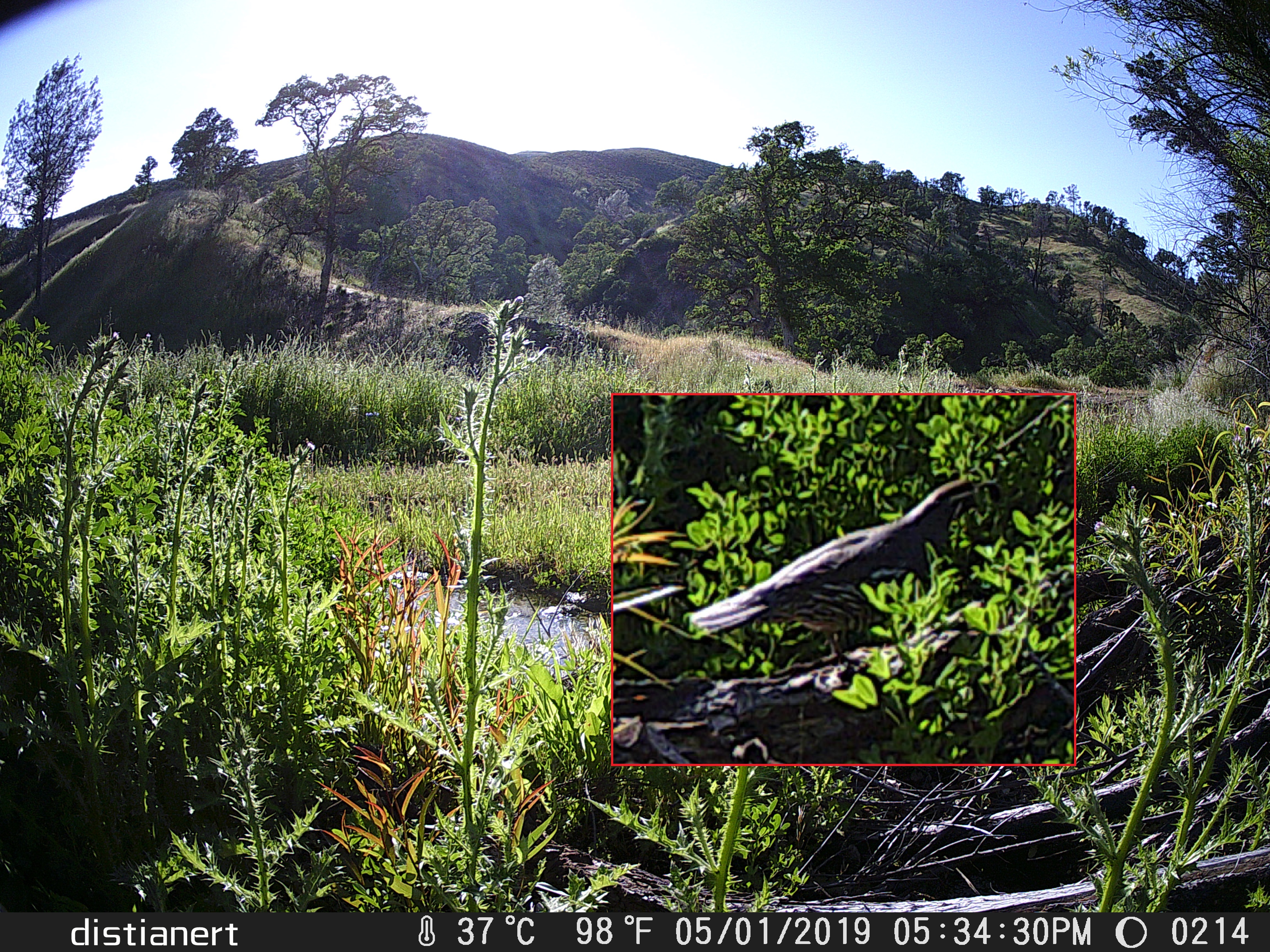
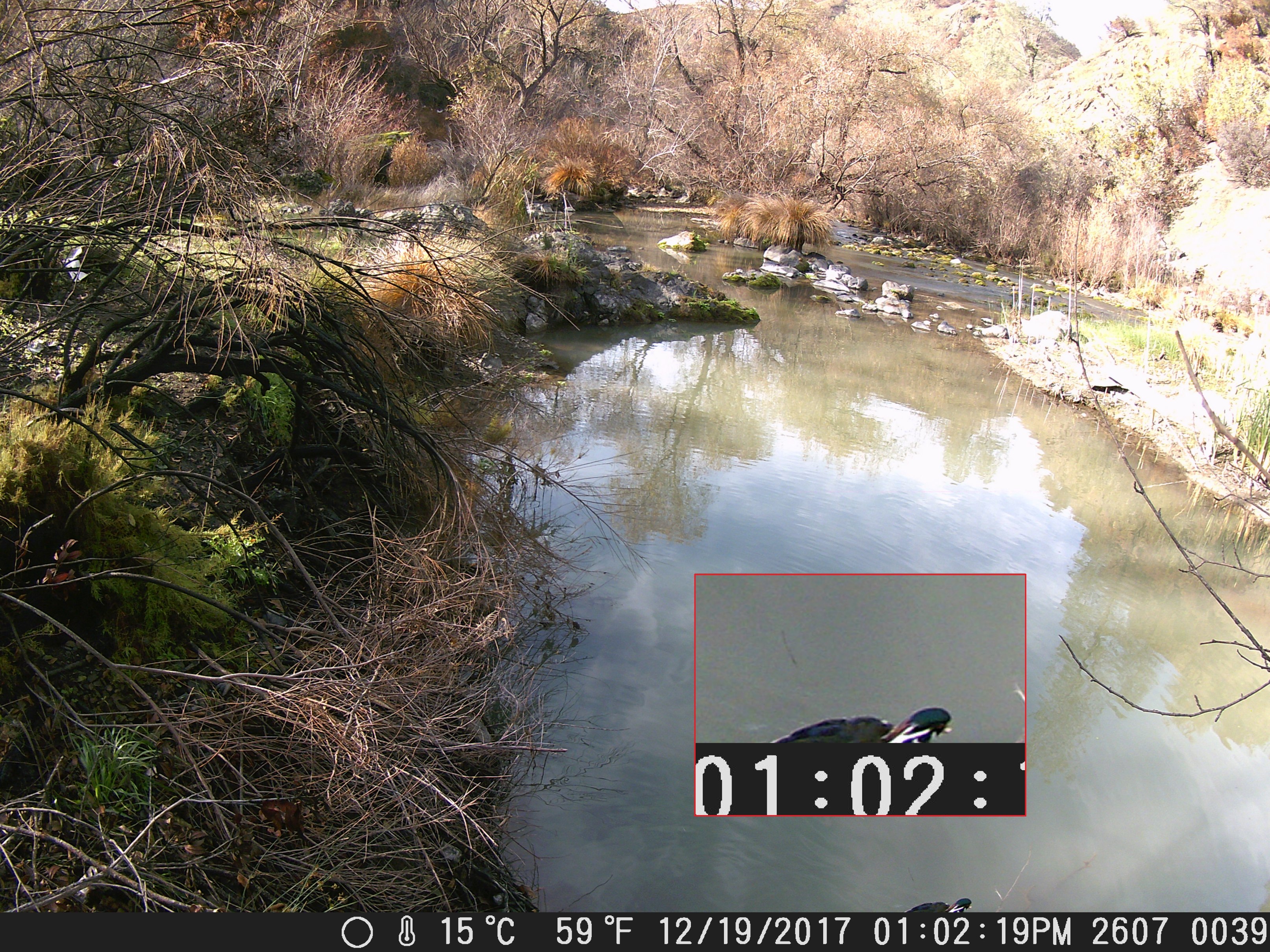
Bird in action!
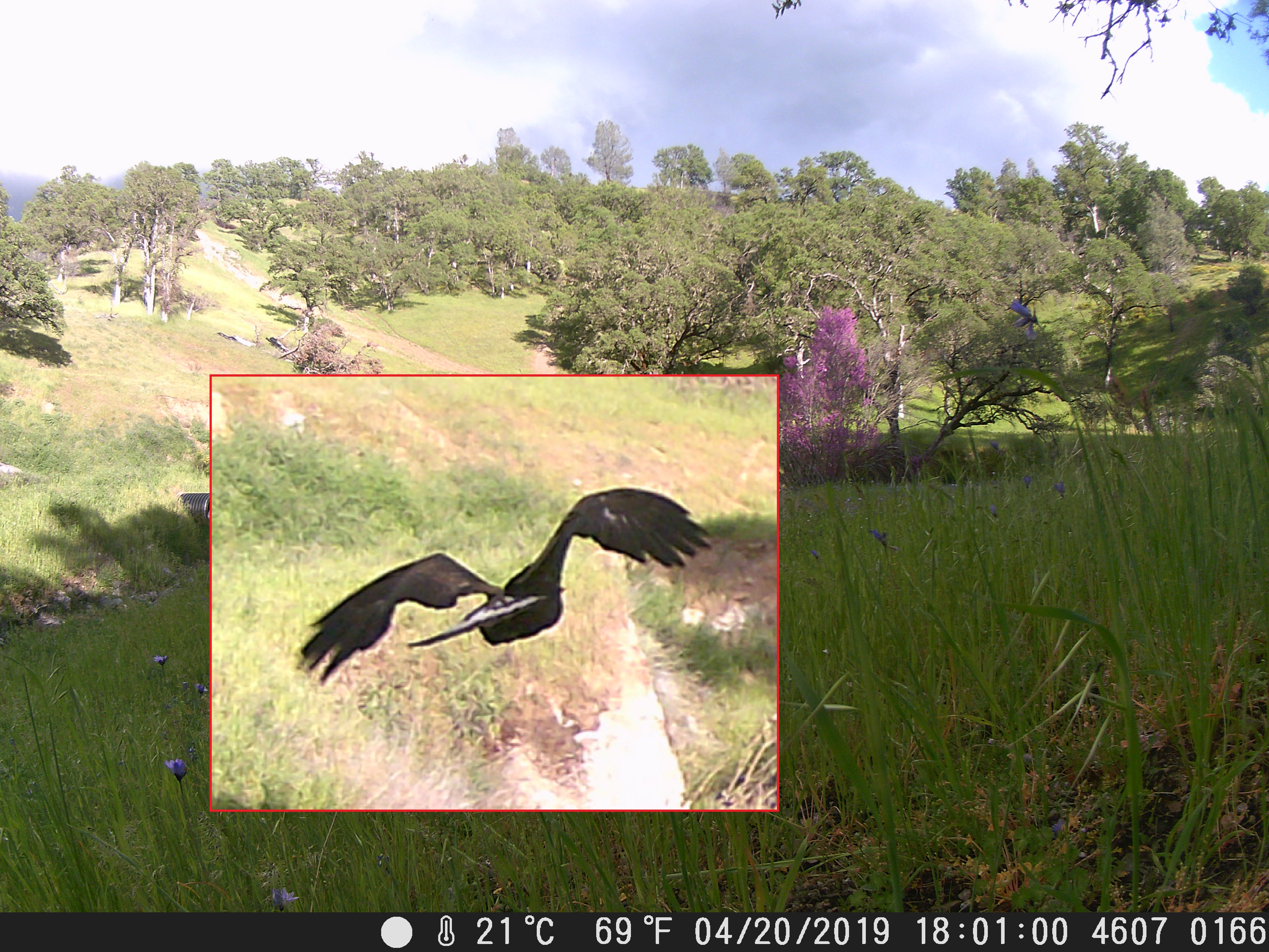
Bald Eagle? Golden Eagle? Something else?
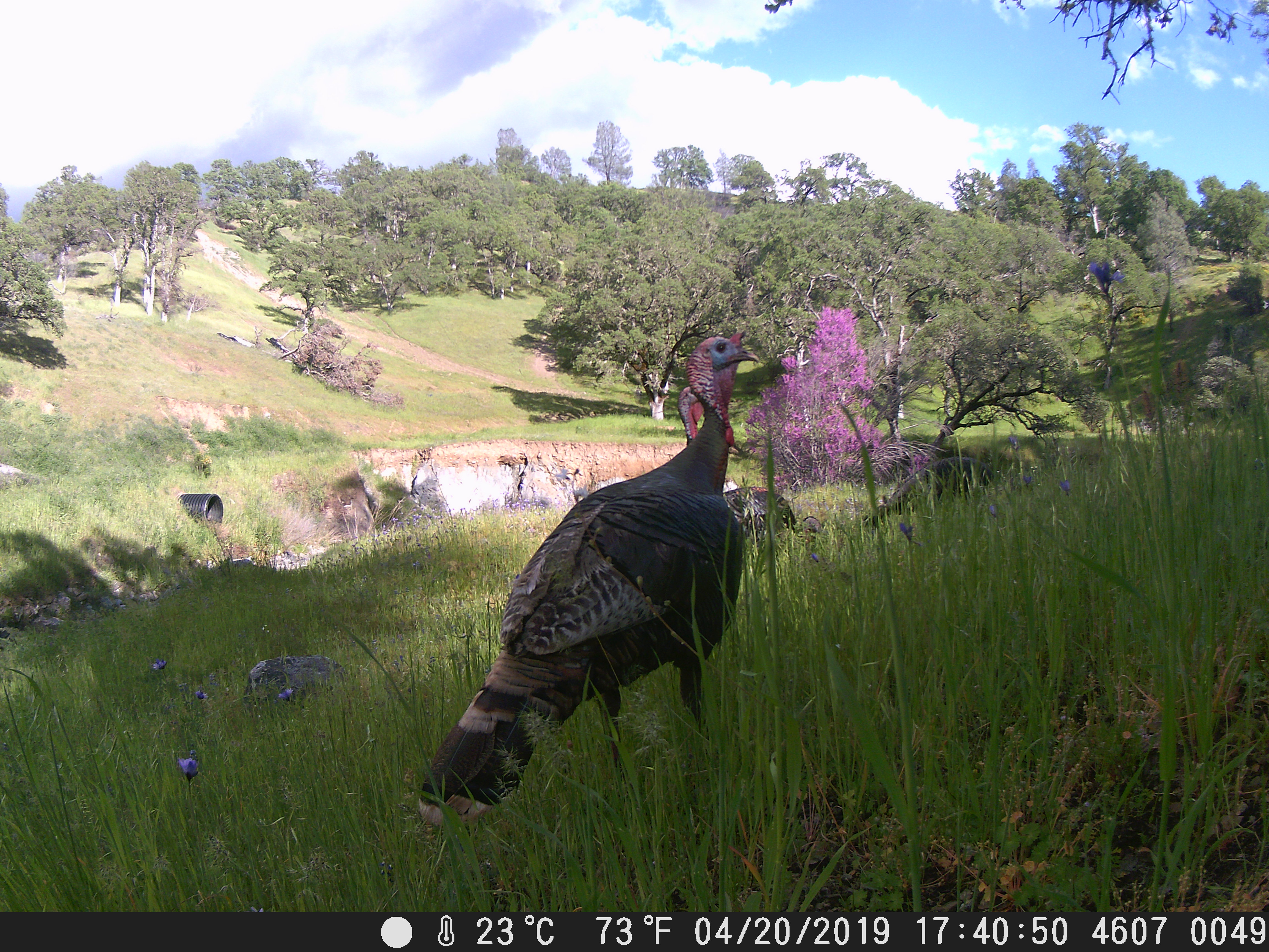
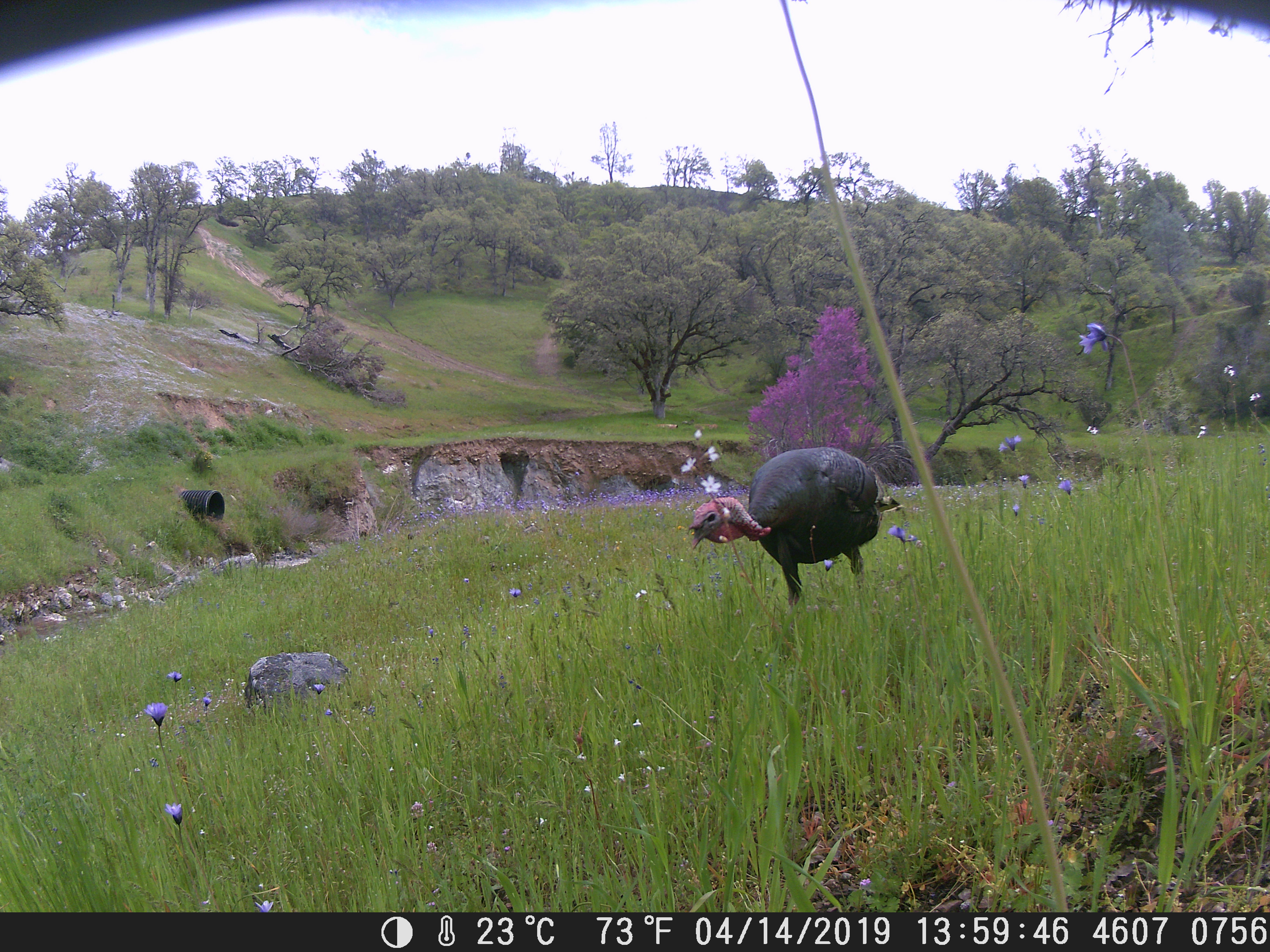
Wild Turkey (Meleagris gallopavo)
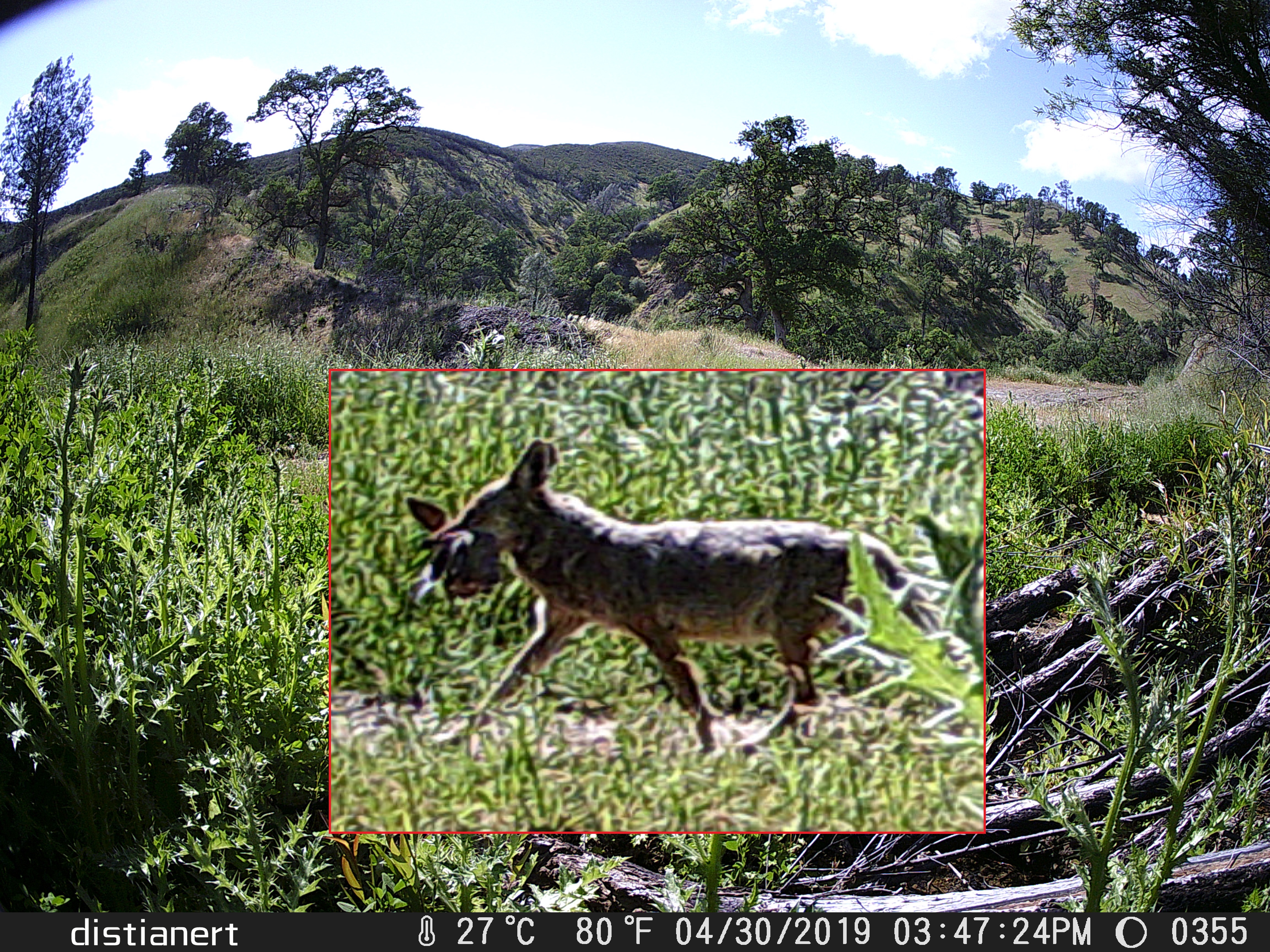
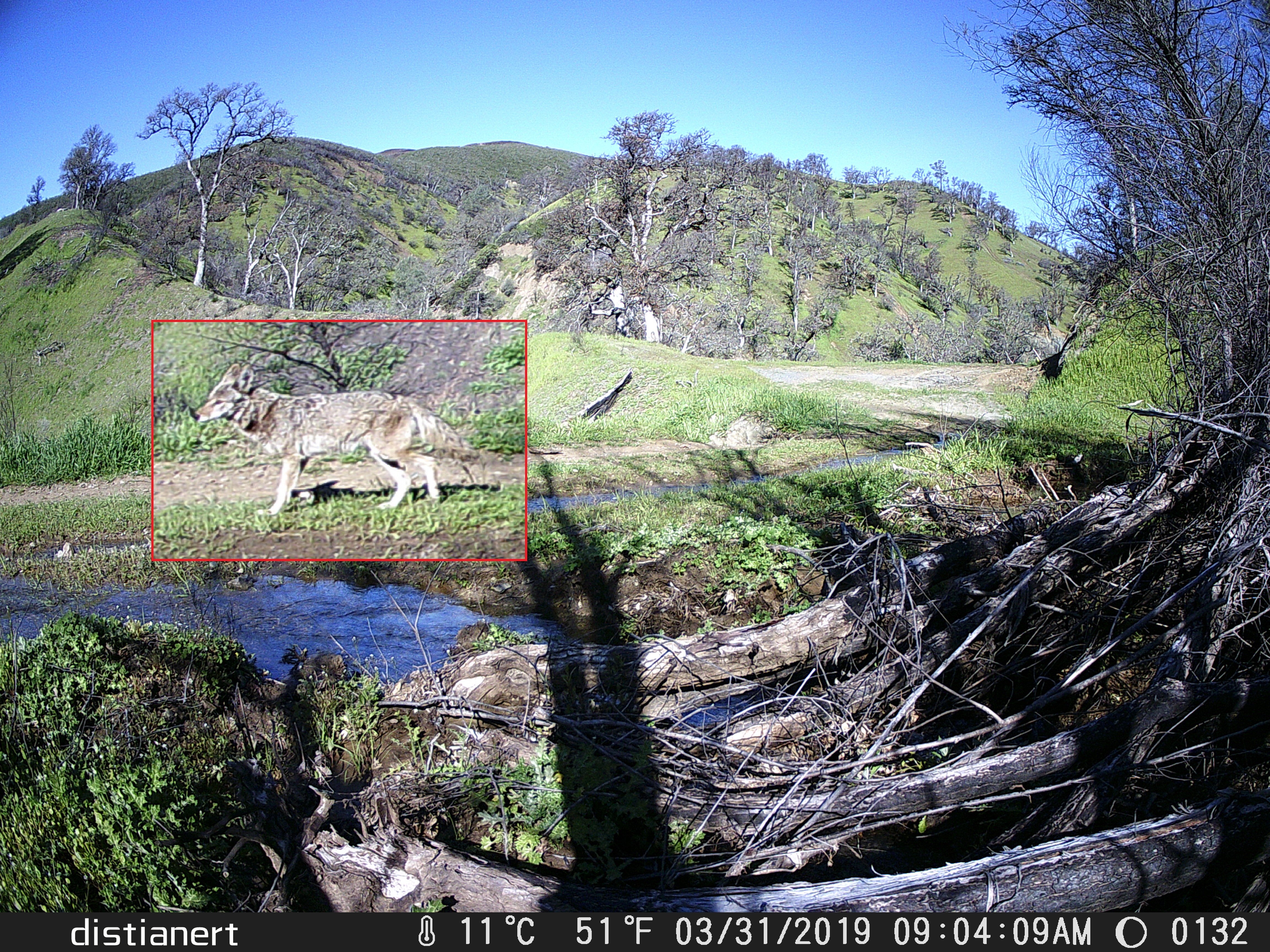
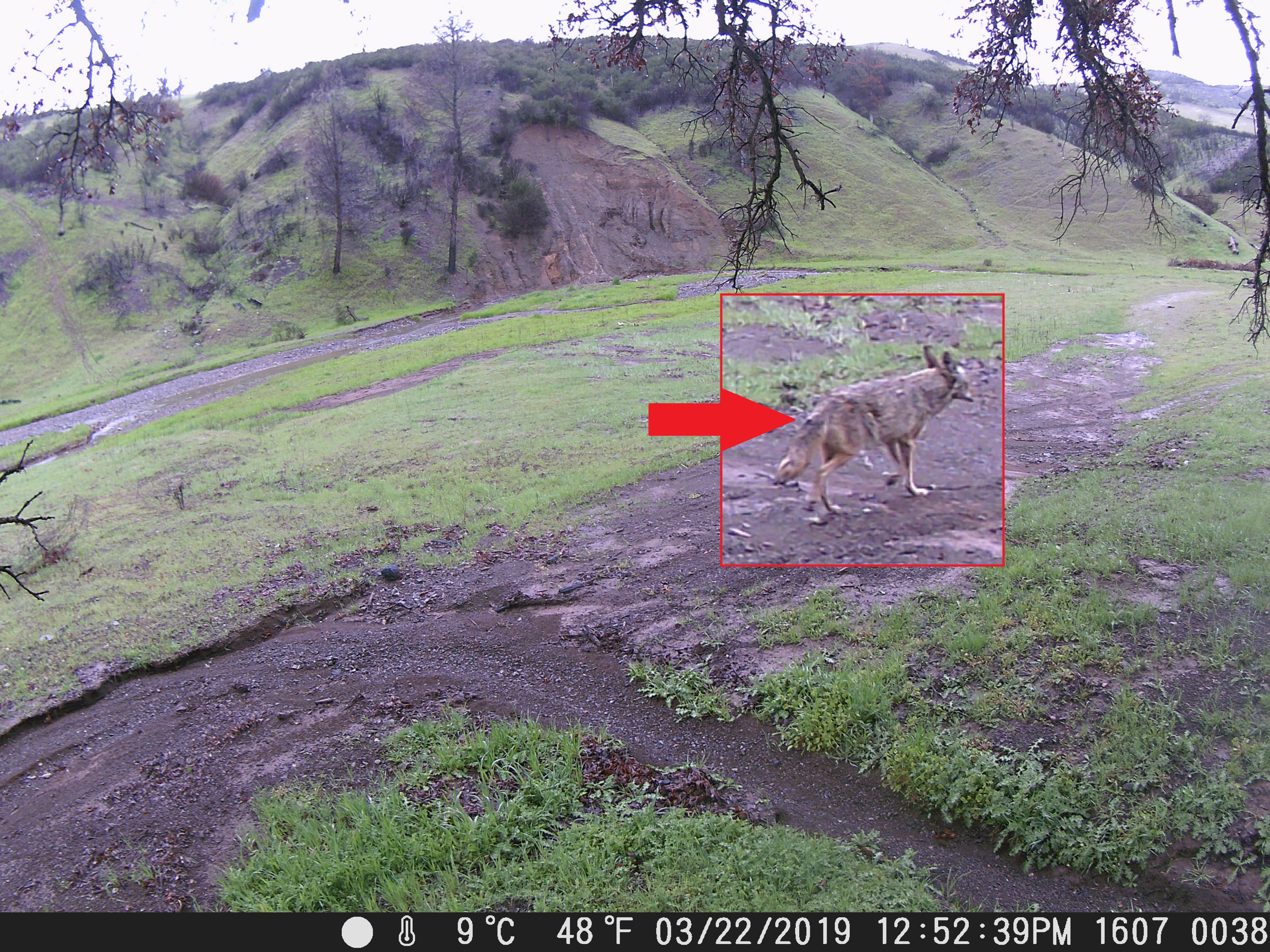
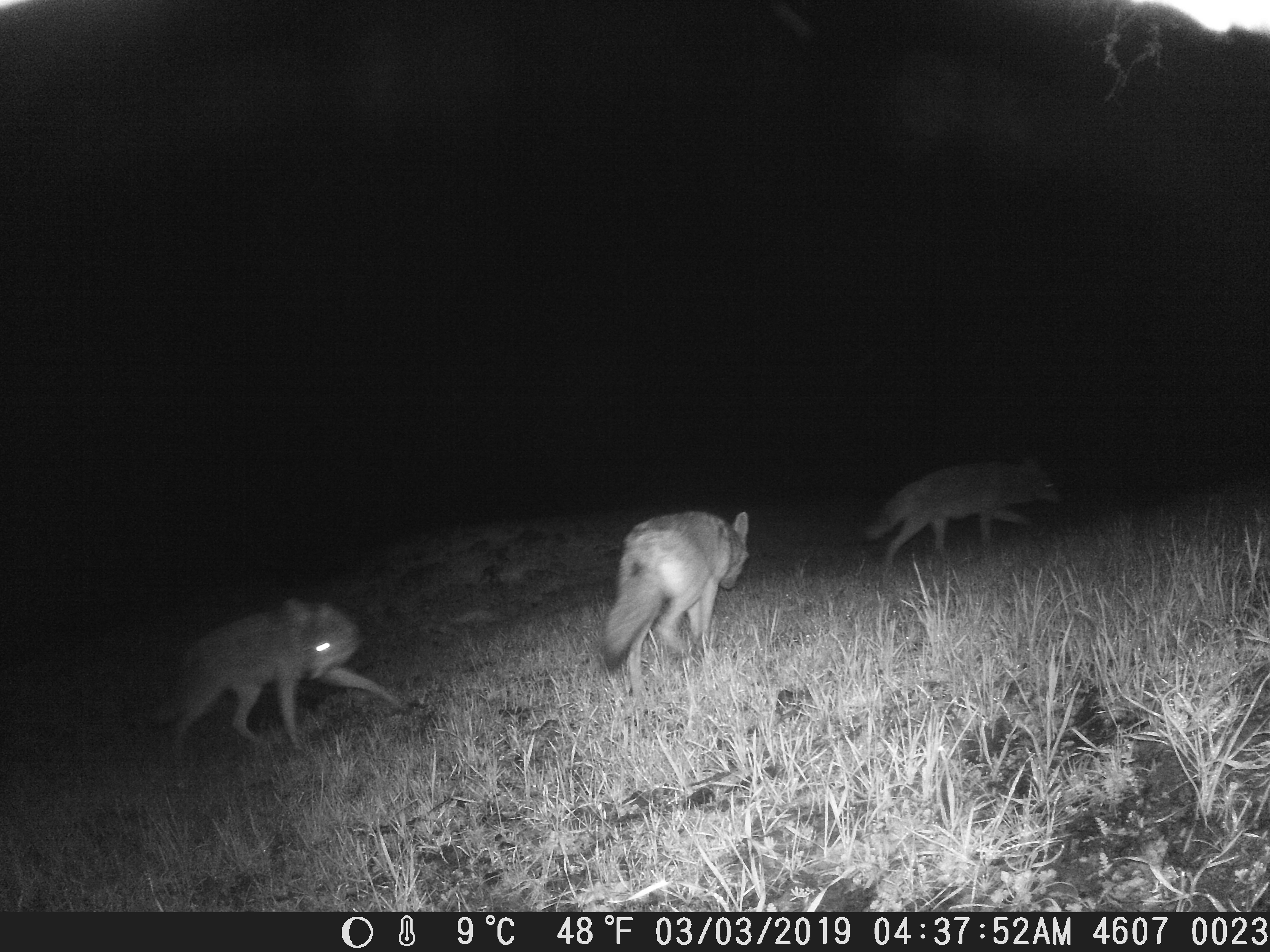
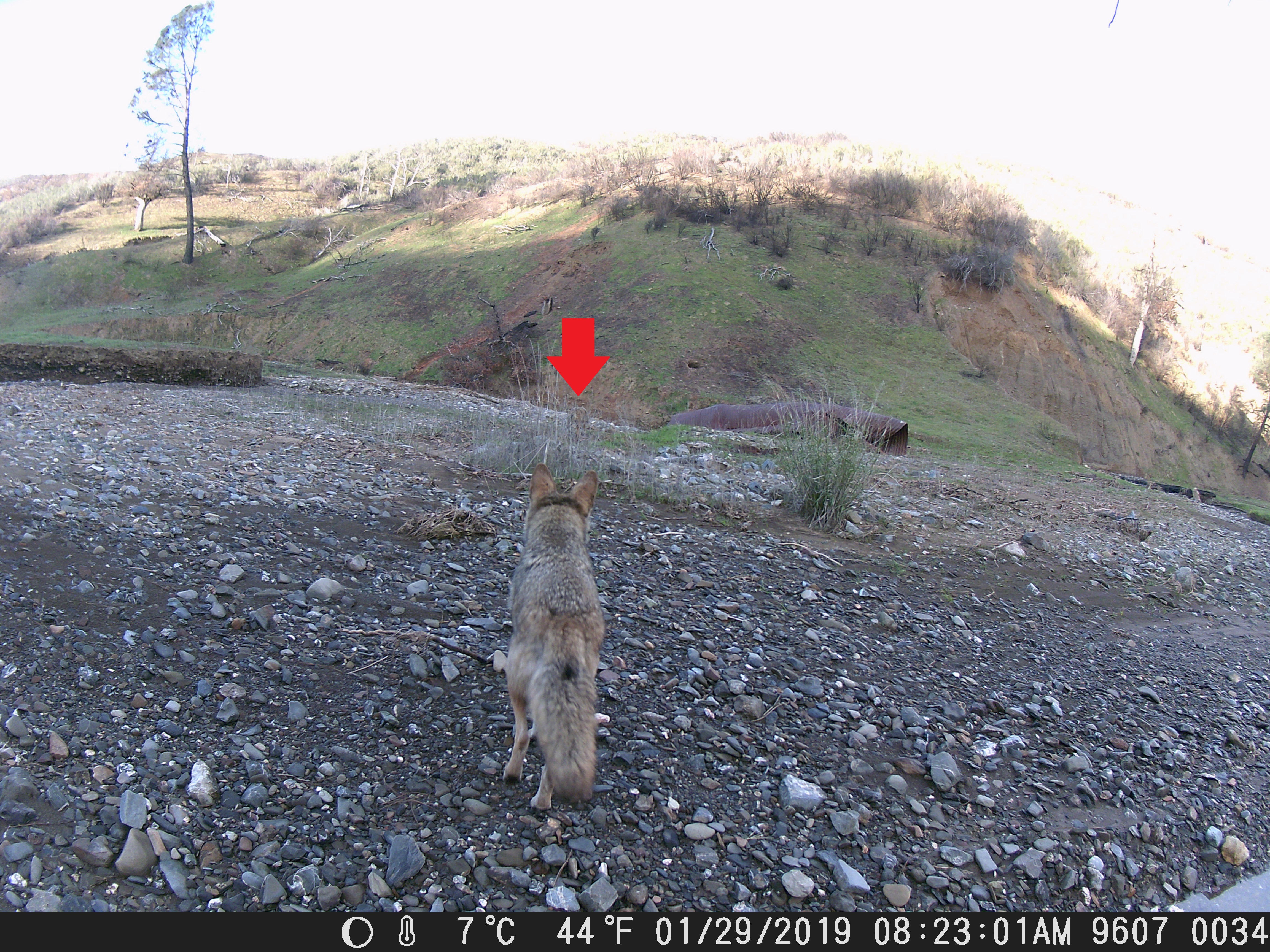
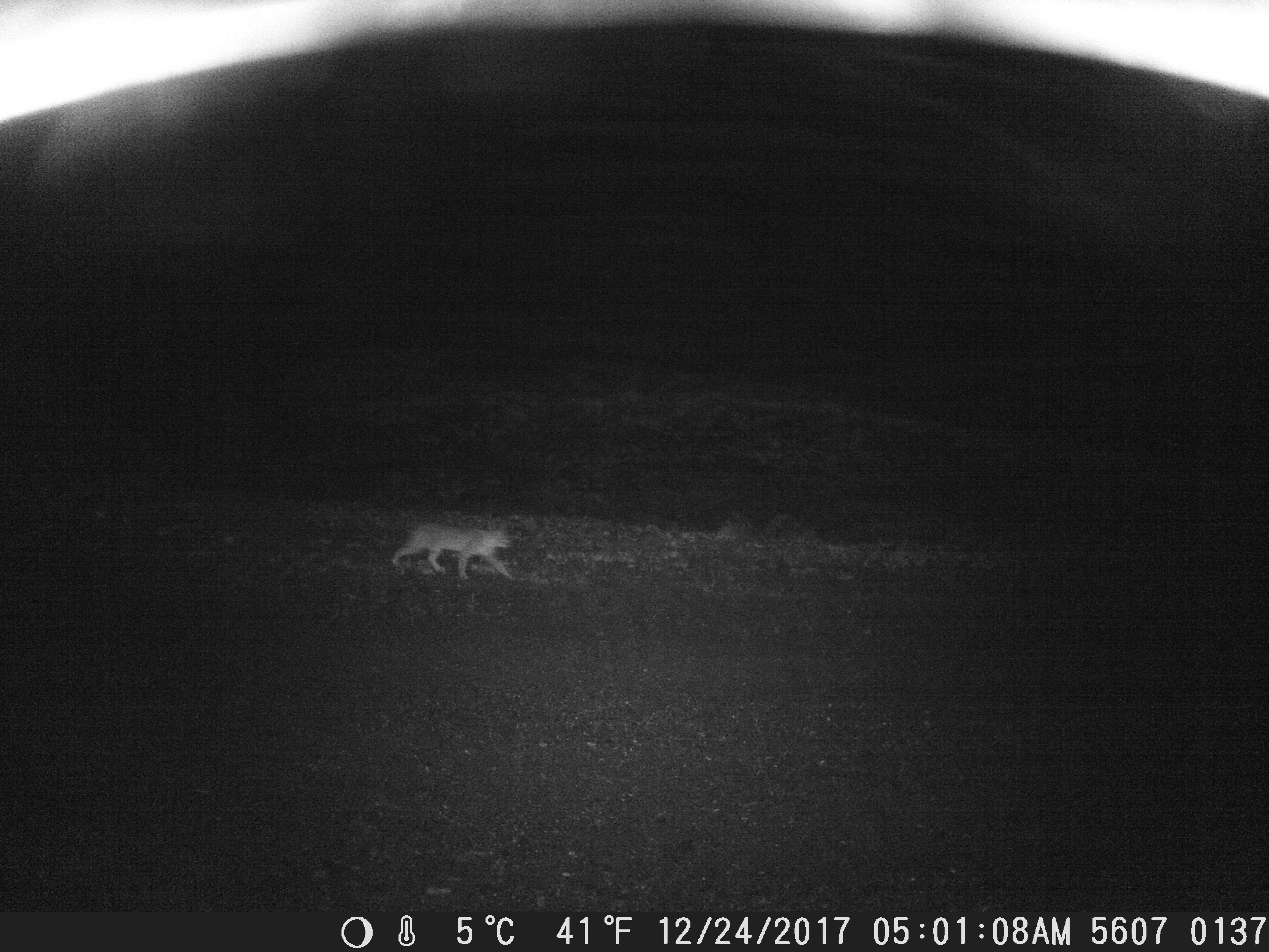
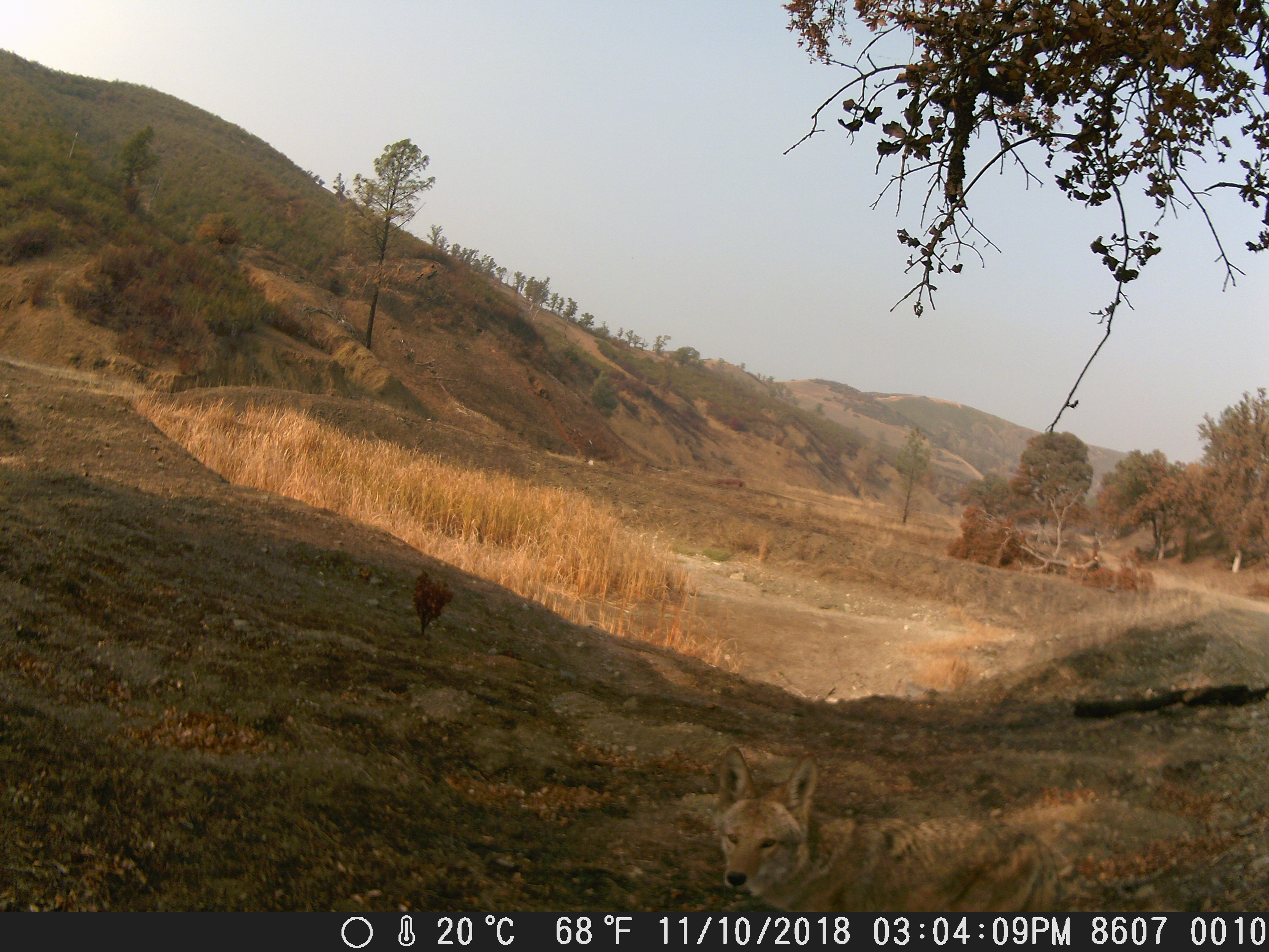
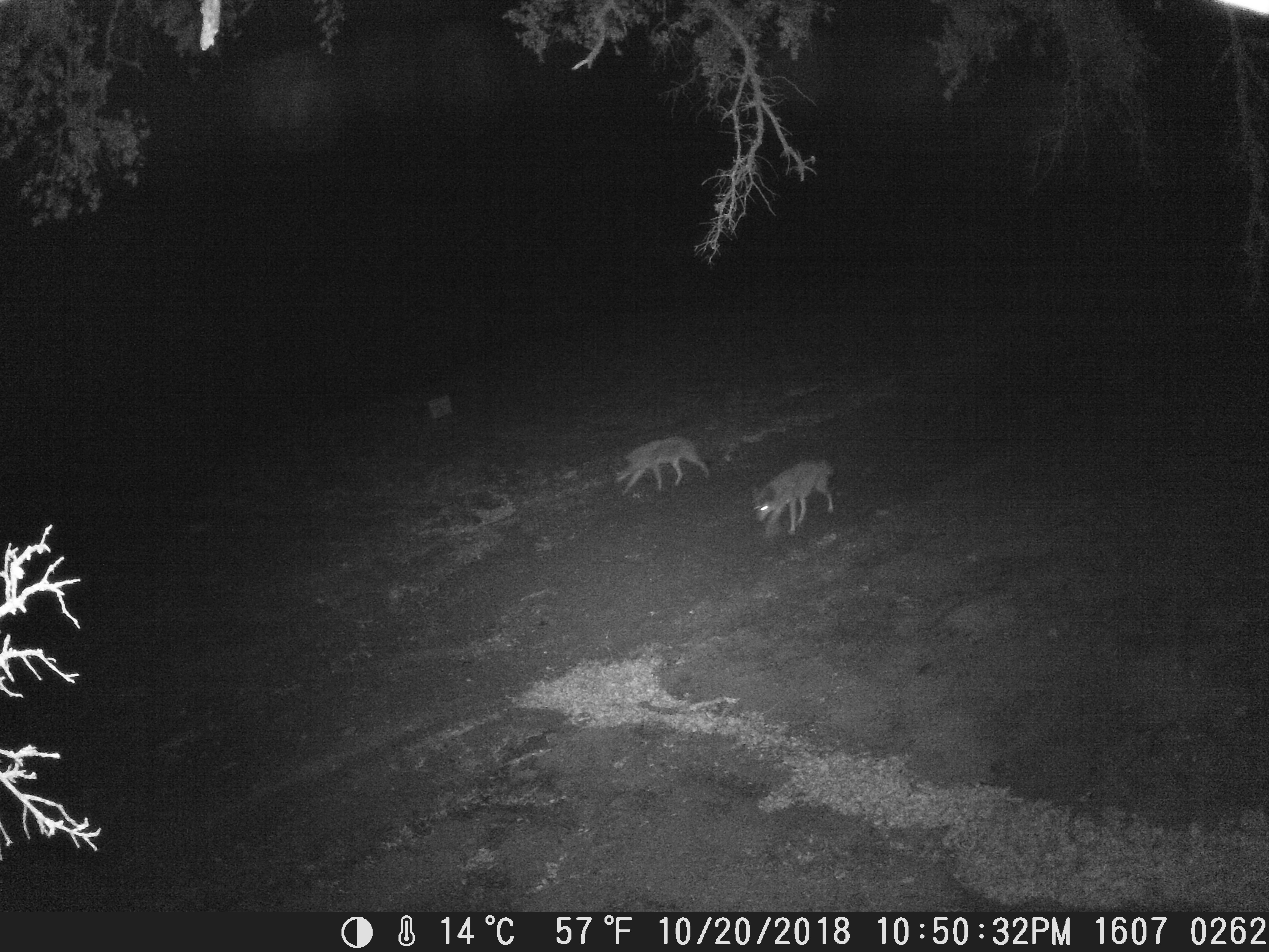
Coyote (Canis latrans) with prey (black-tailed jackrabbit?)
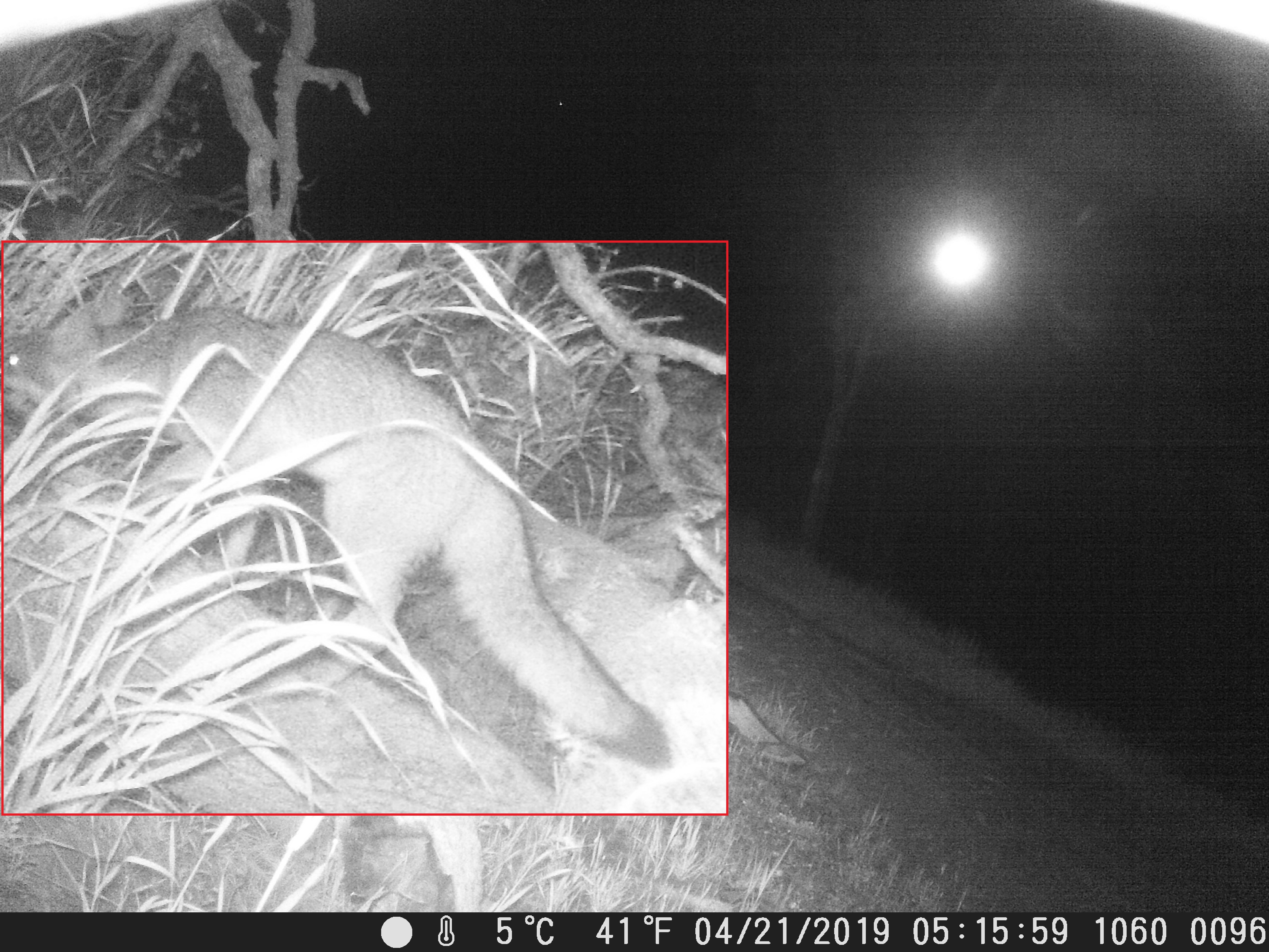
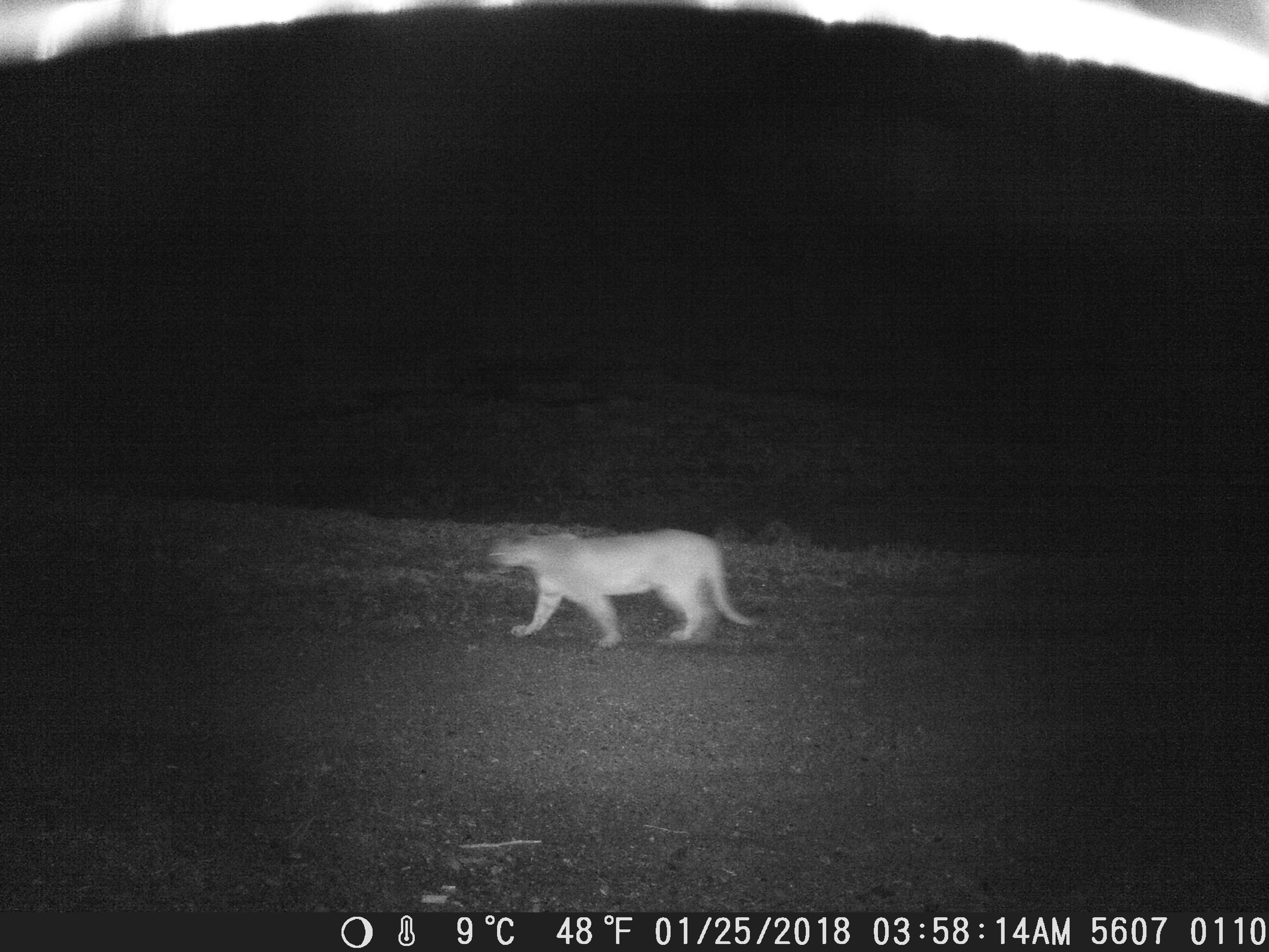
Mountain Lion (Puma concolor)
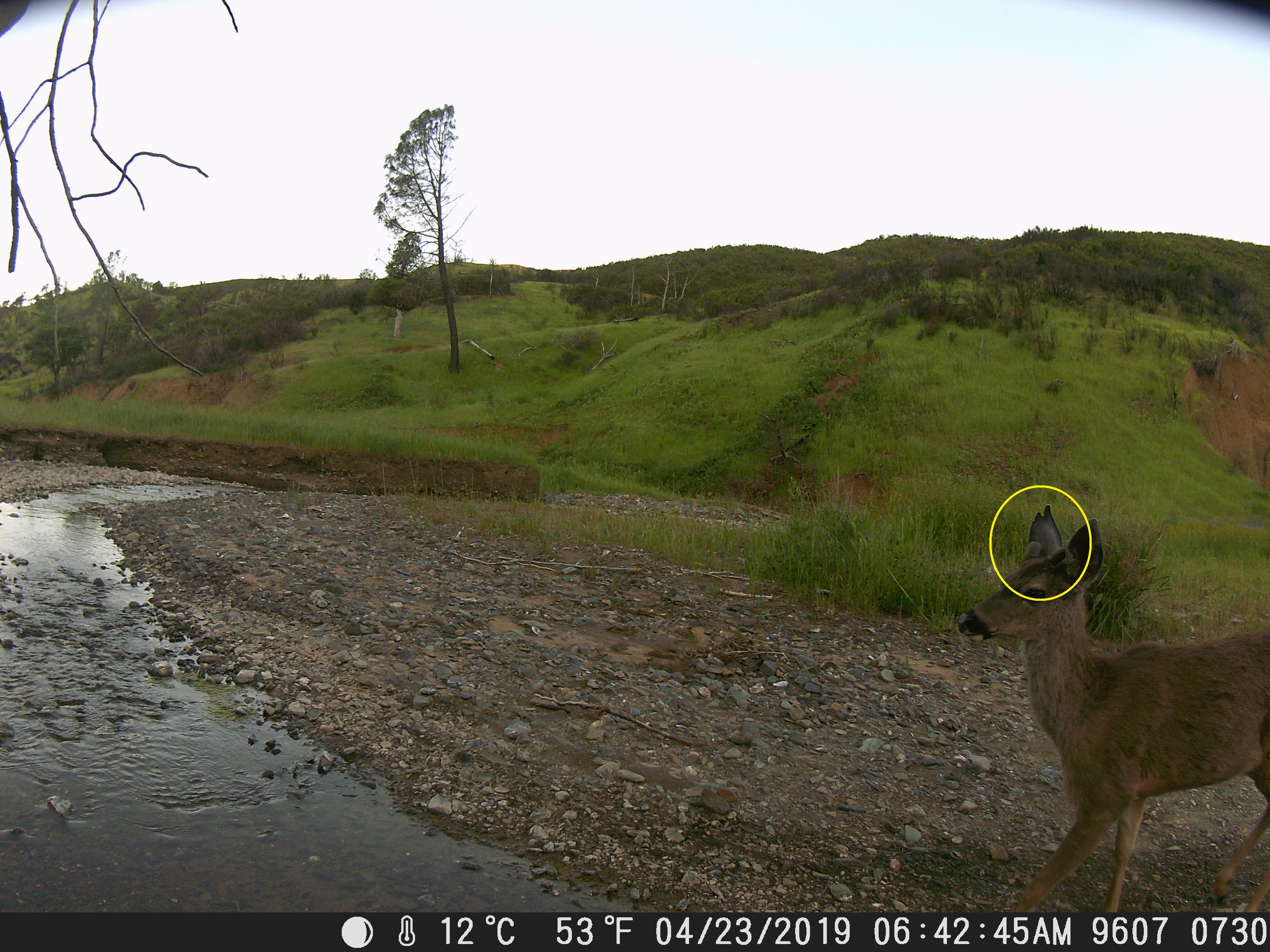
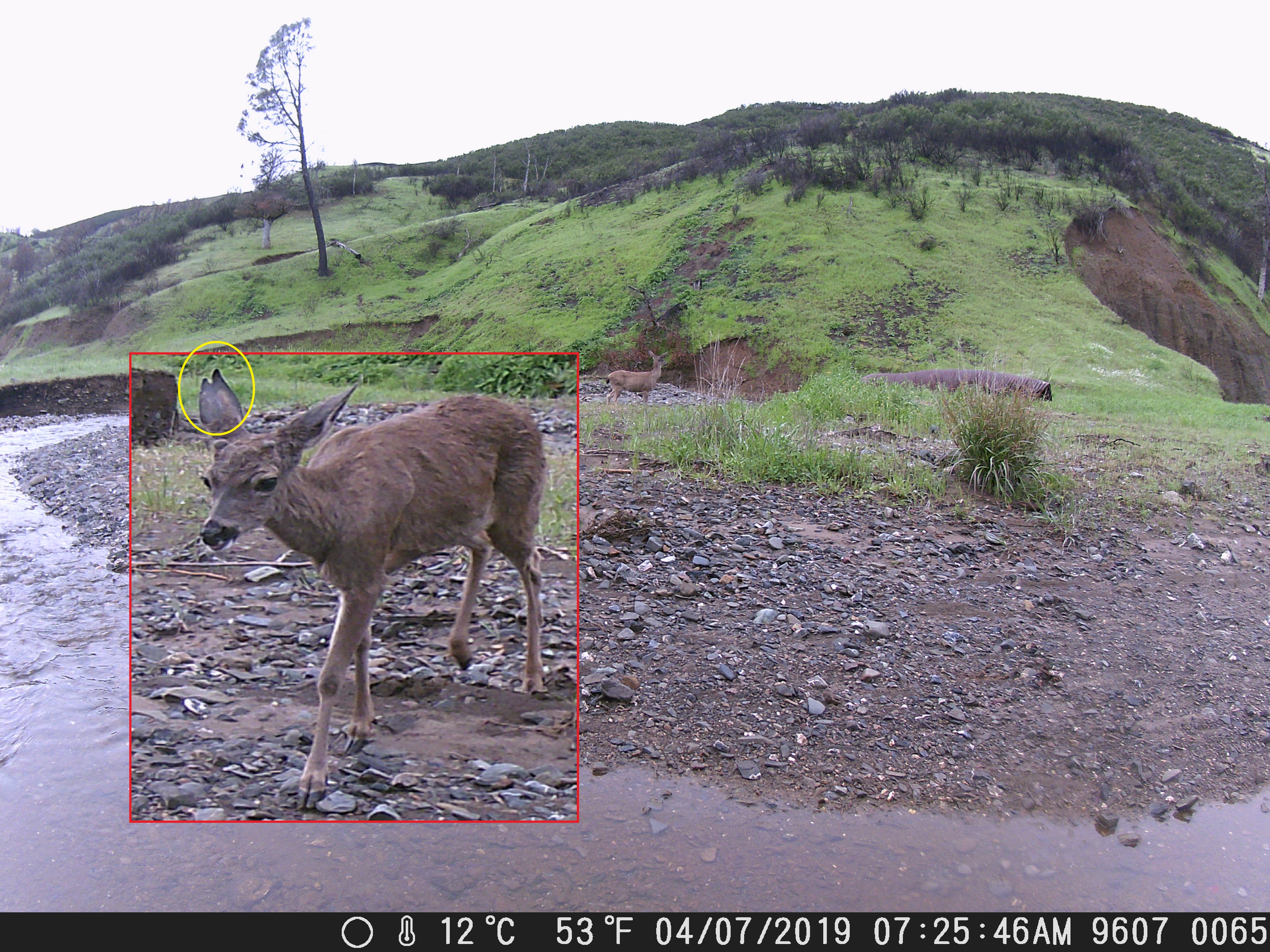
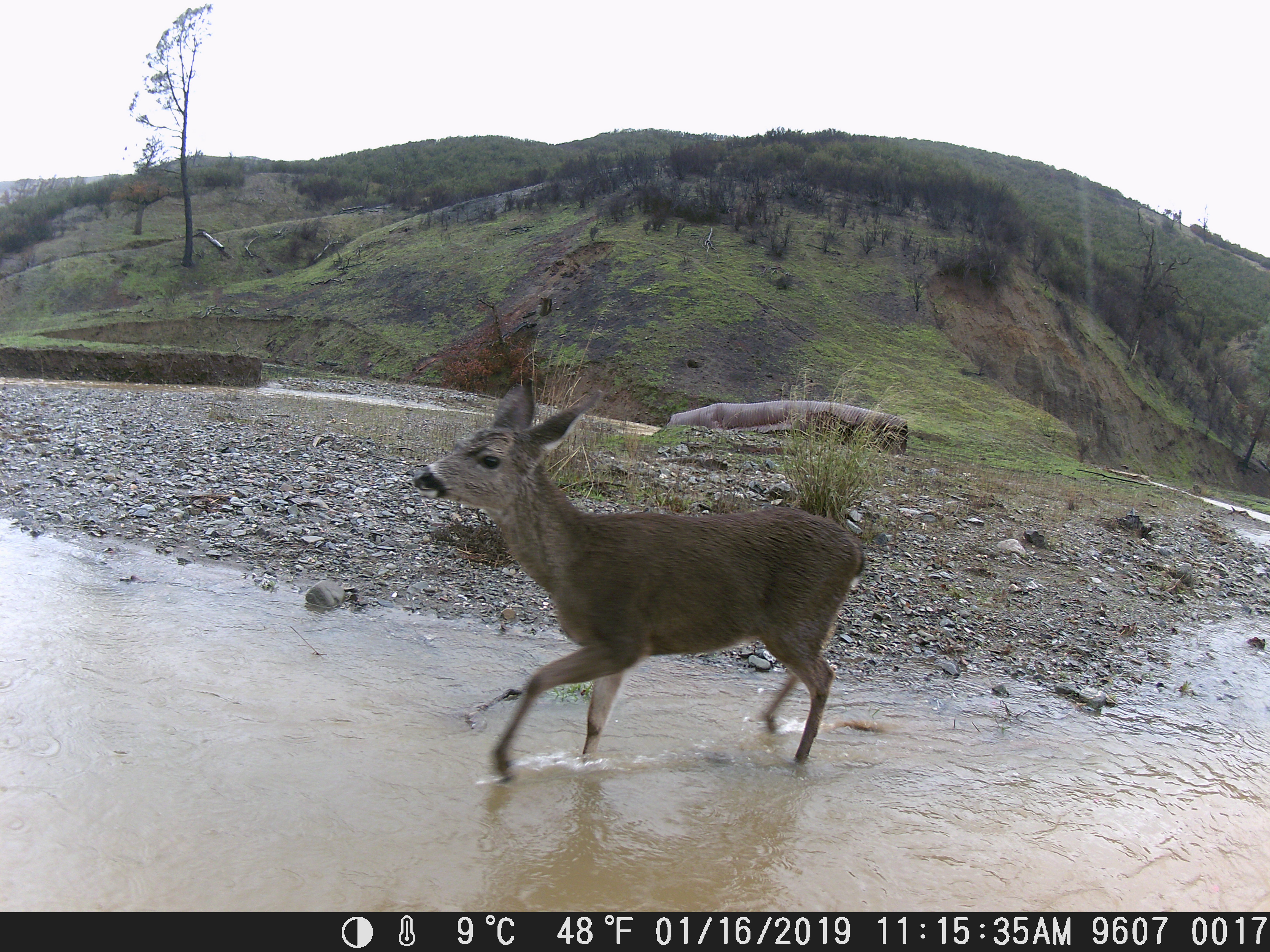
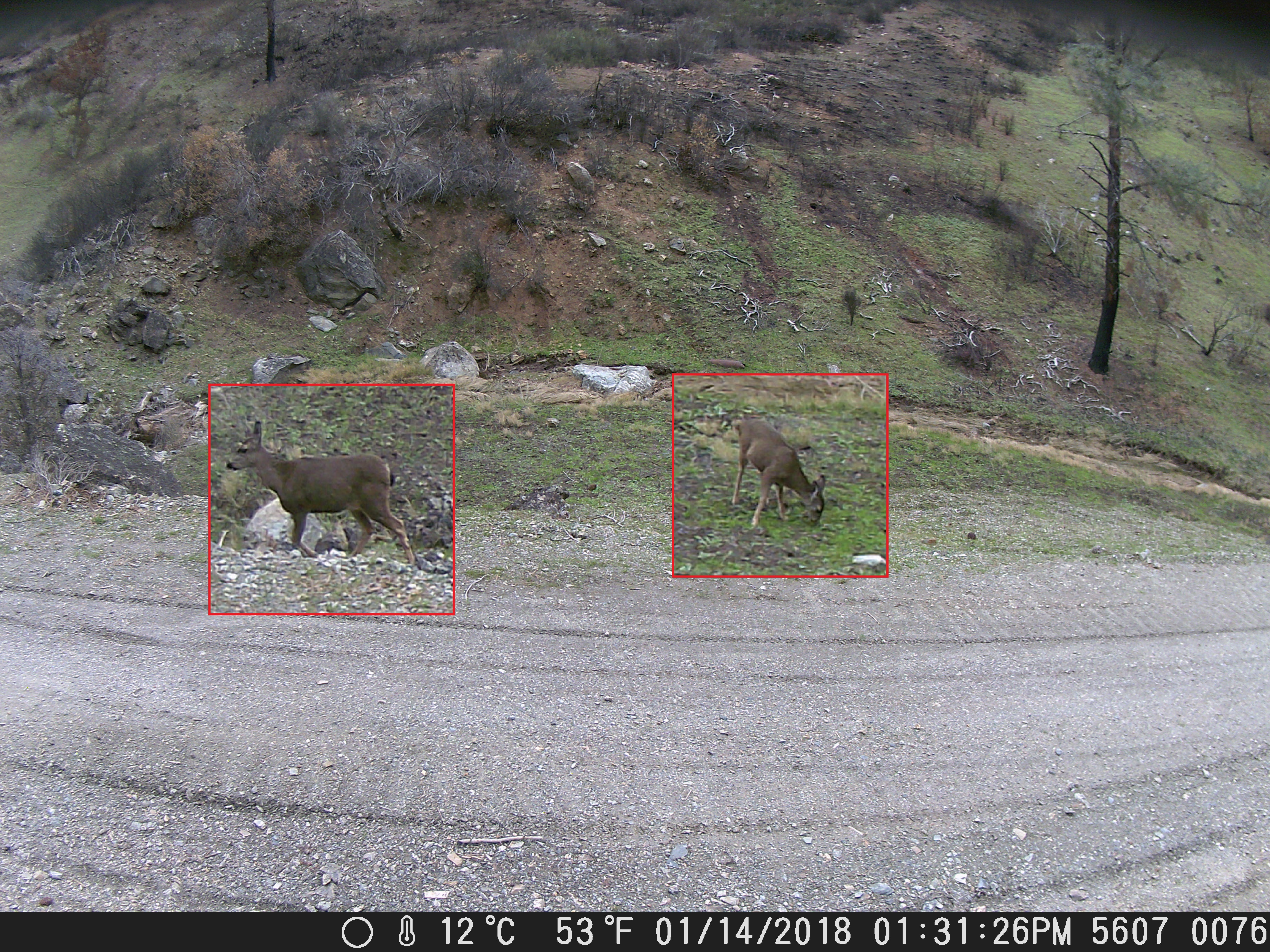
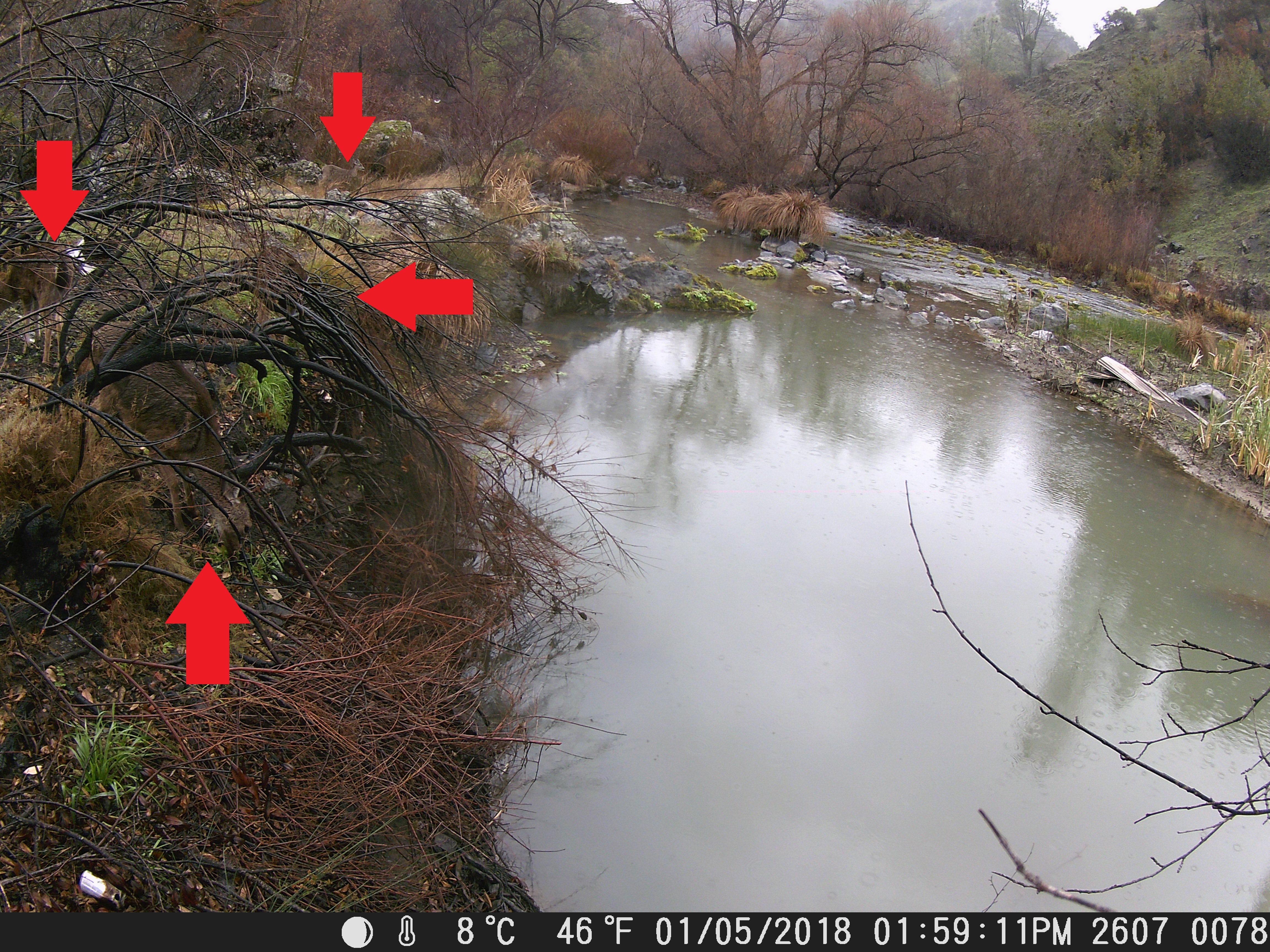
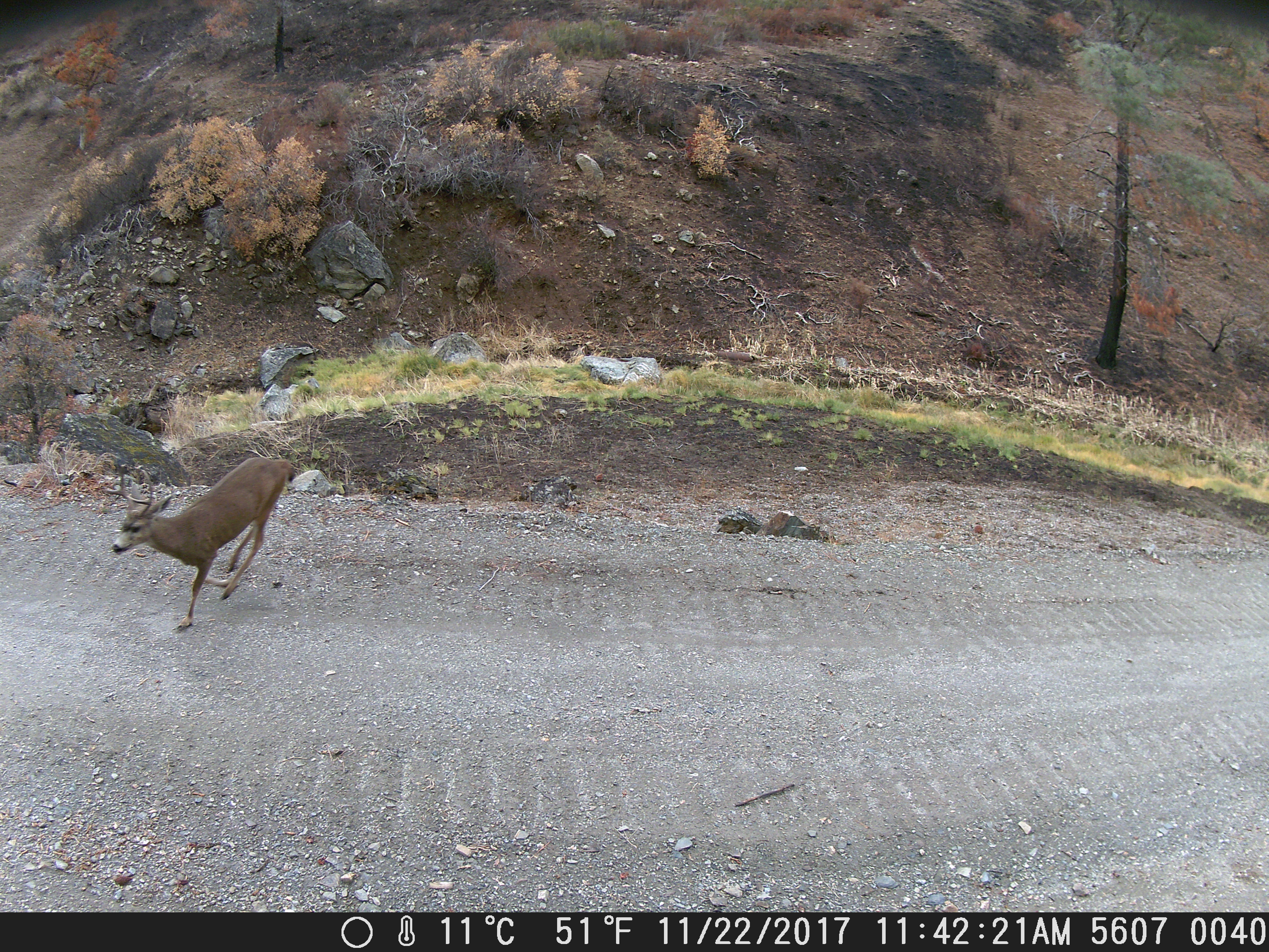
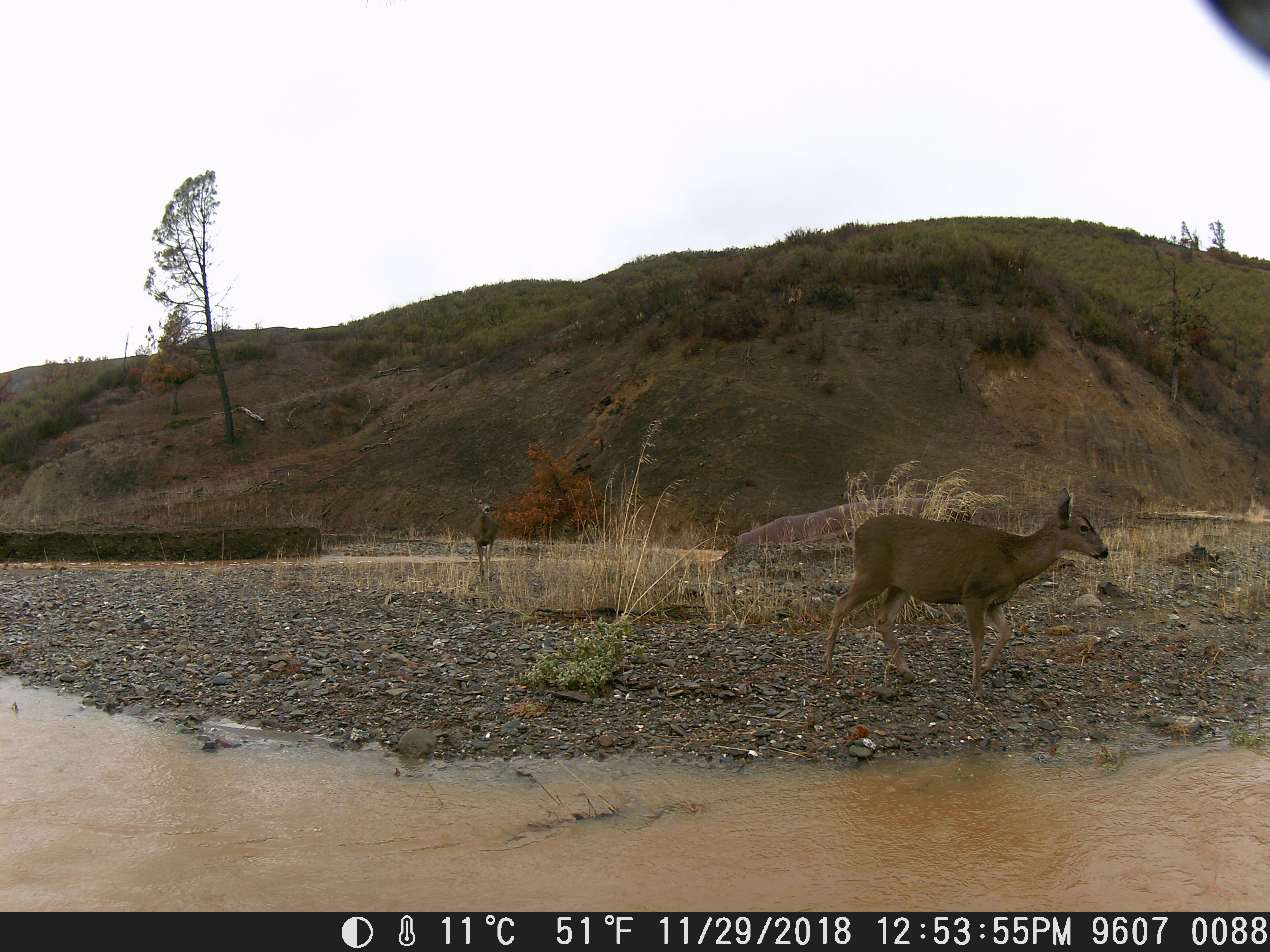
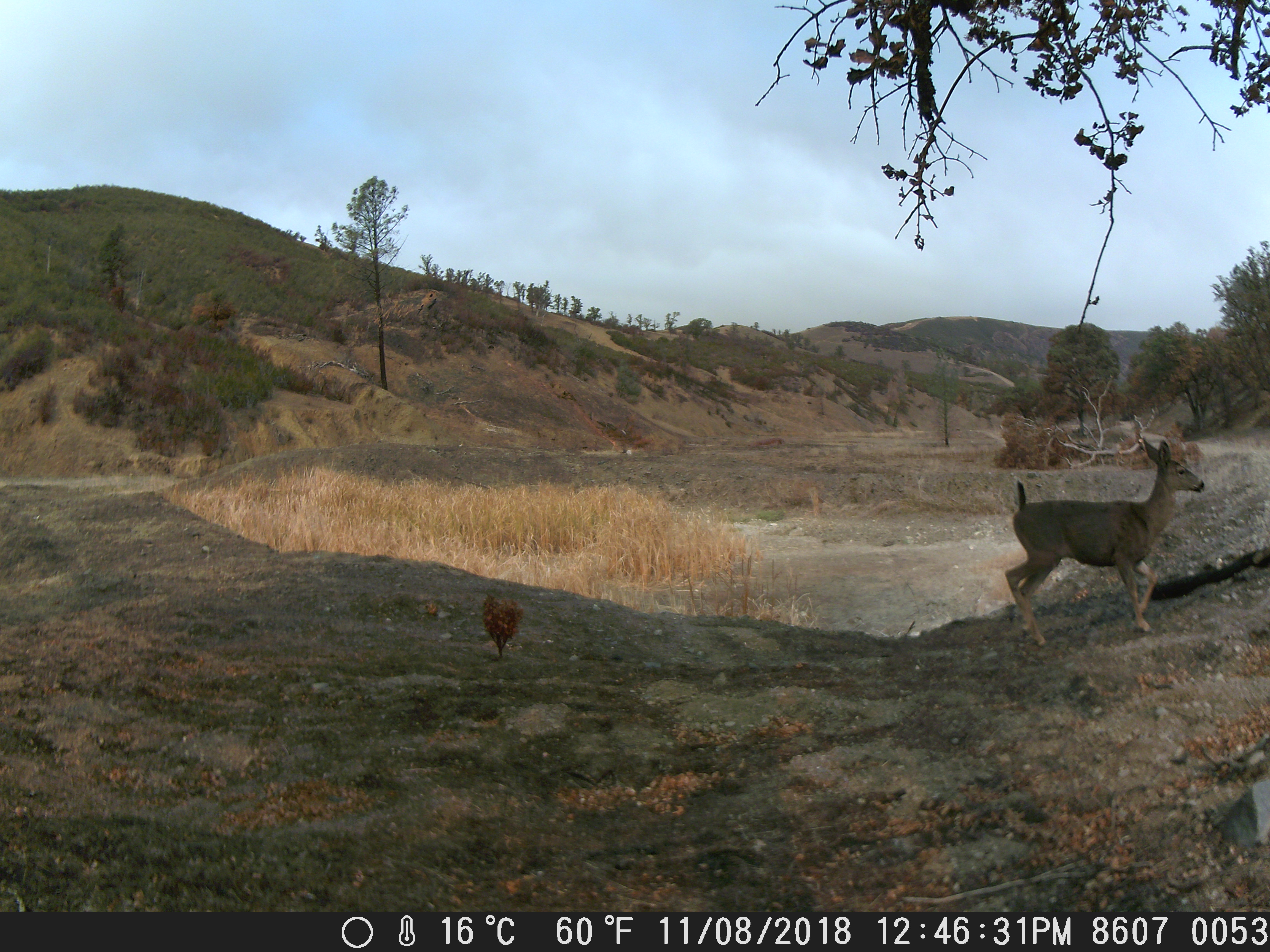
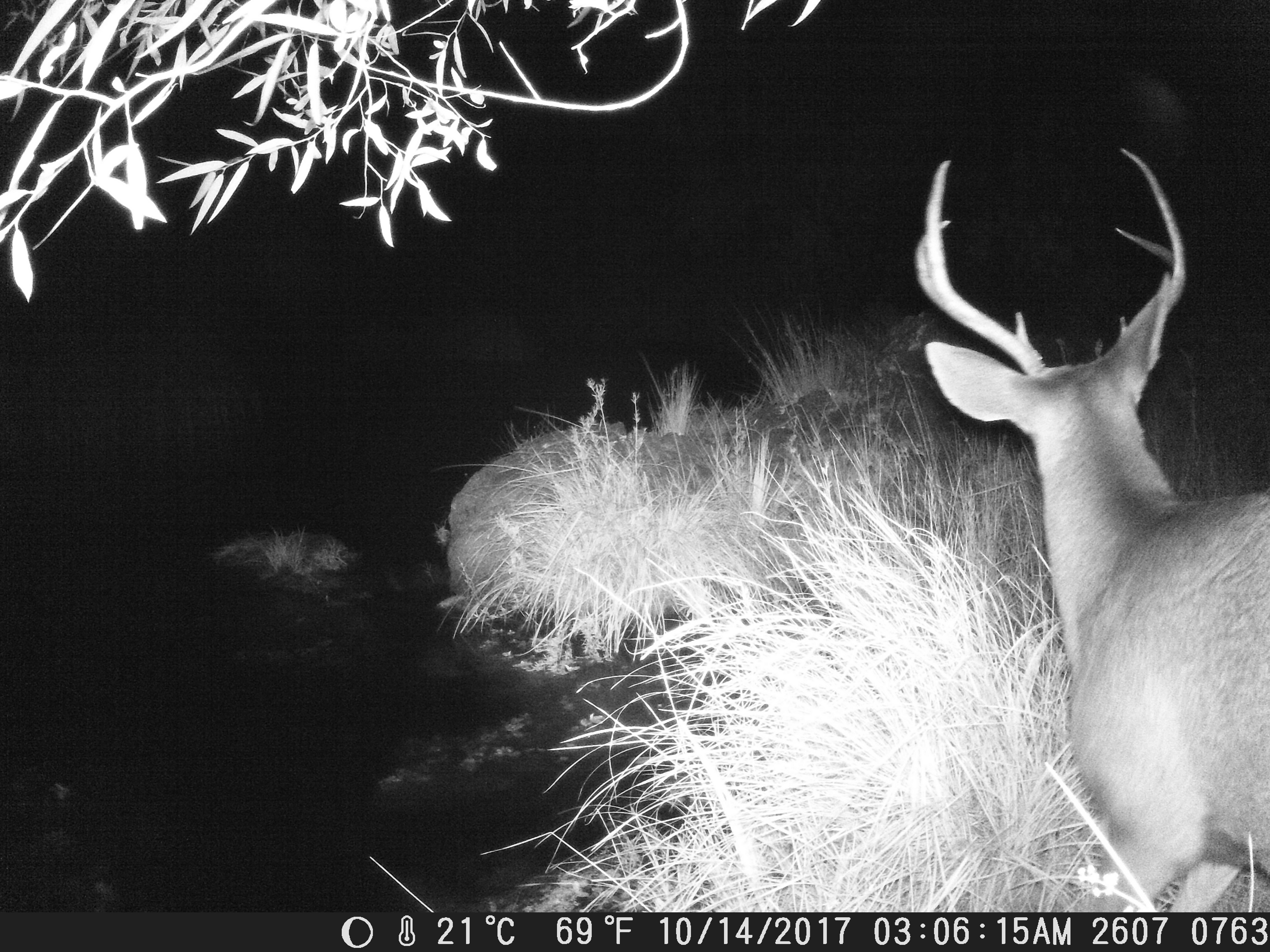
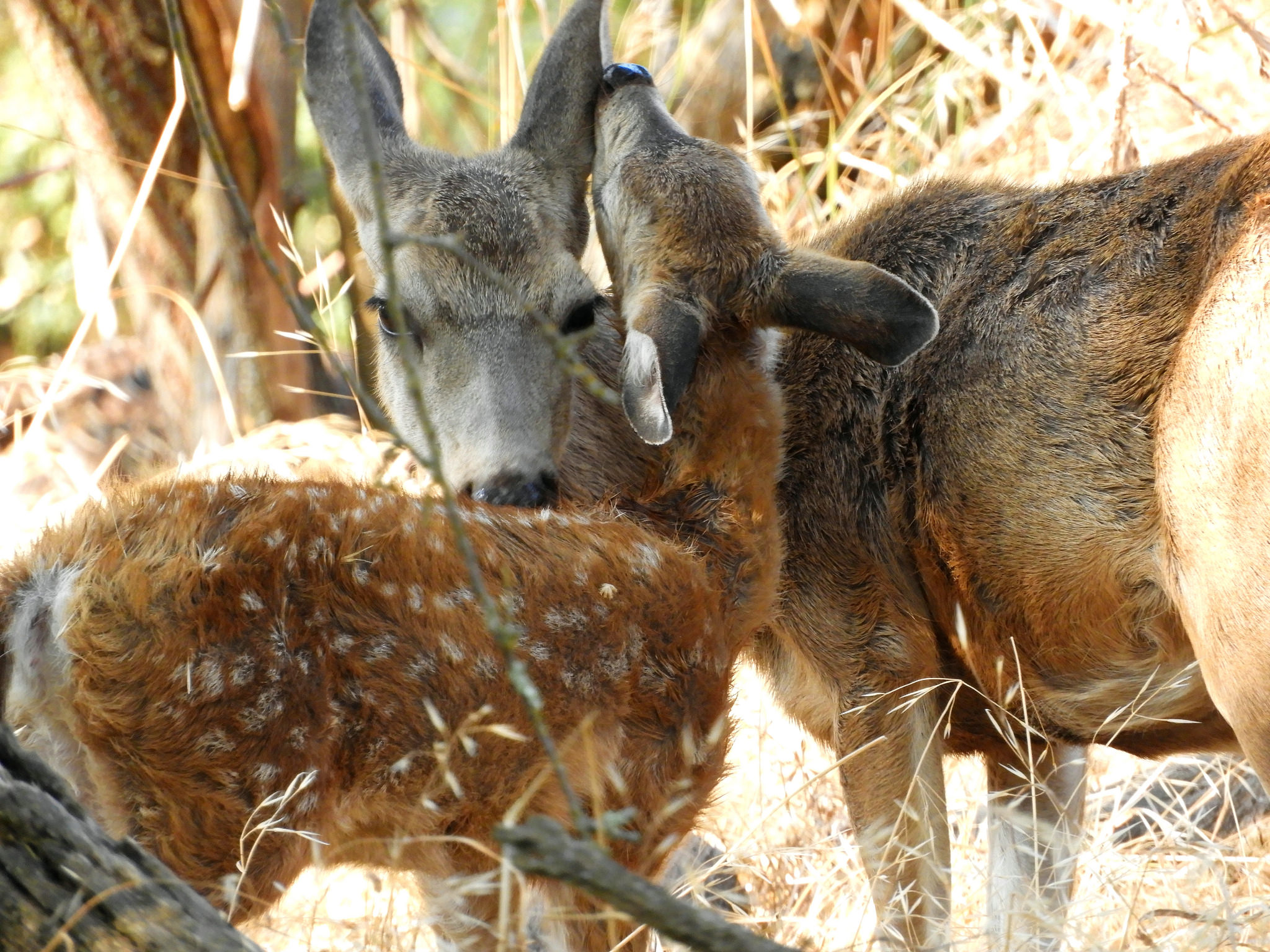
Columbian Black-tailed Deer (Odocoileus hemionus columbianus) - The ear notch shows that this deer was previously captured on this camera (See 4-11-19 post).
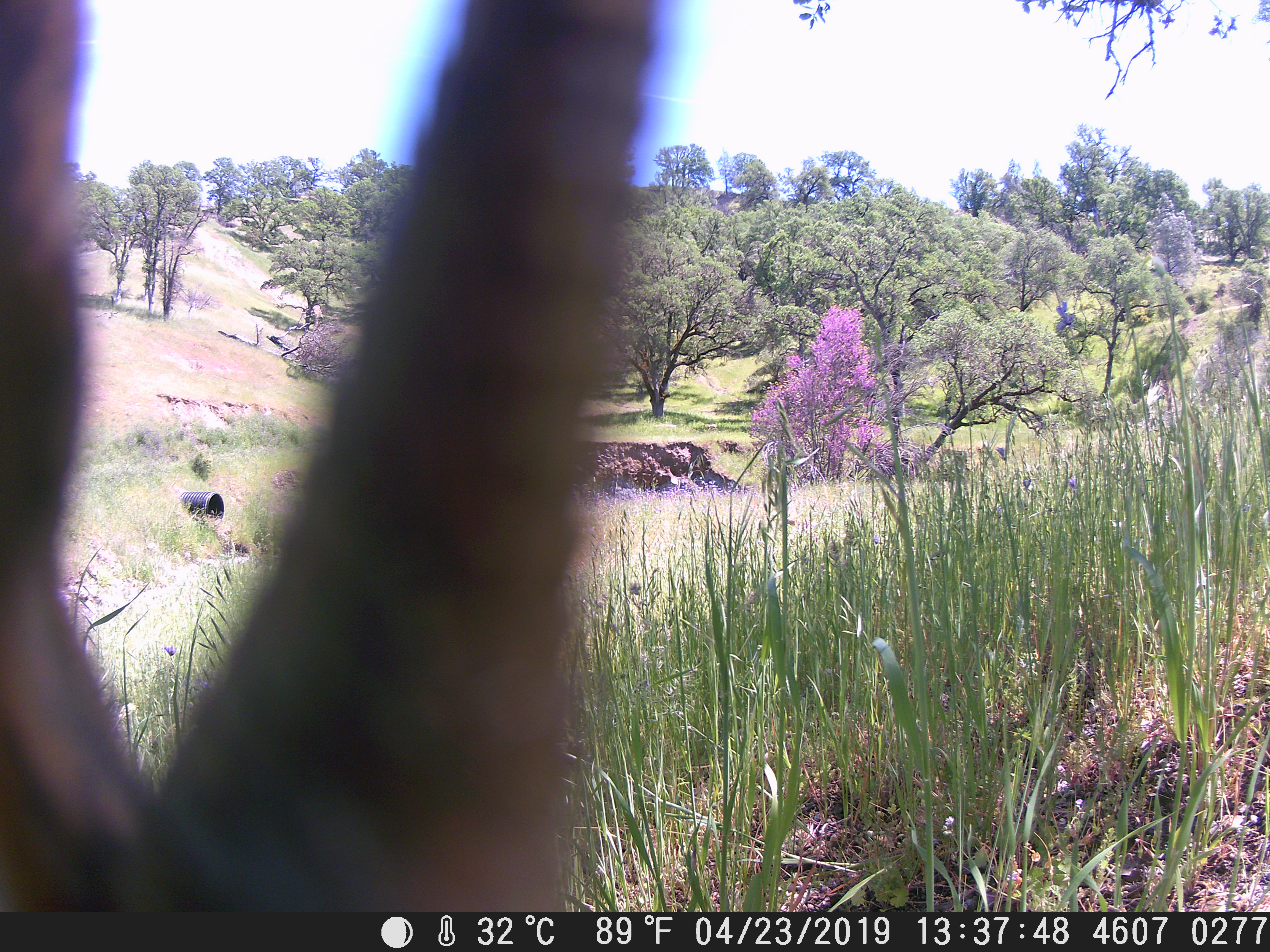
No animals in this picture (except the blackbird on the right side). This photos is shared to show just a small portion of the numerous wildflowers on the property.
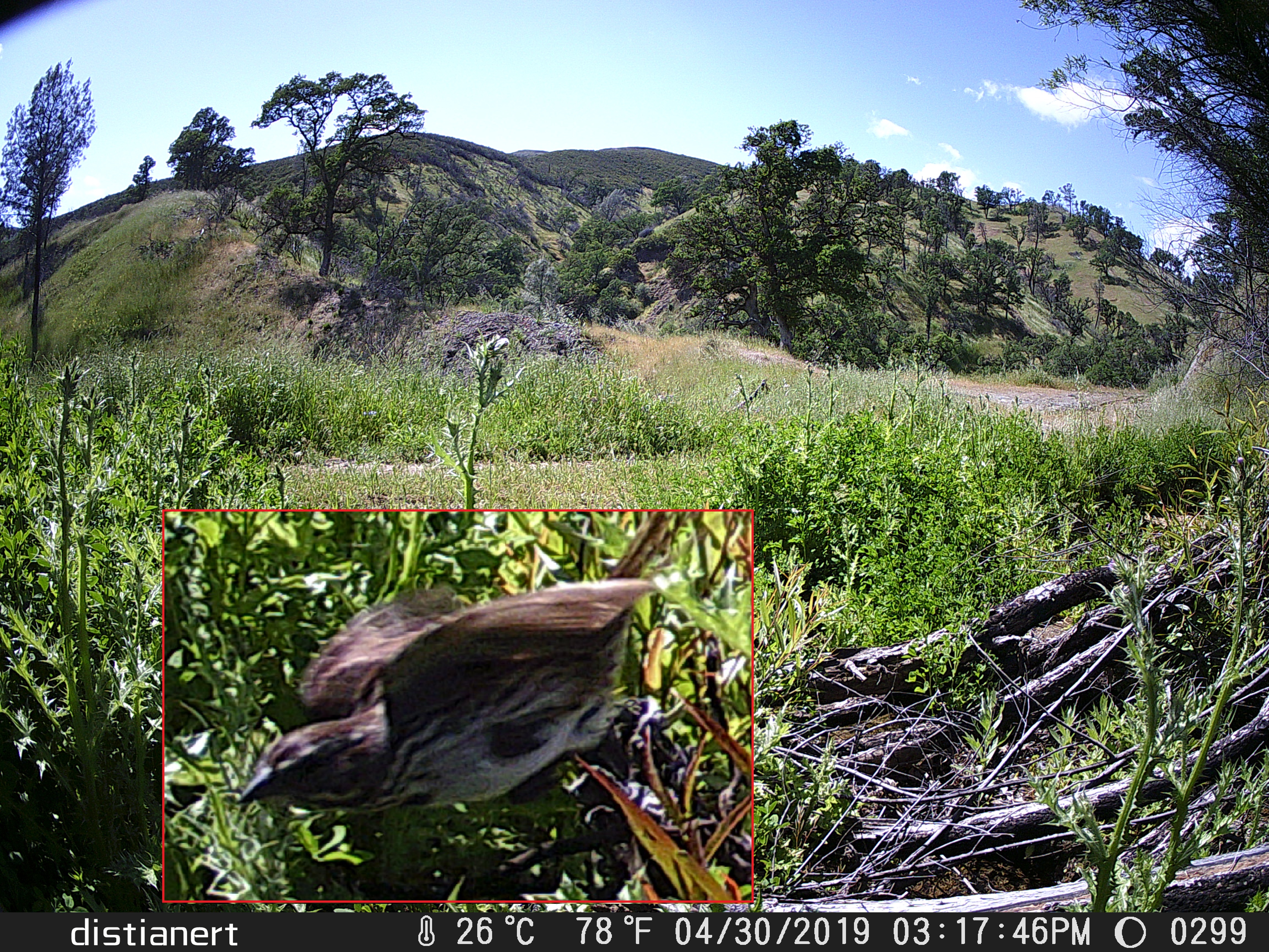
Bird at rest!
California Quail (Callipepla californica)
Wild Turkey (Meleagris gallopavo)
Gray fox (Urocyon cinereoargenteus townsendi)
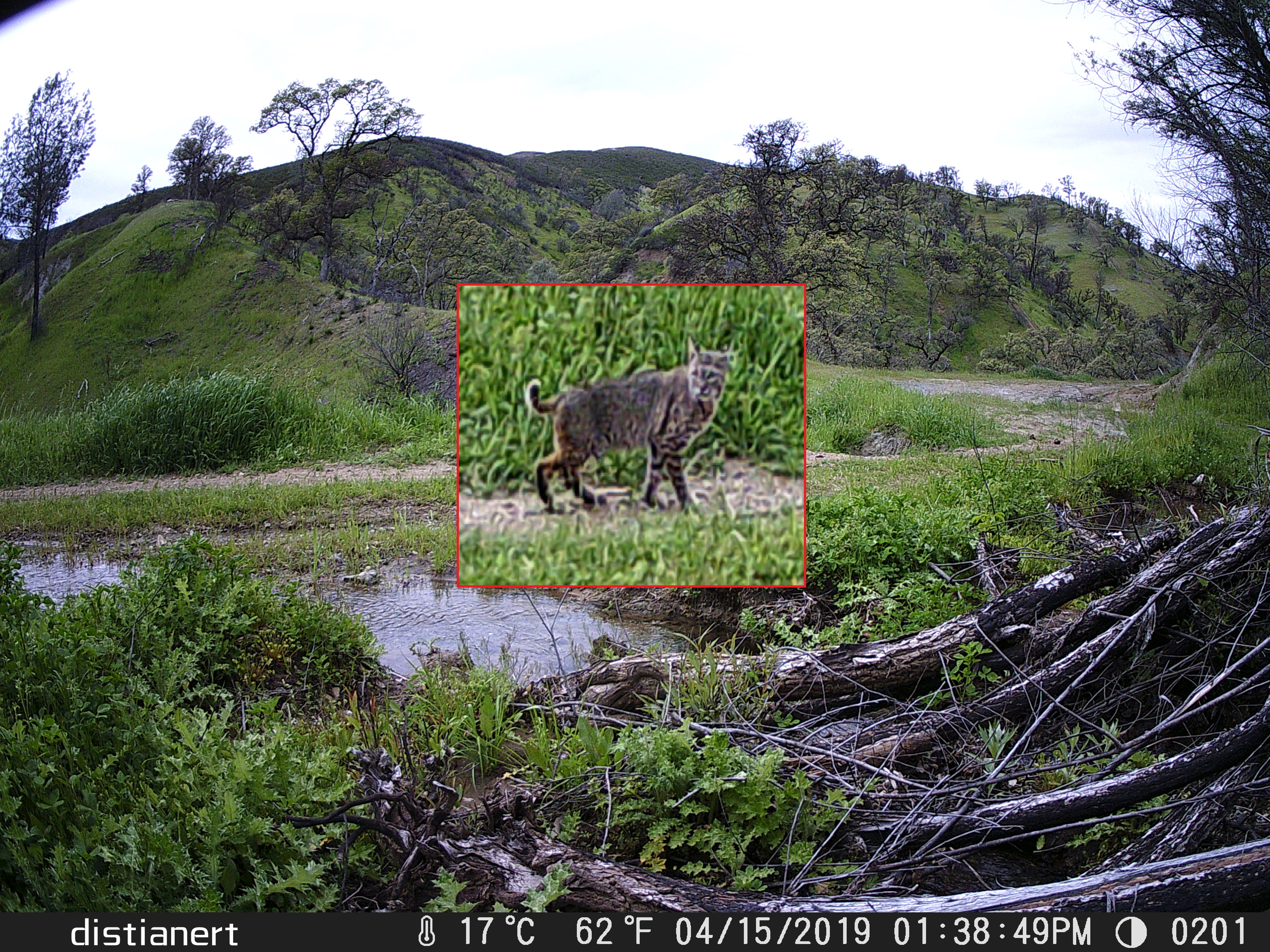
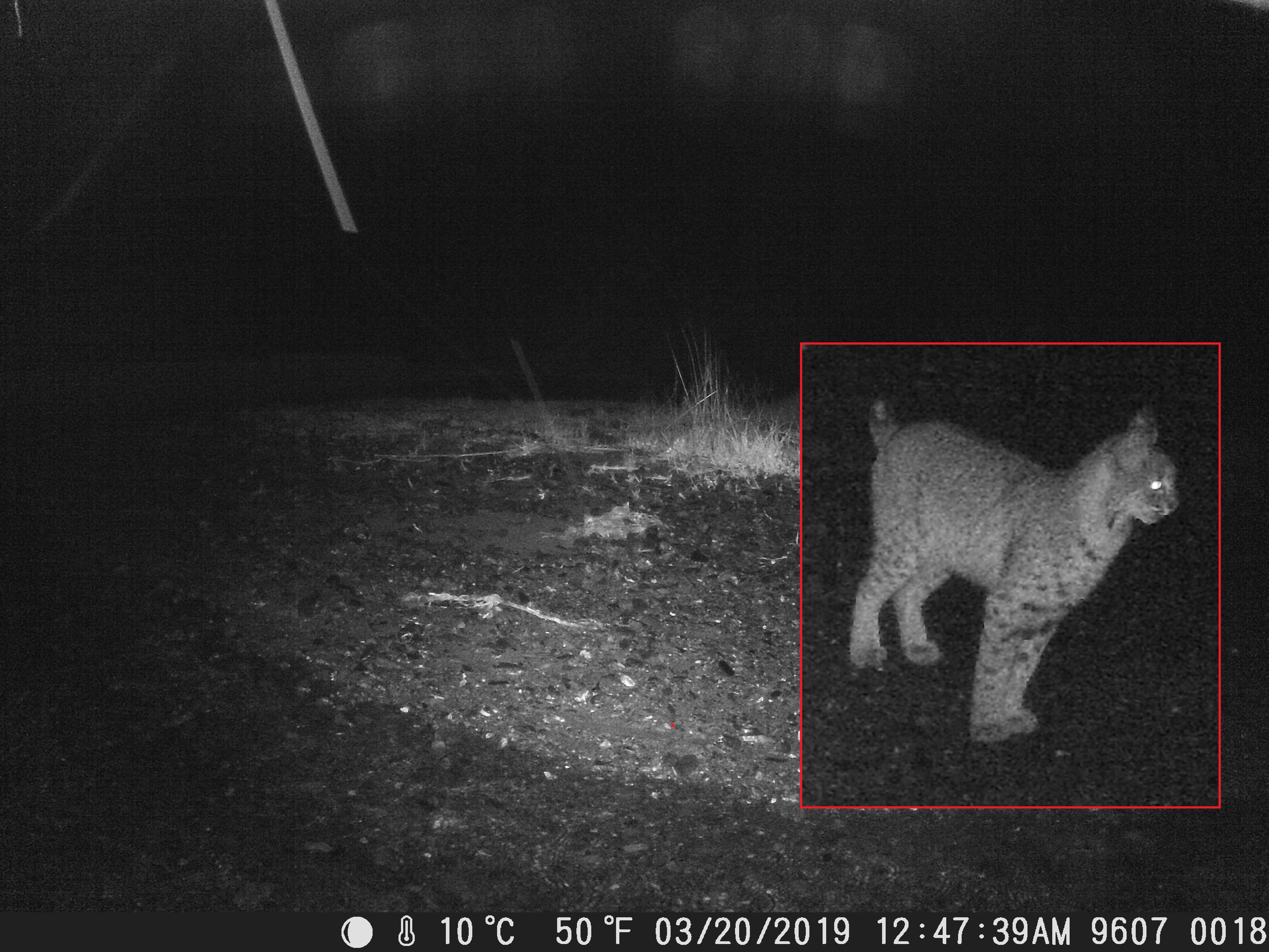
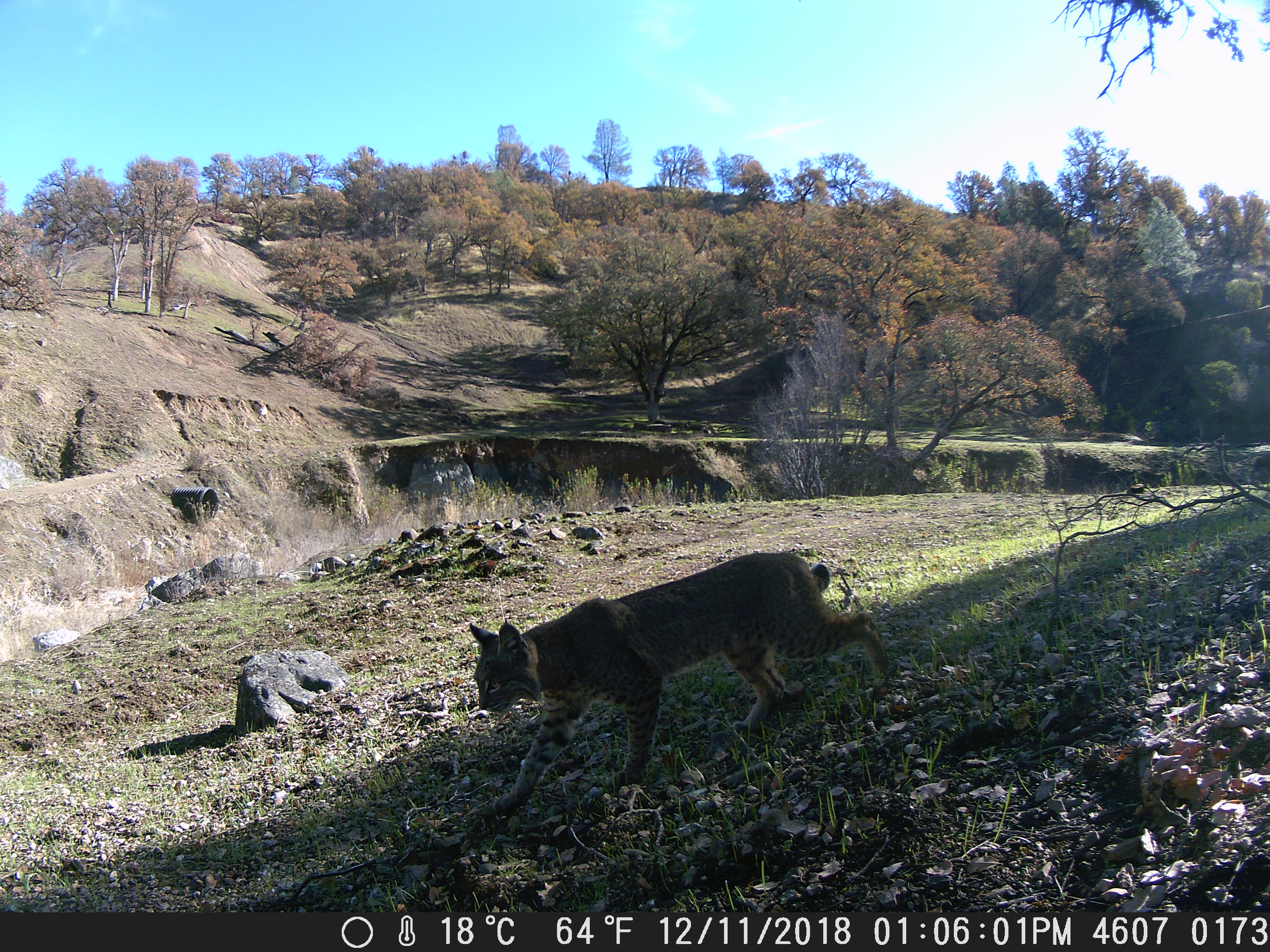
Bobcat (Lynx rufus)
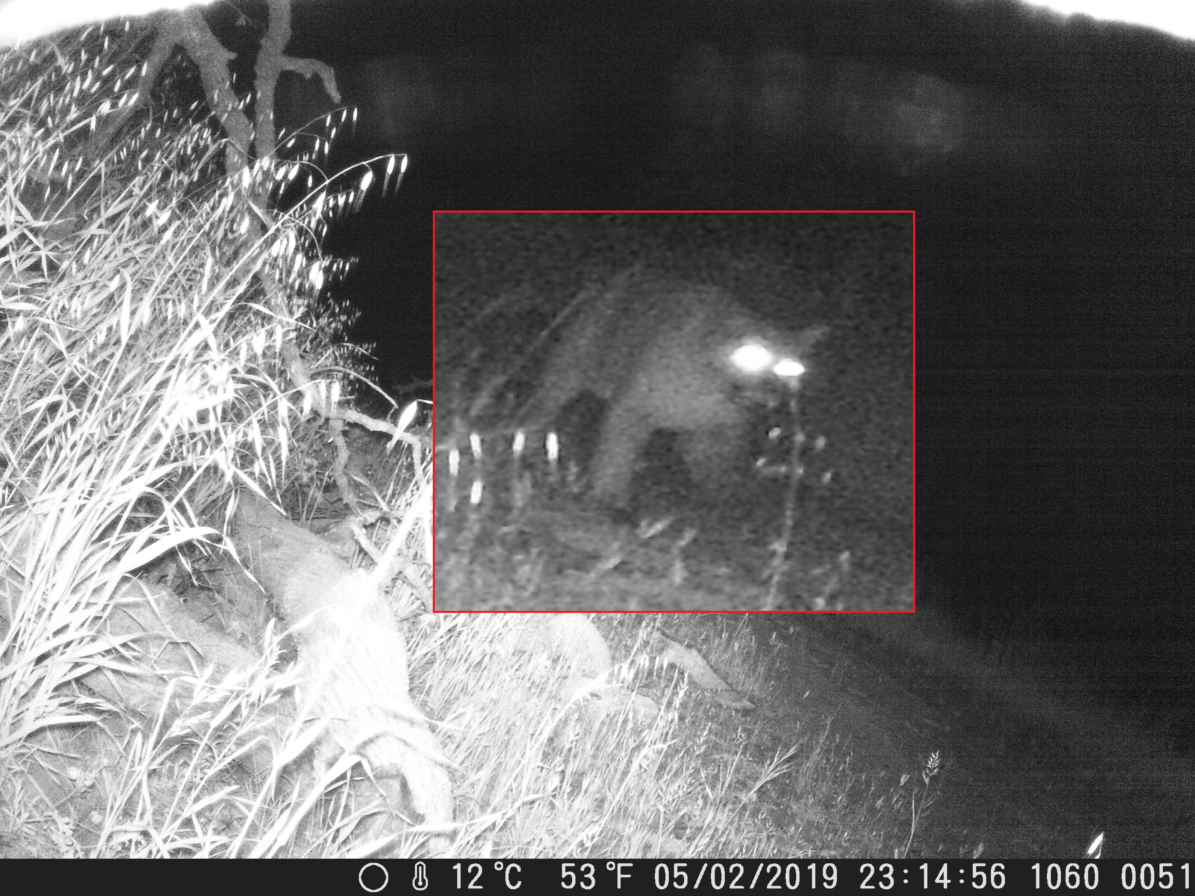
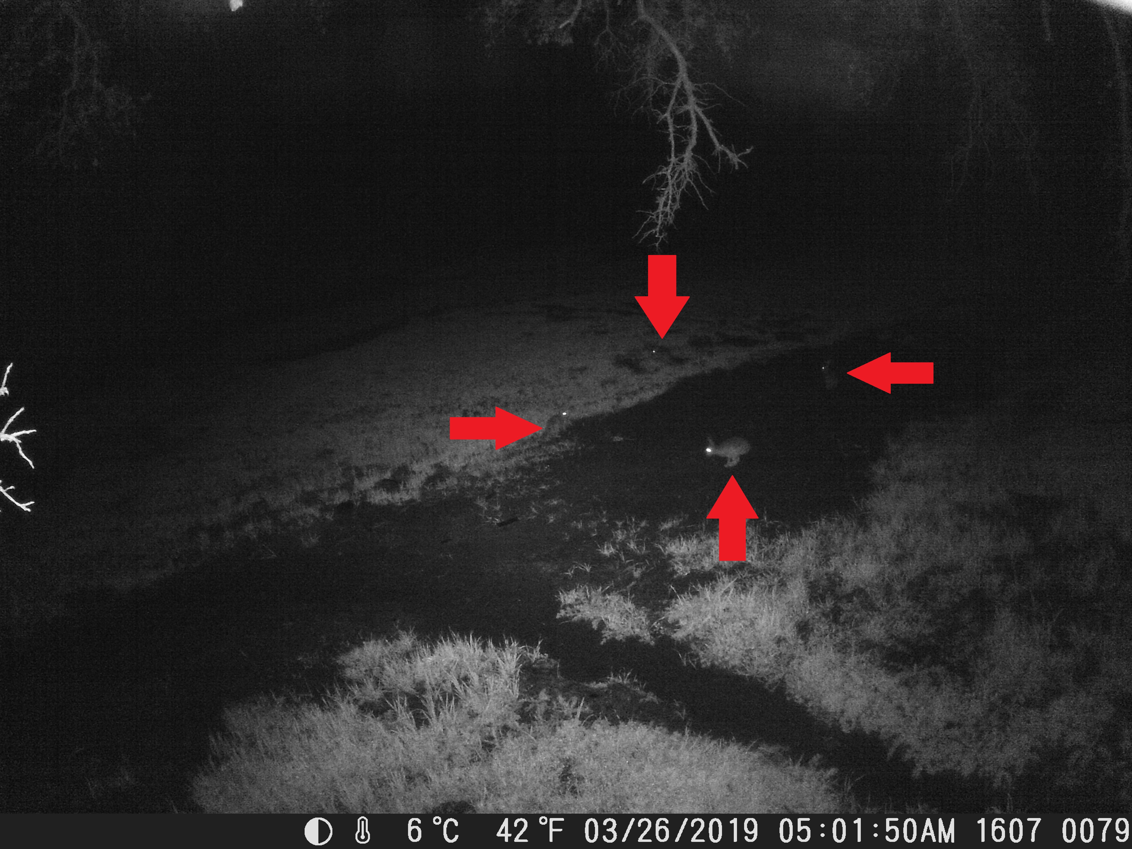
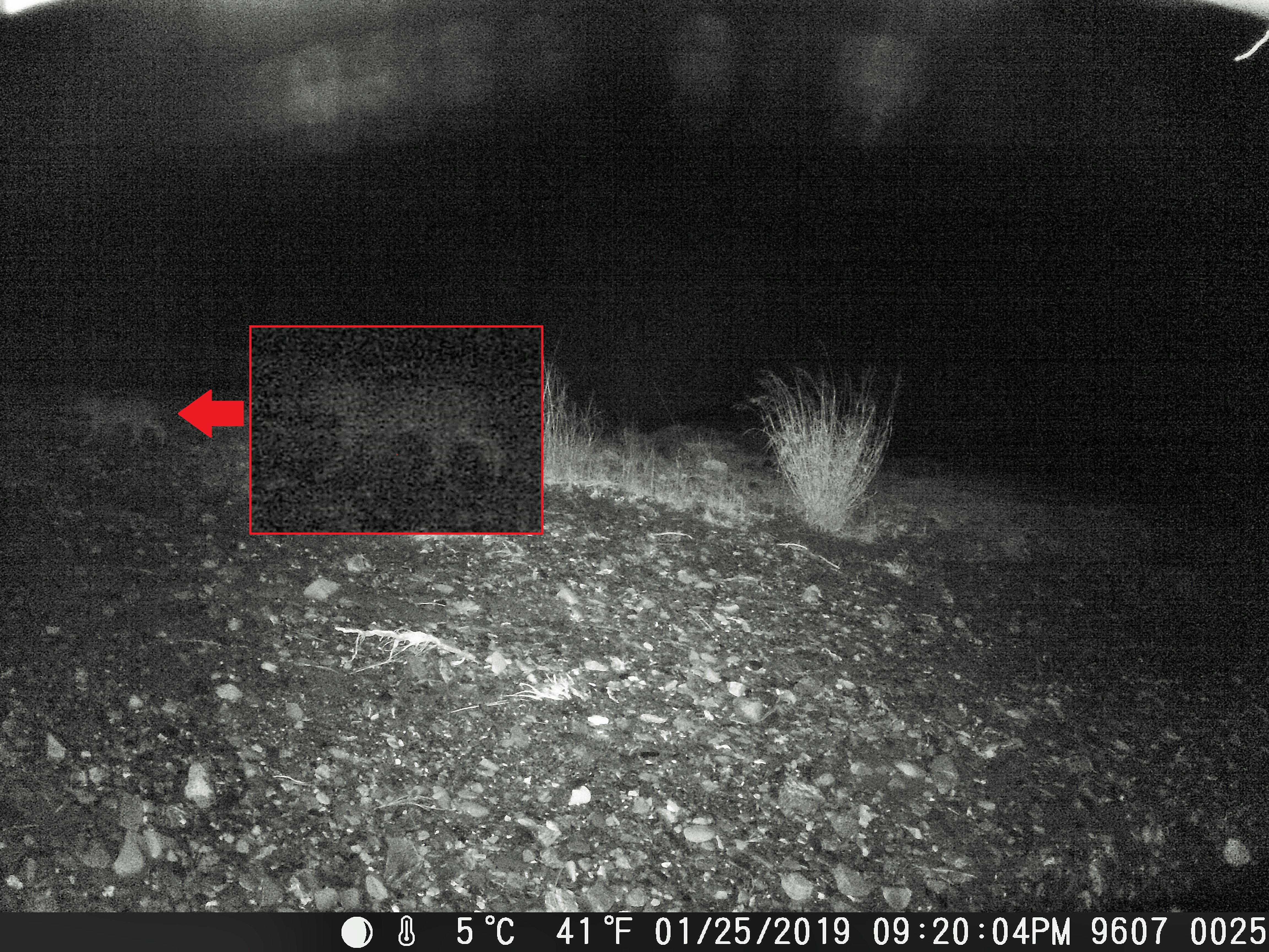
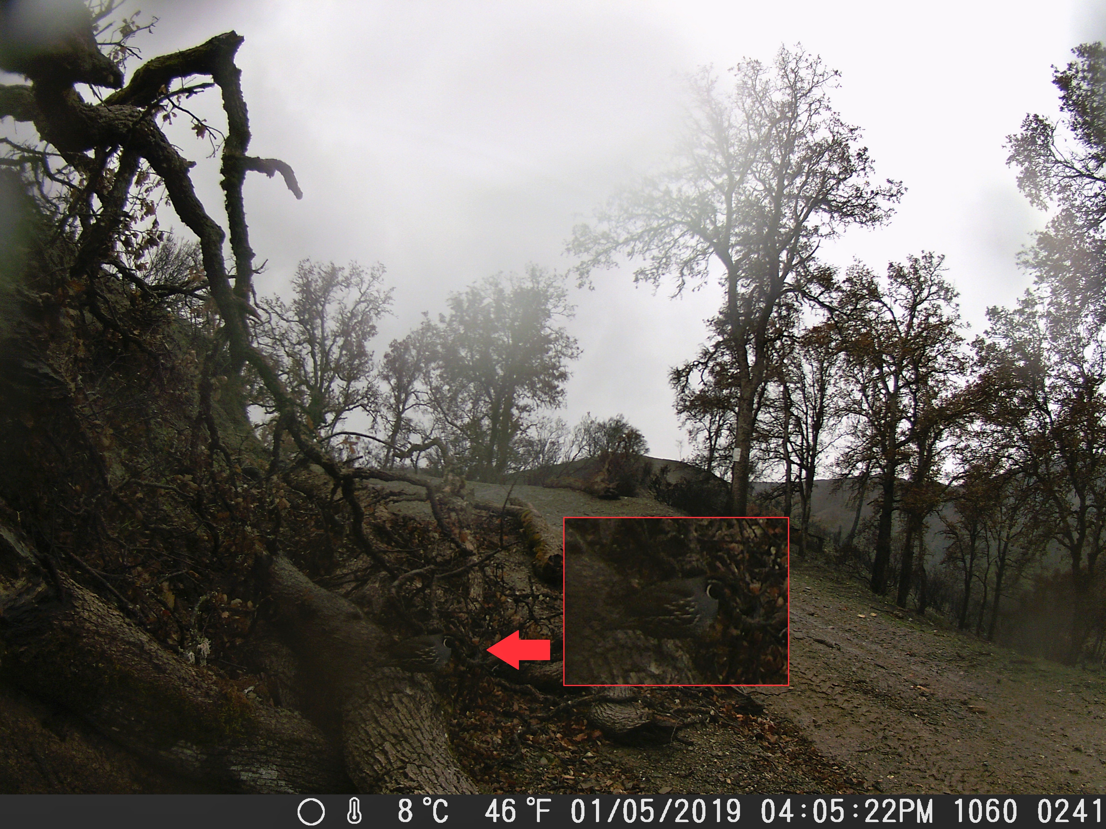
We're stumped! Maybe the ears of a black-tailed jackrabbit? The legs of a wild turkey? Let us know your thoughts! (information@tuleyome.org)
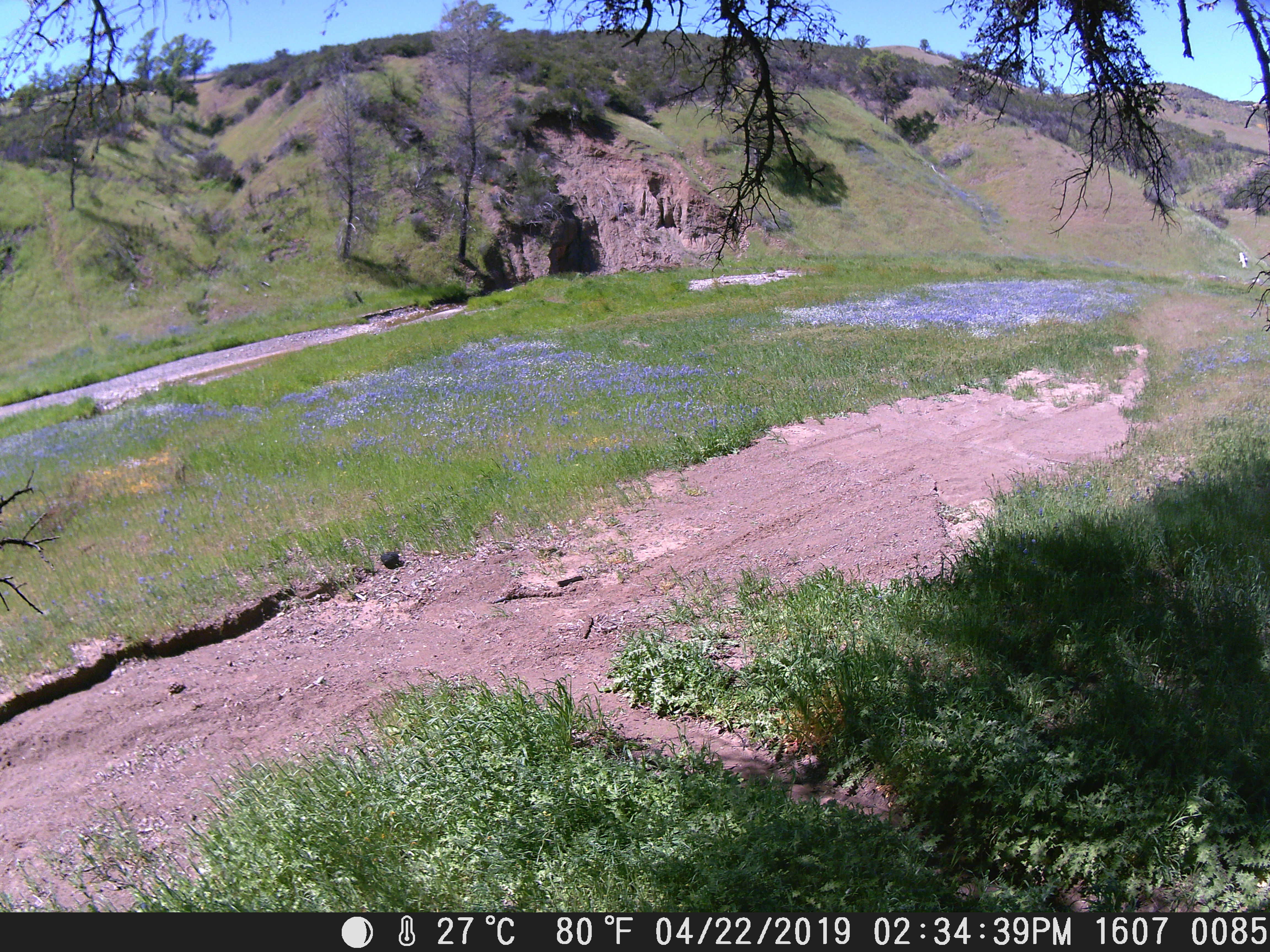
Four days later, the colors have changed but are just as beautiful. Fires can be destructive, but life, both flora and fauna, can thrive in its wake!
POST 4-11-19
PROJECT ID #18-022
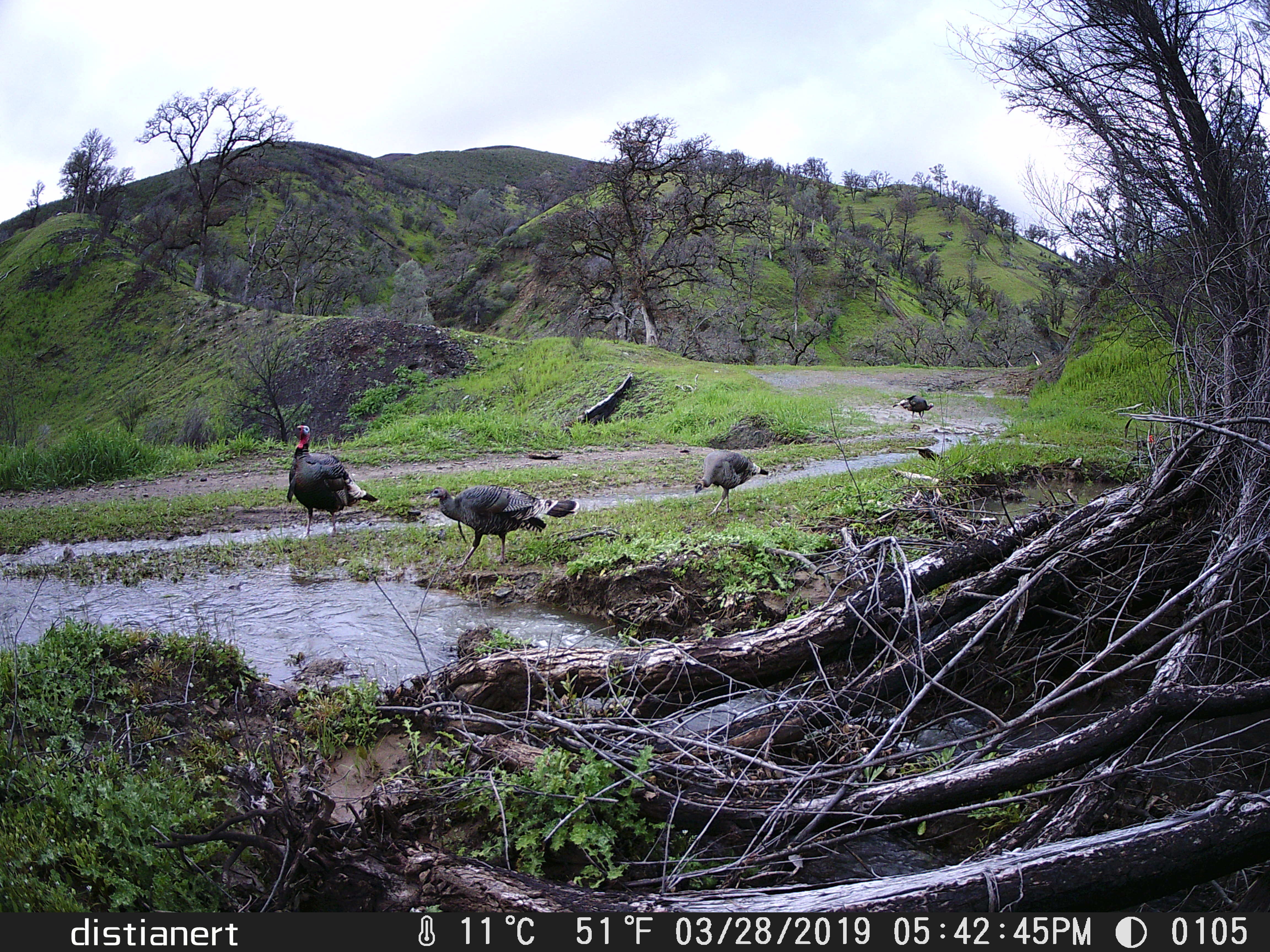
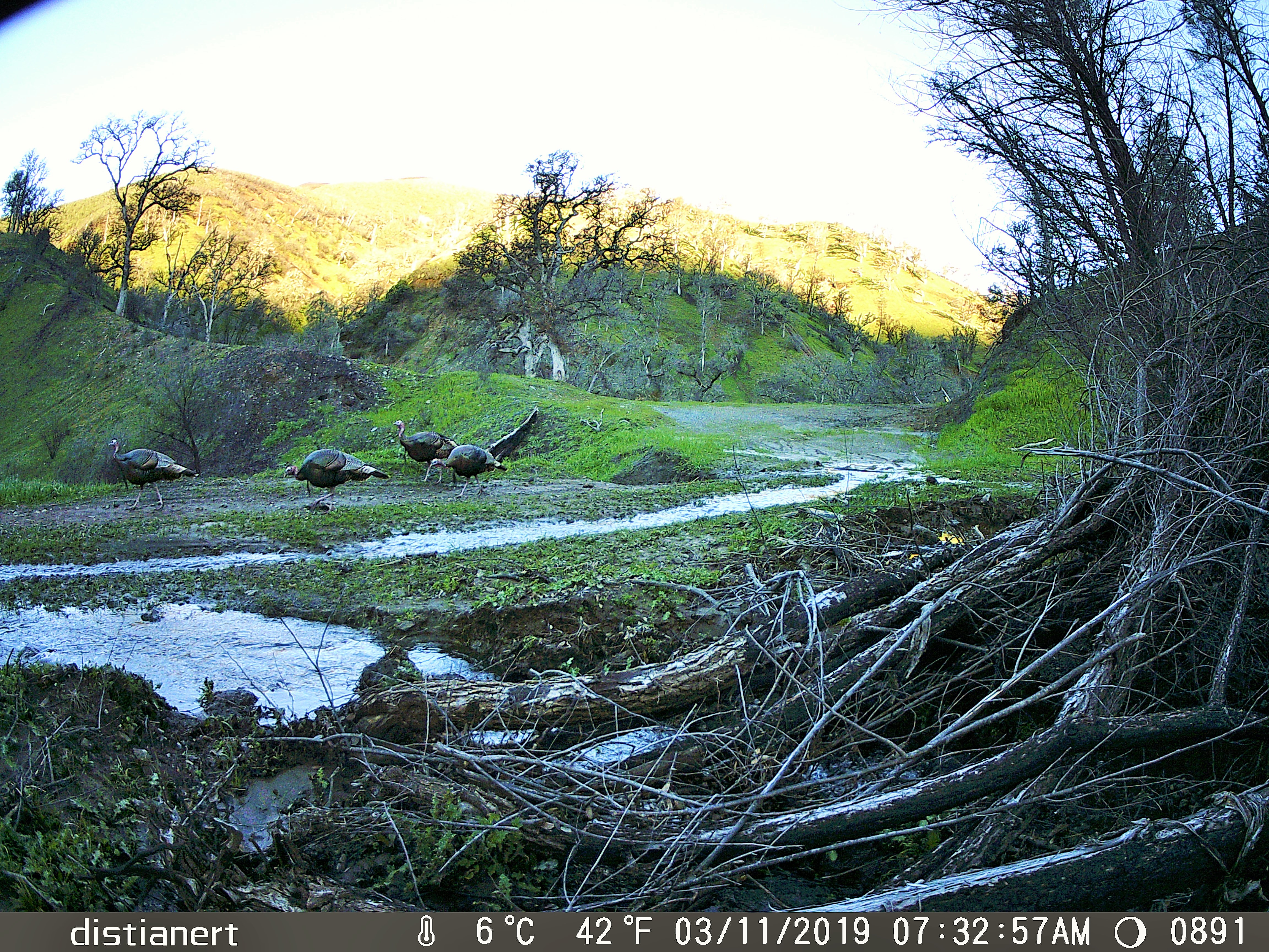
The "Road" camera was busy capturing Turkeys since the March 14 visit. Although solitary birds were captured, turkeys were most often captured in flocks (or RAFTERS!) of 3 or more.
Another common animal captured by the cameras was the Columbian black-tailed deer (Odocoileus hemionus columbianus). This image shows a clipped ear which will help us identify this individual in future captures.
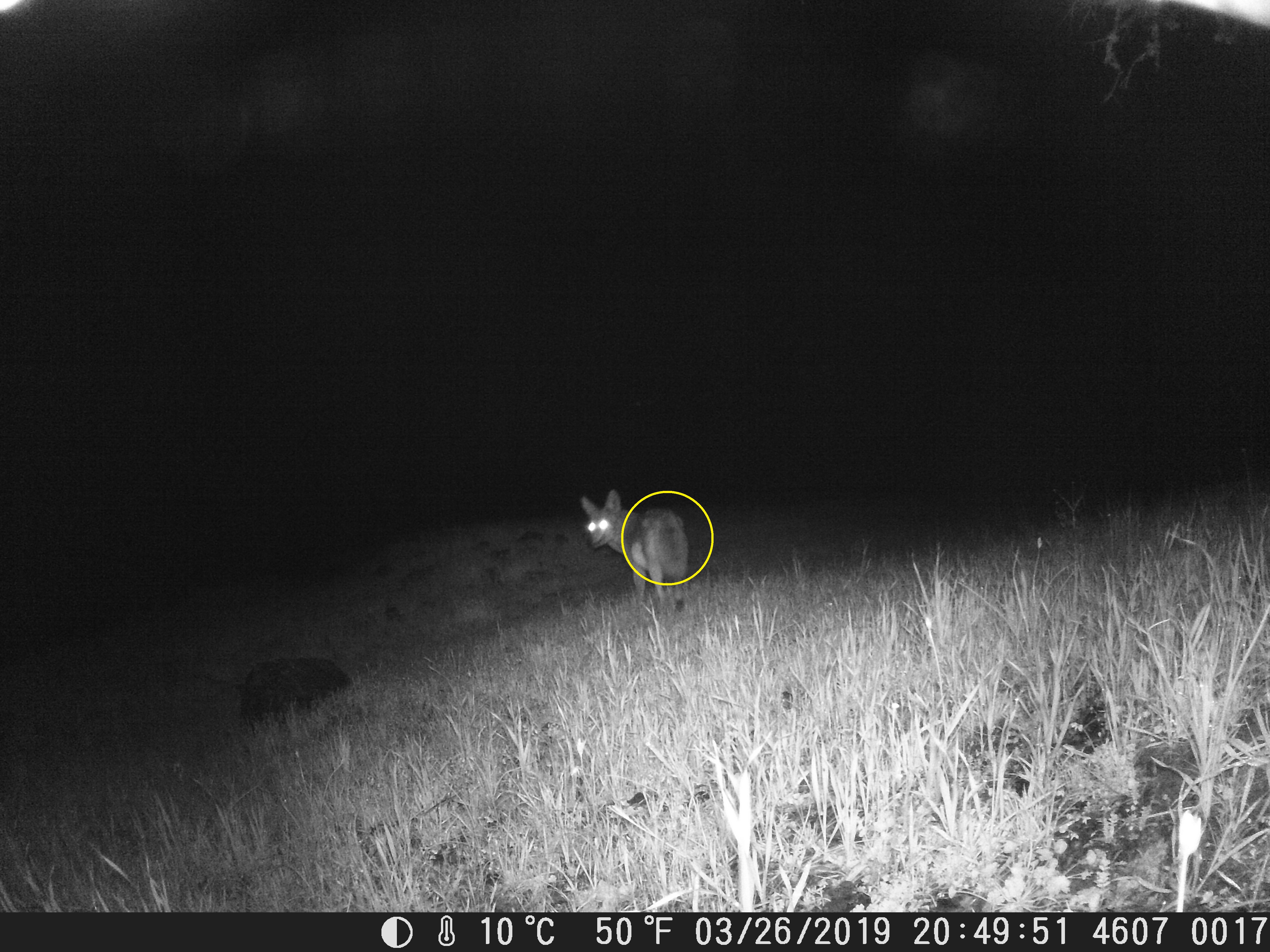
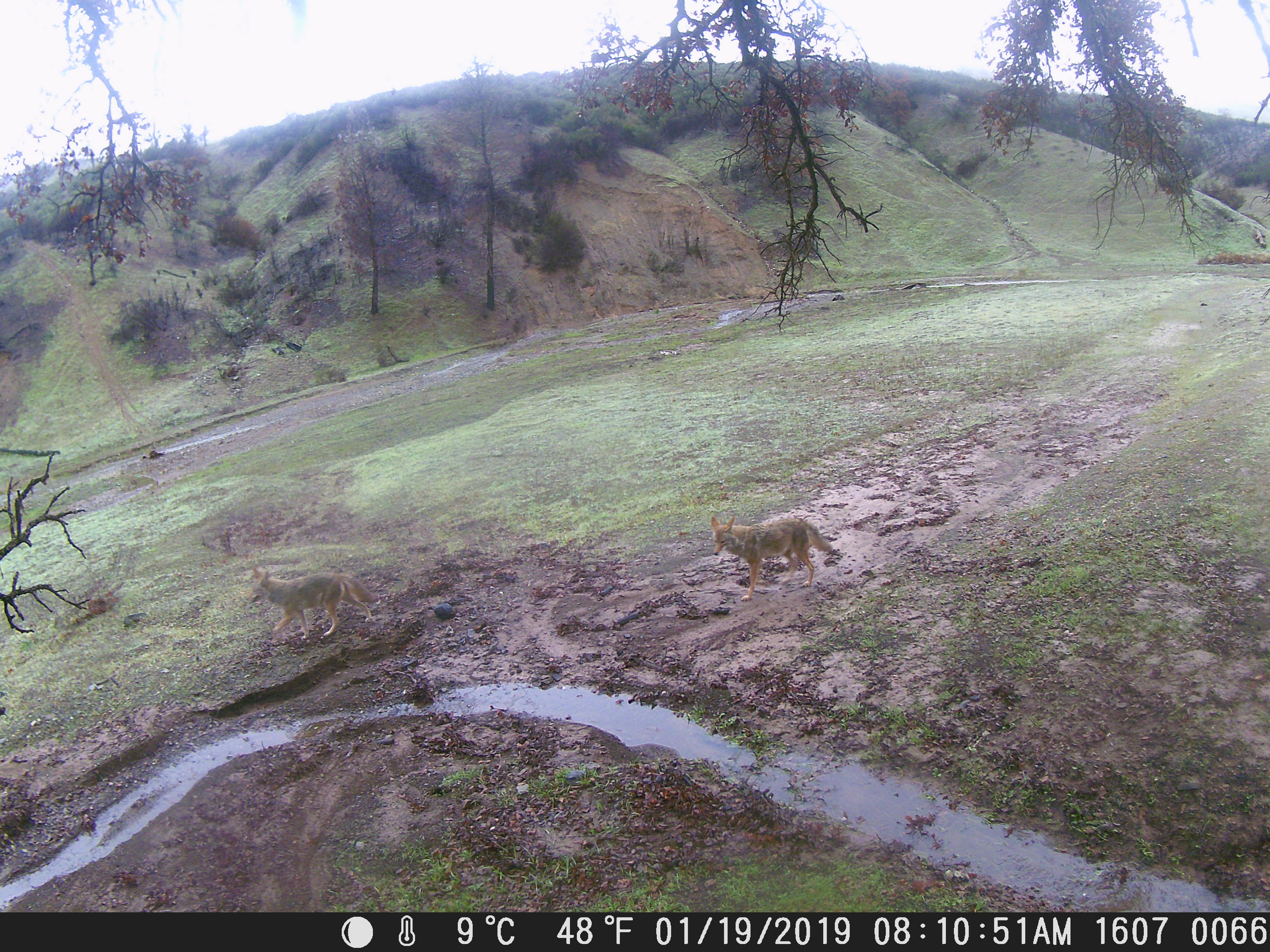
Coyotes (Canis latrans) were again found all over the property - as individuals or in a group of three.
It is easier to find the spotted in some captures...
Some animals, like this Bobcat (Lynx rufus), stop and pose for pictures...
Black-tailed jackrabbits (Lepus californicus) are very active at night and are captured mostly by cameras in the valley.
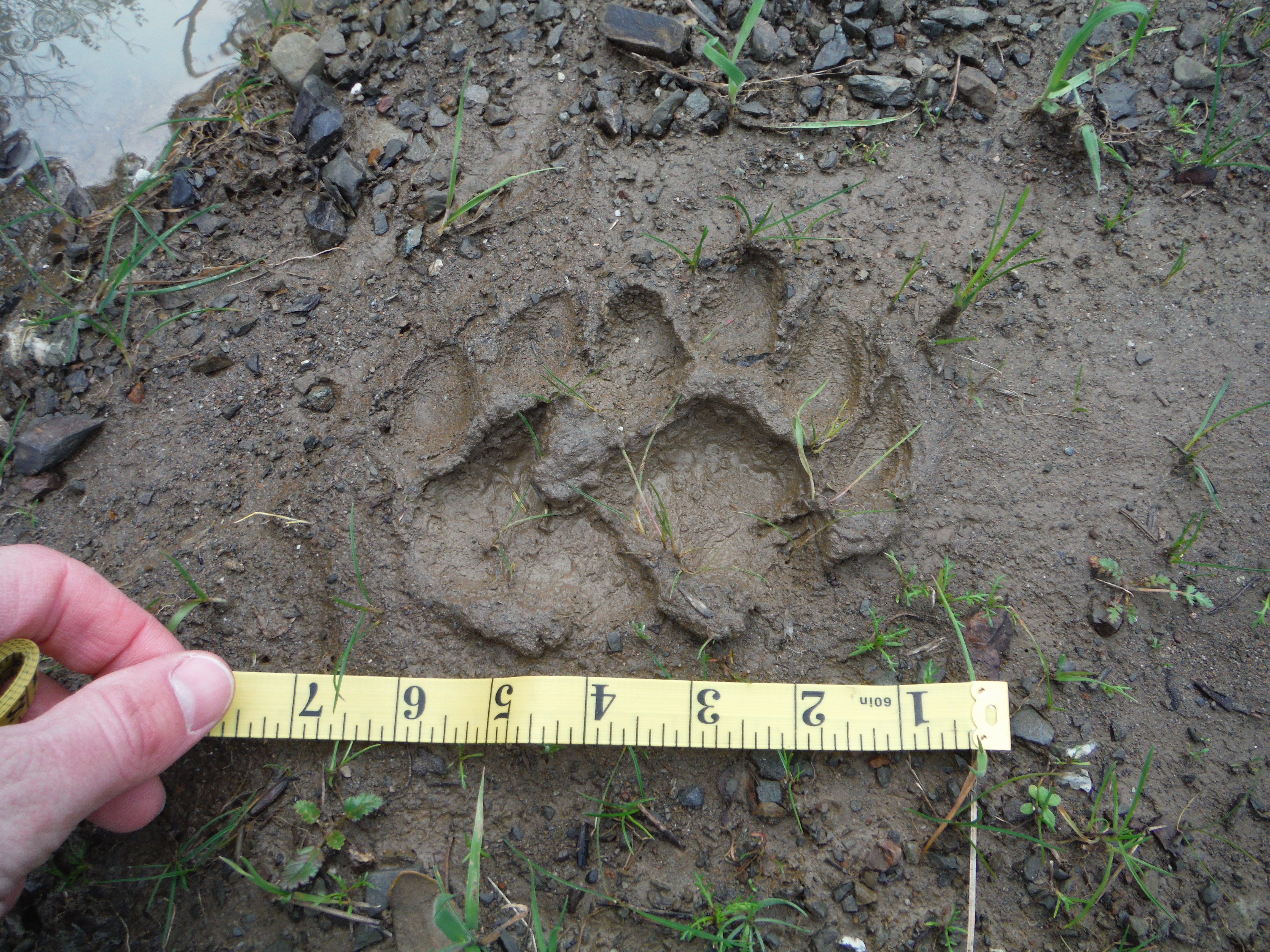
This mountain lion (Puma concolor) walked right past our camera and left beautiful prints in the soft ground next to the camera. When we saw these prints while servicing the camera, we were excited to get back to the office to see an up close view of the animal.
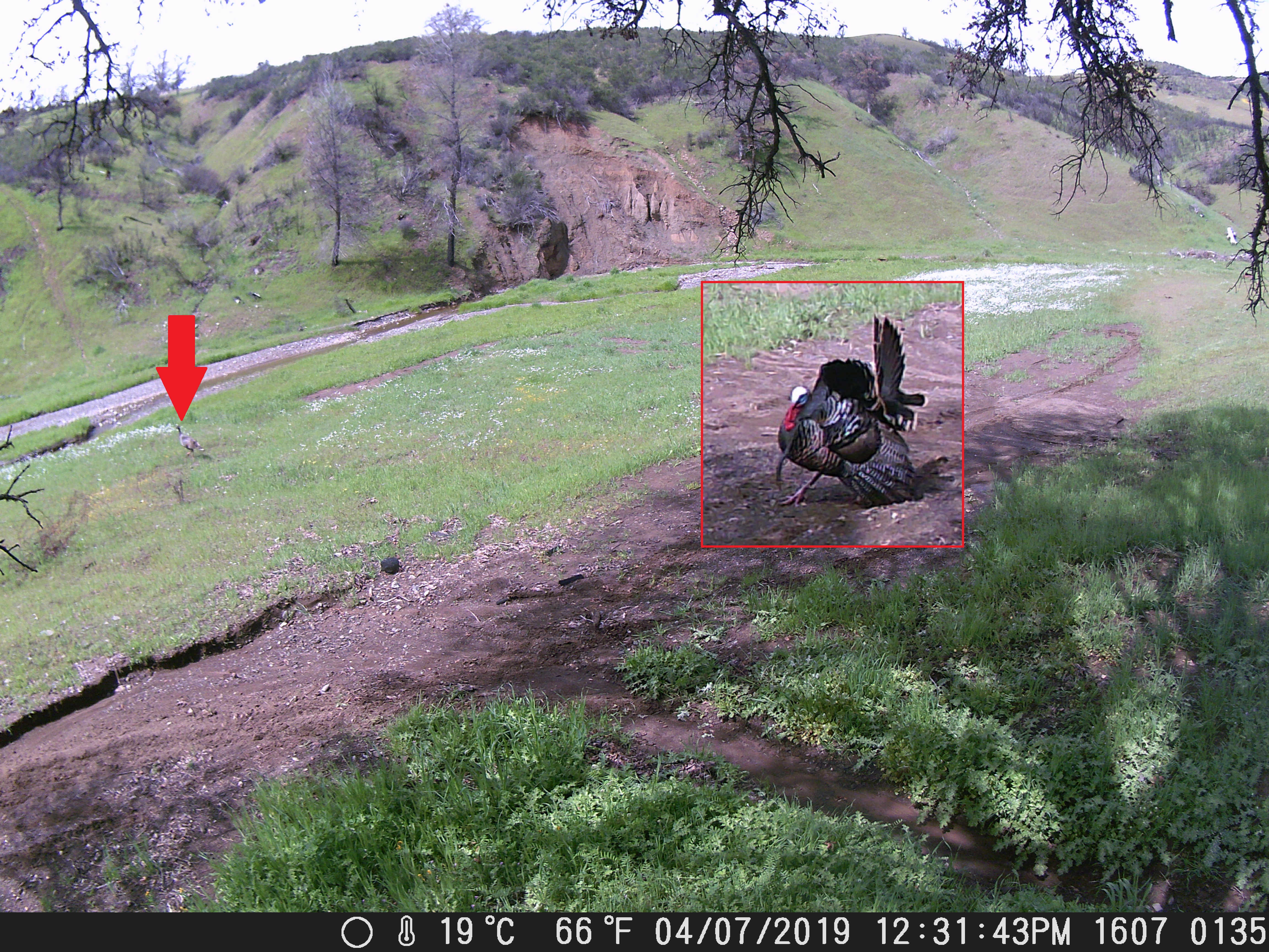
Turkeys were captured on most of the cameras, often with males displaying for females. This picture shows a male (box) showing off for a female in the distance (arrow).
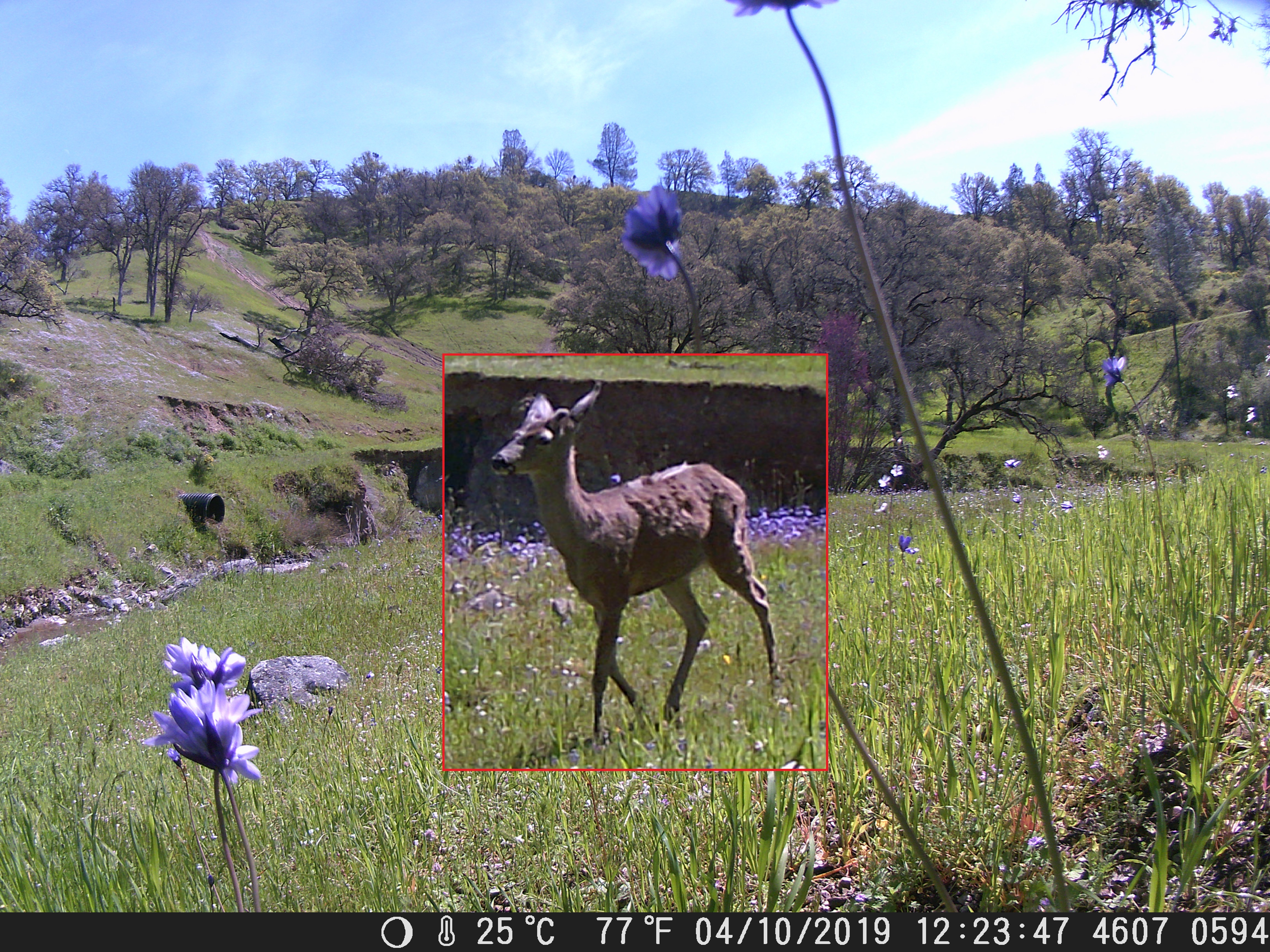
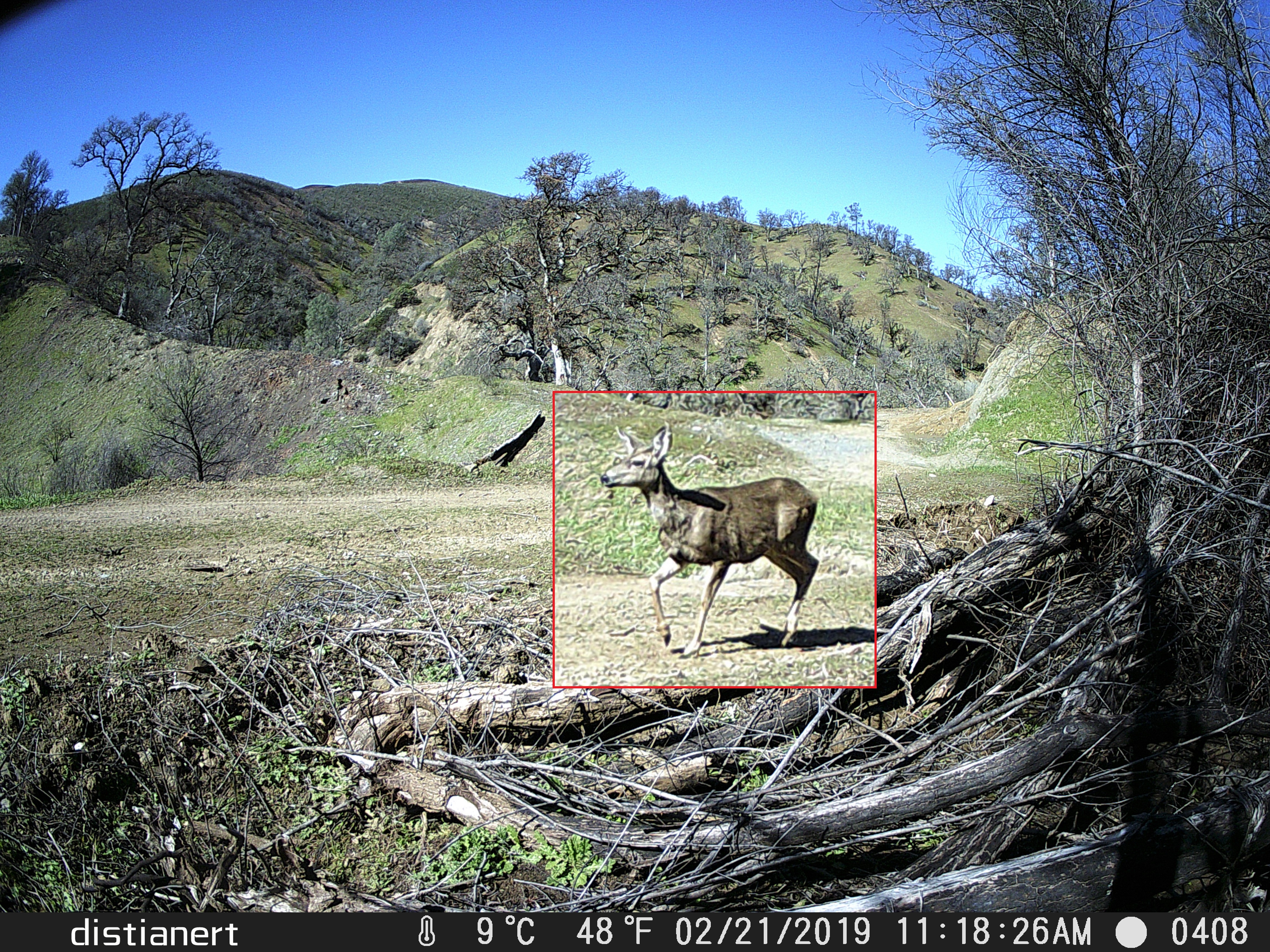
This deer was captured taking a stroll through the wildflowers. Of note in the photo are the spikes on top of his head. These antlers are still covered in velvet which will fall off as the antlers age.
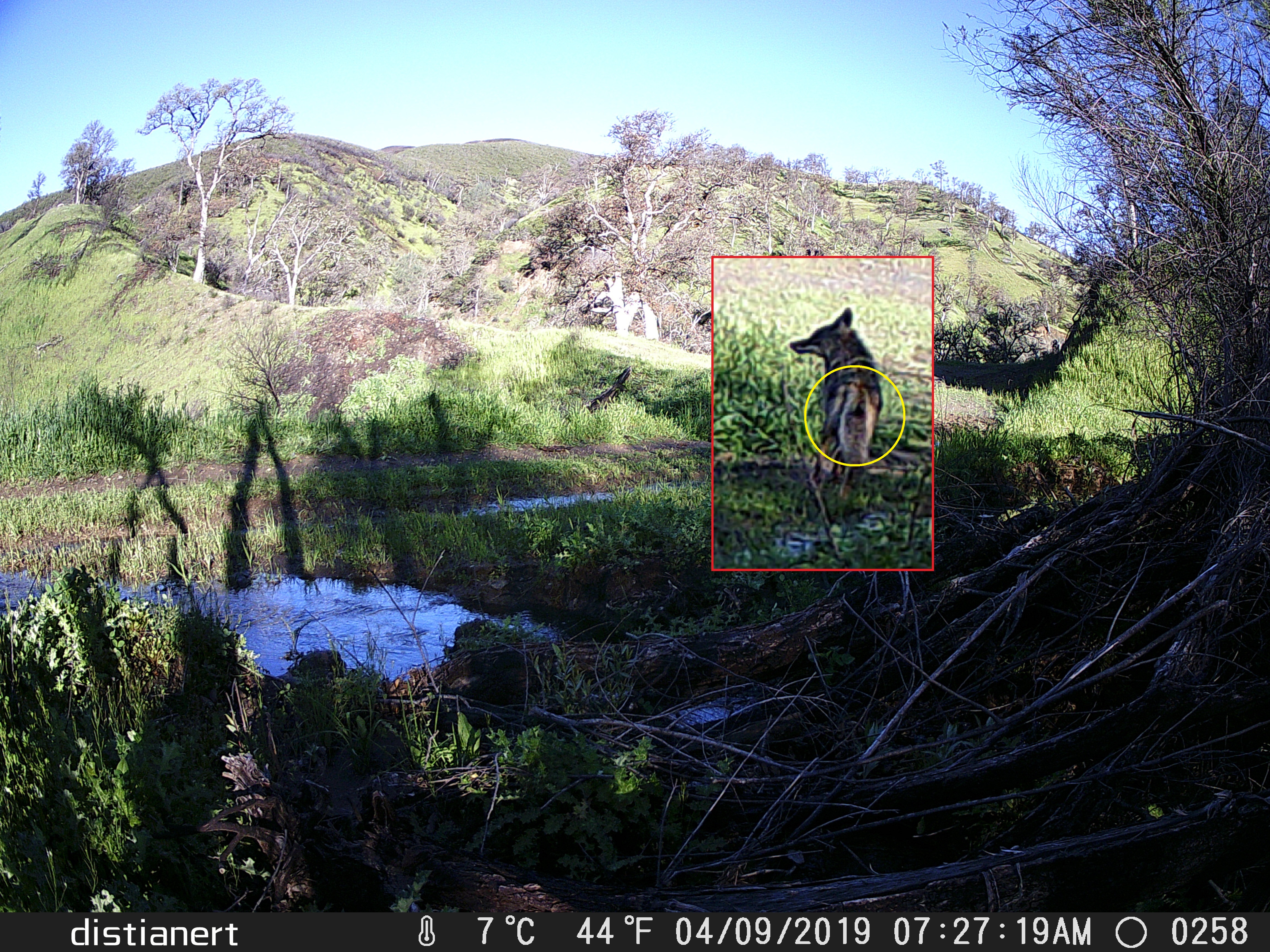
We are able to identify one individual by looking for a spot on its tail. This animal has been seen by itself and in a group.
...while other captures require a keen eye.
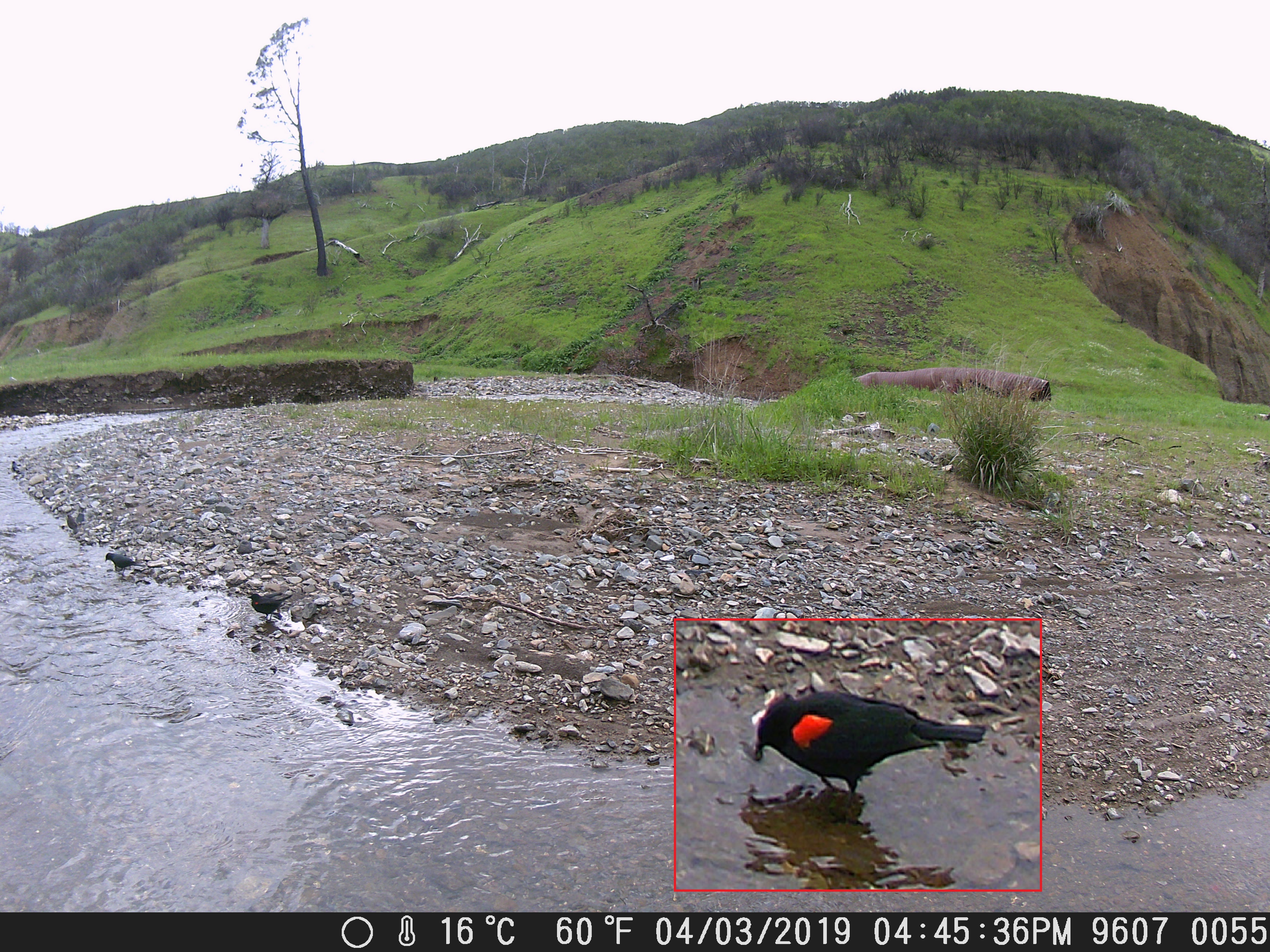
...while others like these Red-Winged Blackbirds (Agelaius phoeniceus) go about their business.
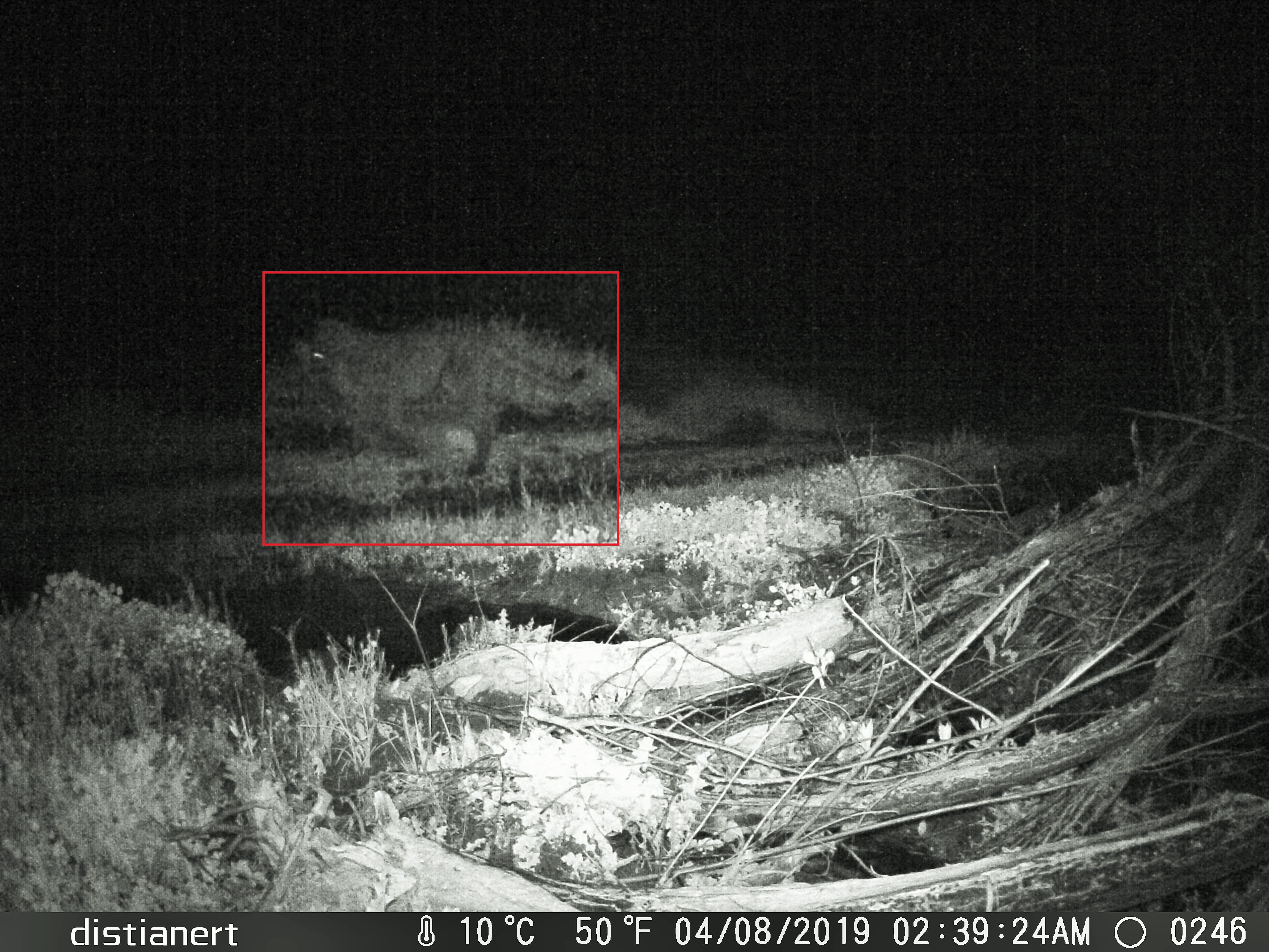
Mountain lions (Puma concolor) are also mostly active at night. They have been captured mostly walking along the road.
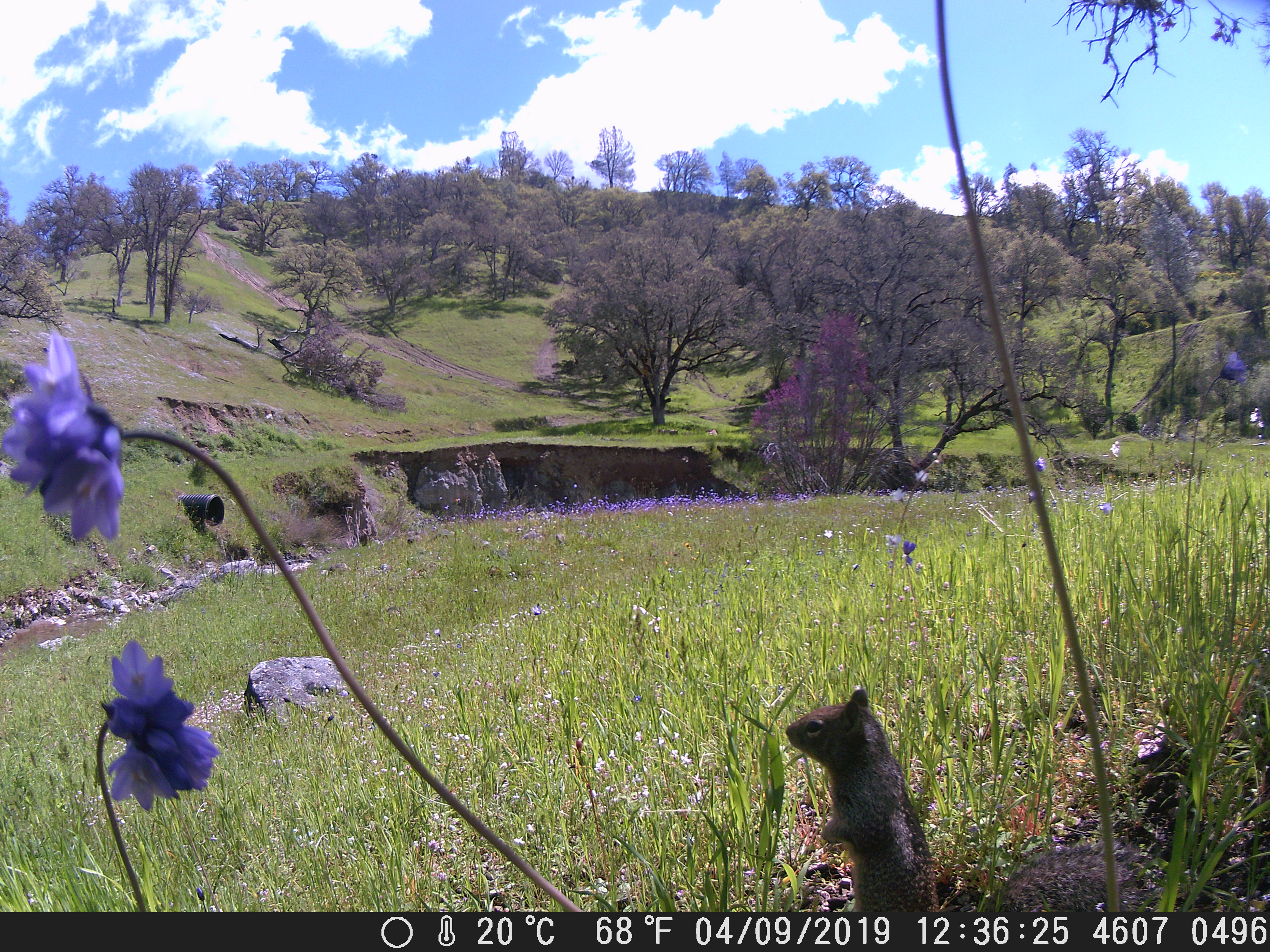
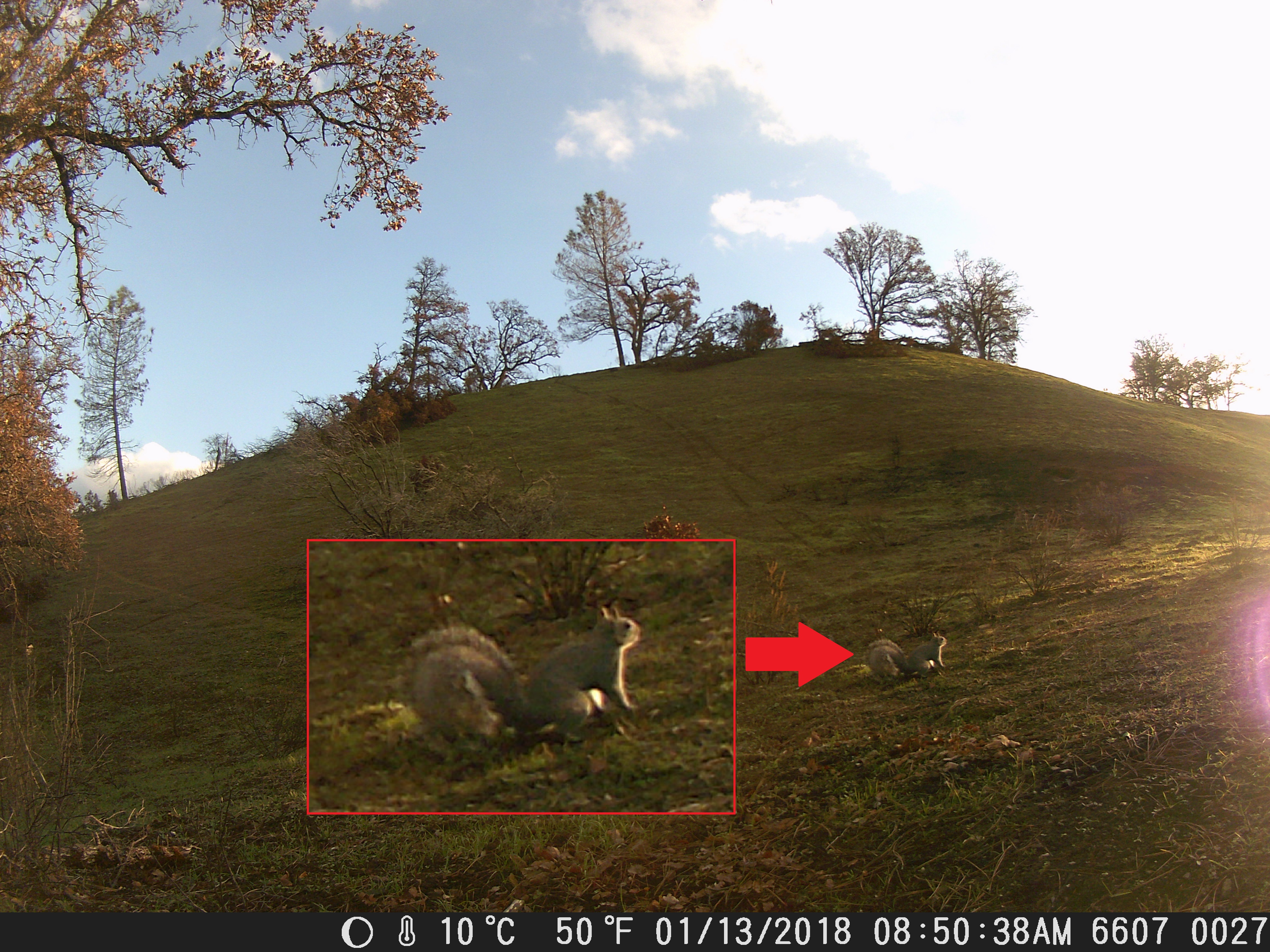
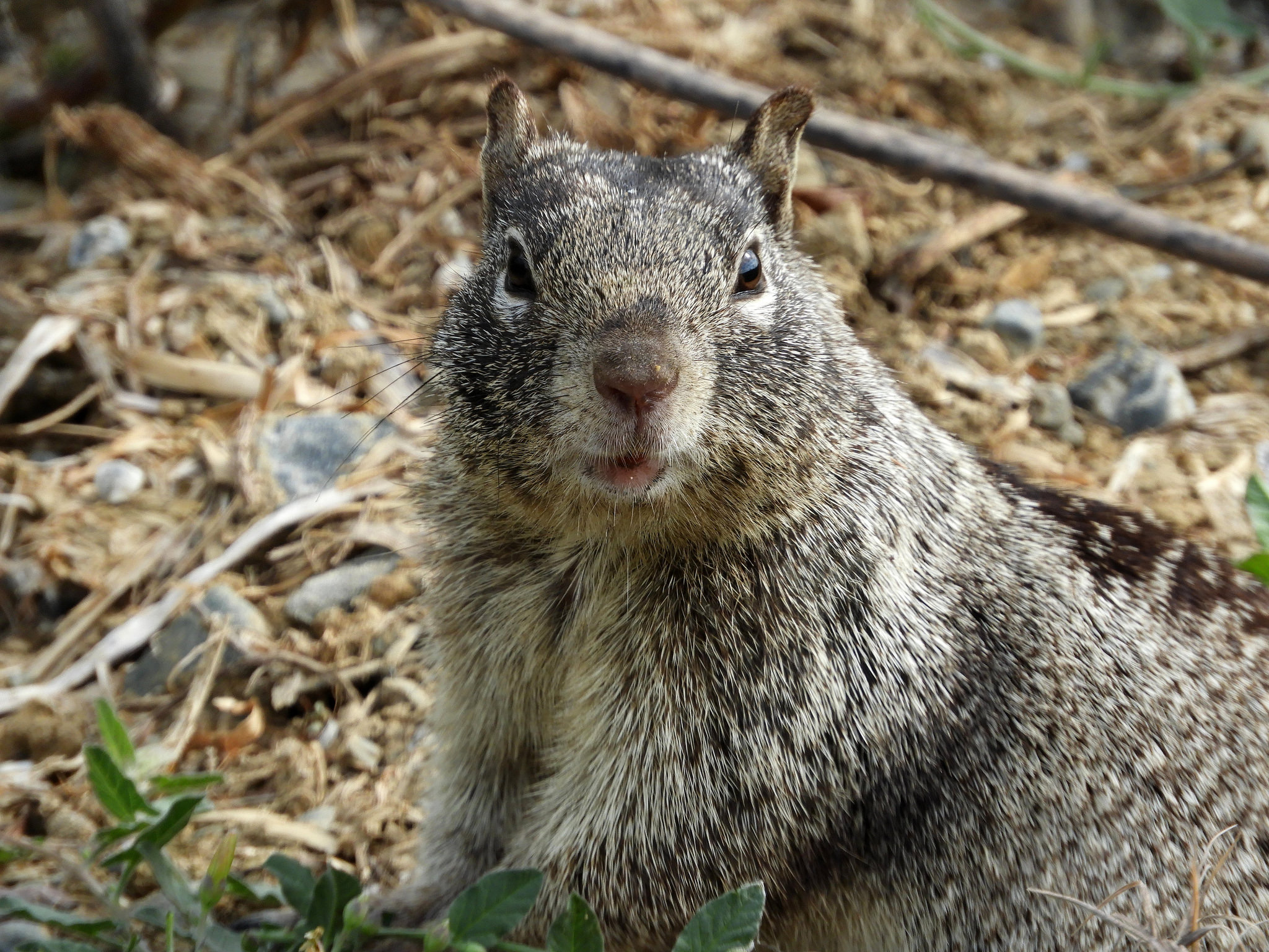
Animals like to play games, too! At least that's the feeling we get when we look at this picture of a squirrel playing peak-a-boo with the camera!
Post 3-14-19
Project ID #18-022
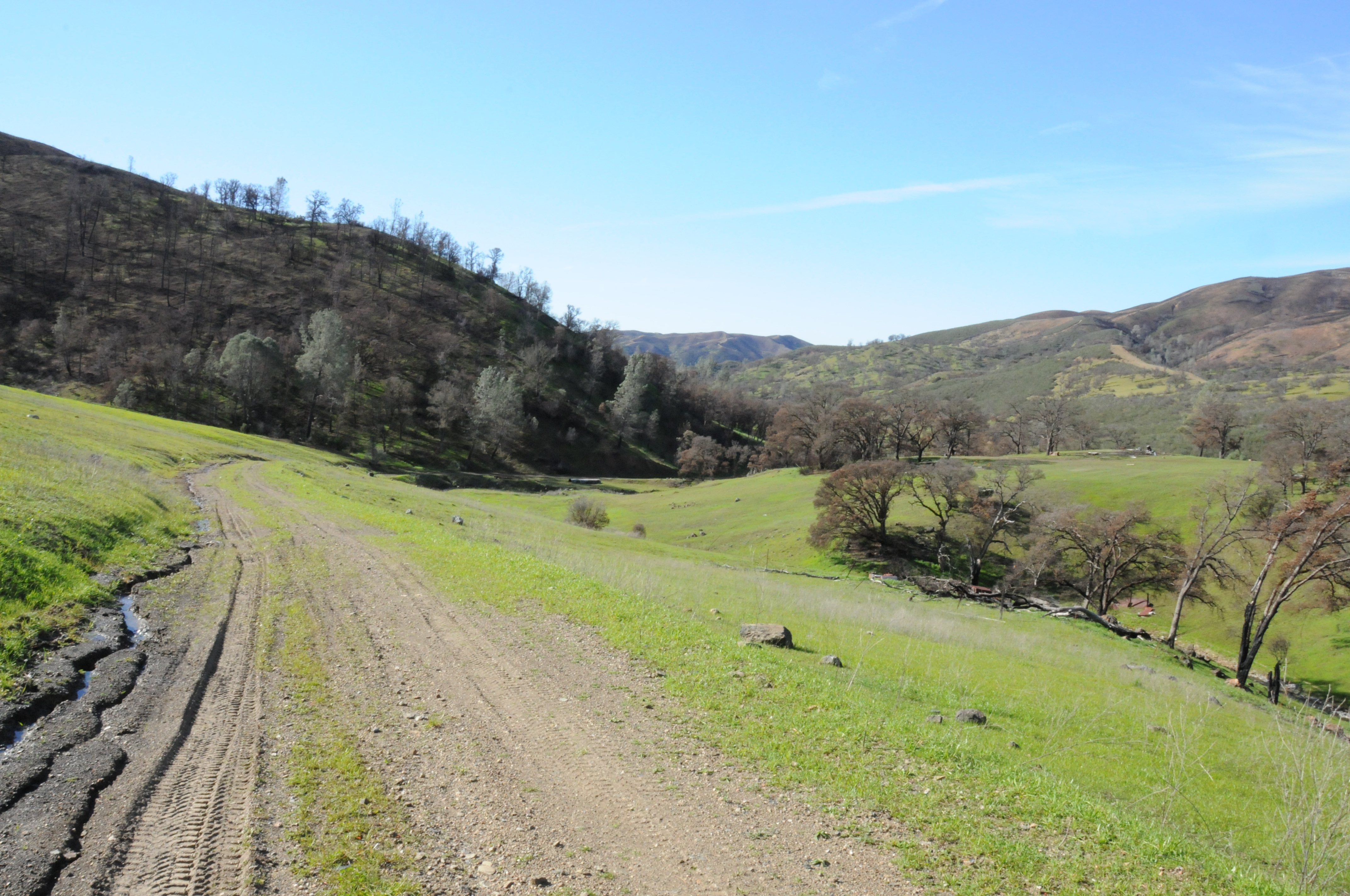
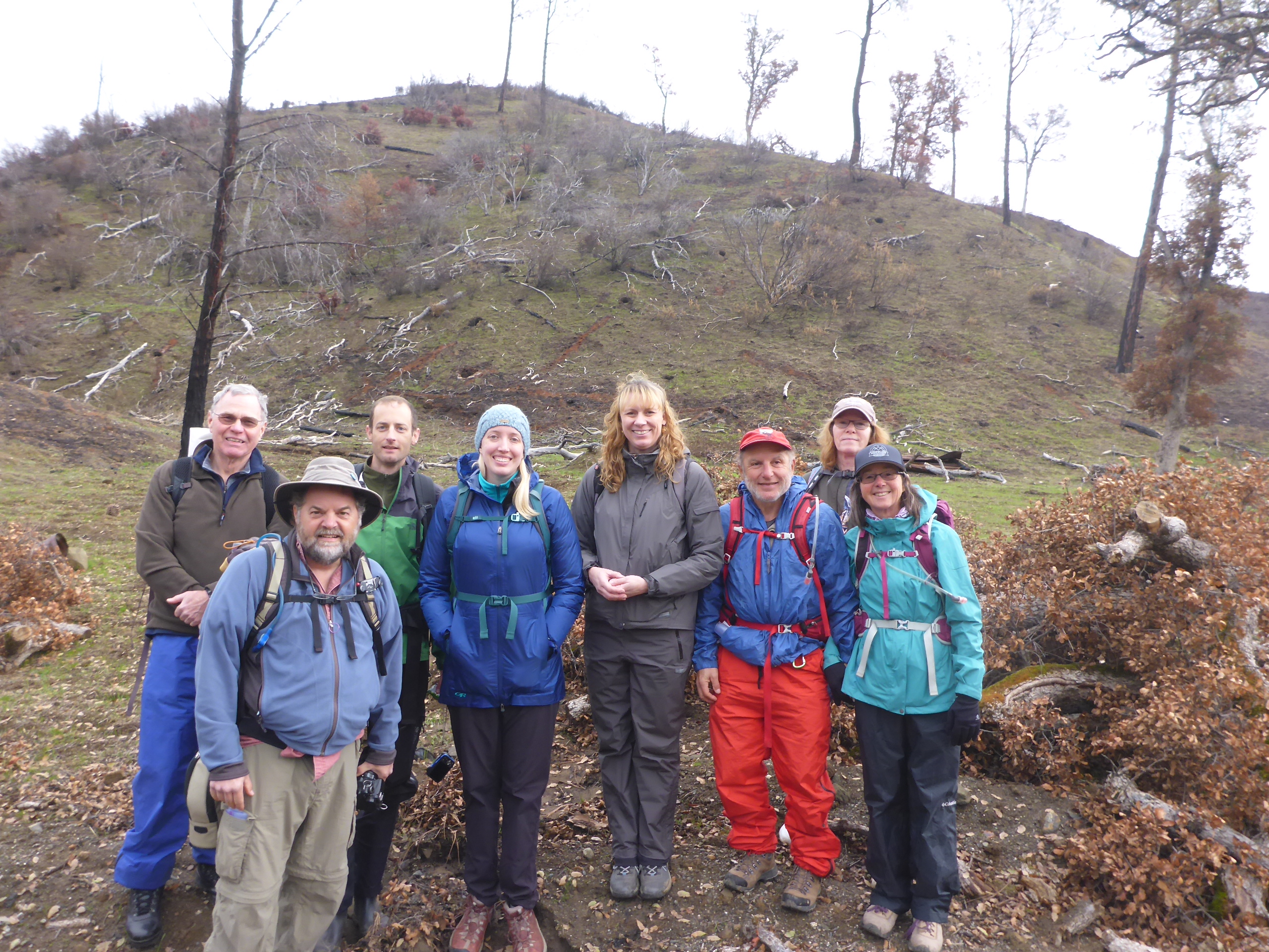
Due to the weather enforced, last-minute rescheduling of the March 7 outing, Bill Grabert and Nate Lillge were joined by only two volunteers: Johannes Troost and Kevin Scott. The small number of volunteers required quick work at each camera and regeneration site. The heavy rain on March 13, washed away most of the tracks—the group therefore didn’t have to take time to document what they saw in the mud. However, there were many early season wildflowers! Expectations are high for the April 11 visit!
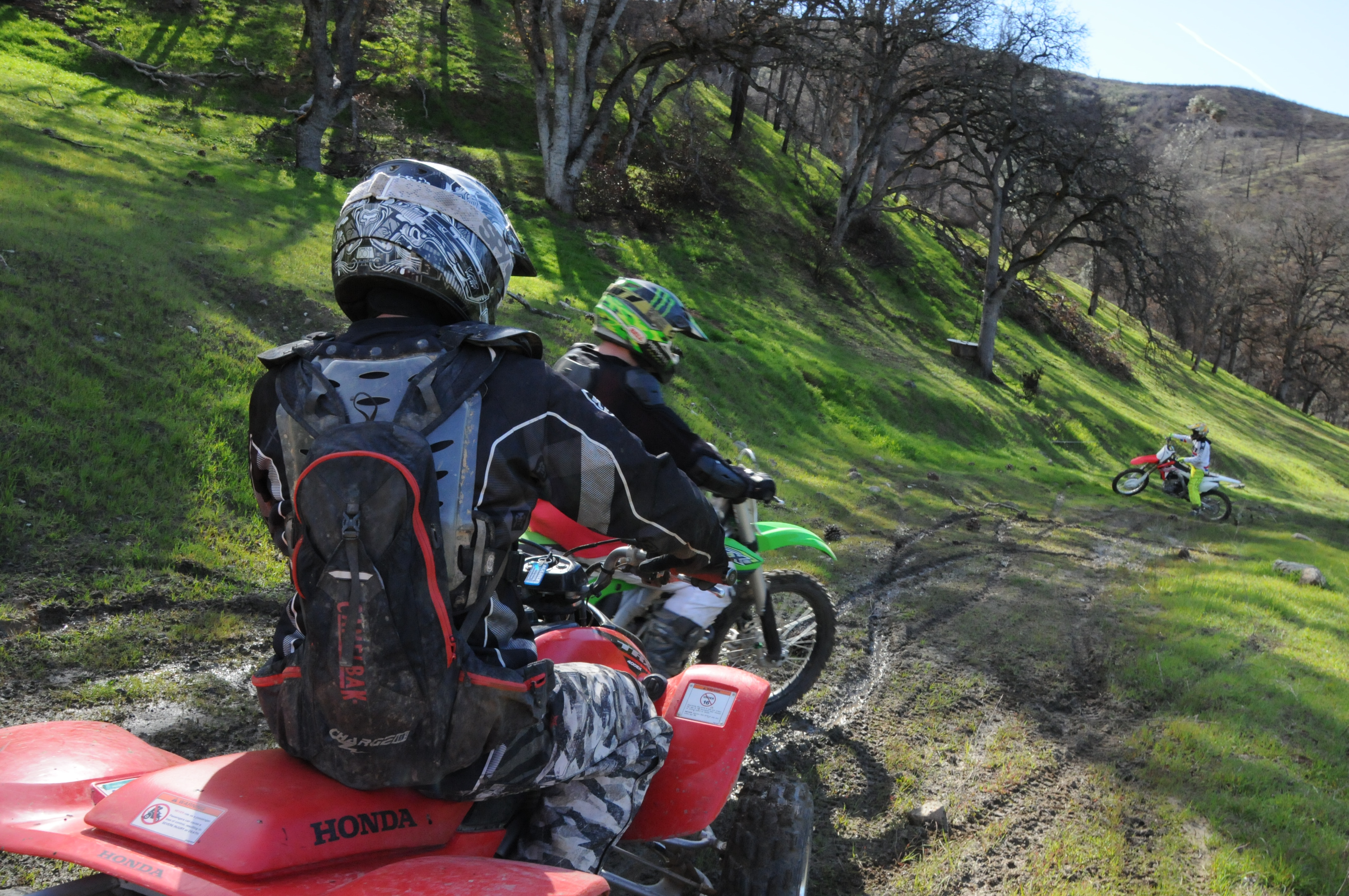
As the group was walking down the road toward Benmore Canyon, a group of OHV riders entered the property. Nate quickly ran up the hill and asked the half dozen riders to return the way they came and use the roads and trails to the north. The cameras have consistently captured many OHV riders using the property but this was the first time that we had the chance to engage with any of them. While they complied to our request, they were reluctant and a couple of them took the opportunity to turn around on the hillside—causing additional erosion and damage to the hillside. As stated previously, illegal OHV access is an ongoing issue and one that Tuleyome is trying to remedy. There are many ways to enjoy nature—OHV riding is one of these. However, when riders create new trails or trespass, it becomes a nuisance.
The early signs of spring have made us excited about what is to come! We are looking forward to next month’s visit to see what wildflowers show up. During our next visit, it is our intention to dedicate a couple of volunteers to make note of the species to continue our species identification. We may also decide to take multiple trips to the property to increase the number of species recorded.
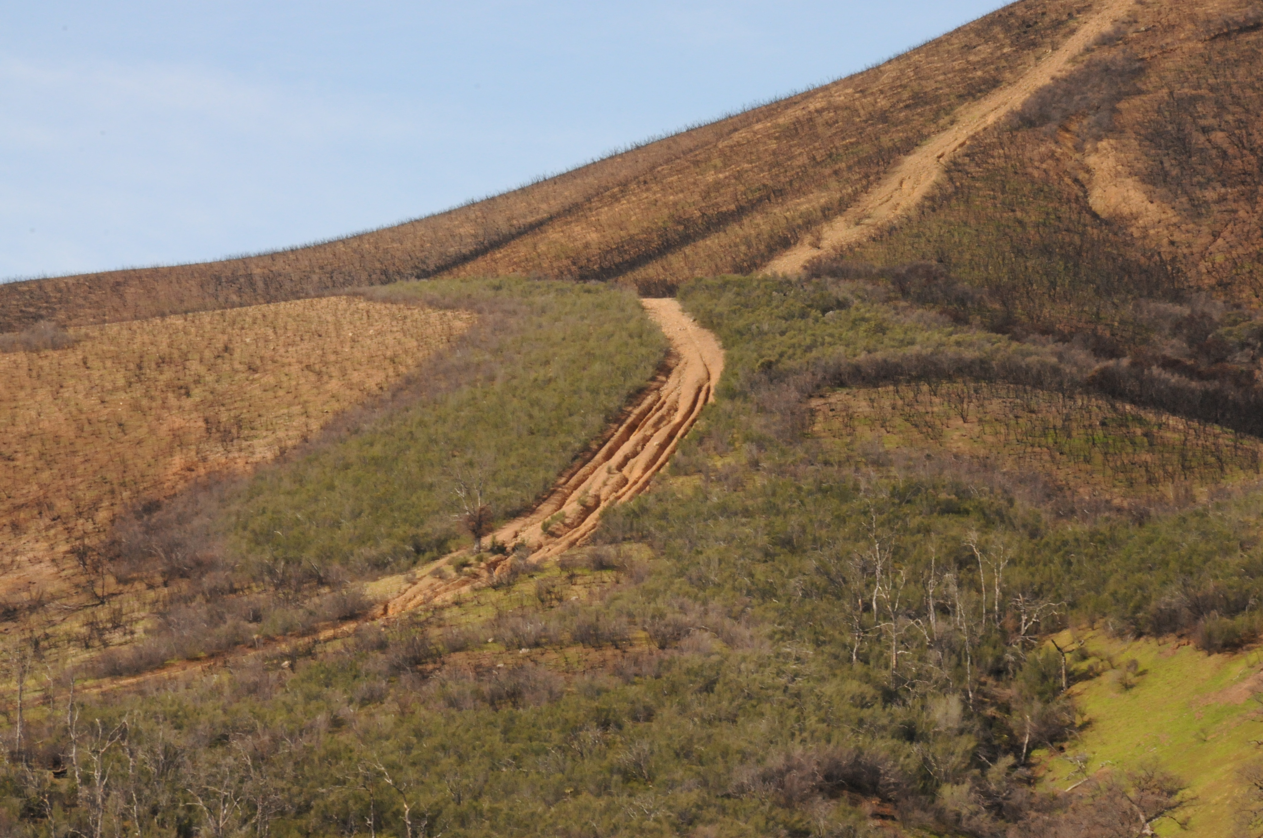
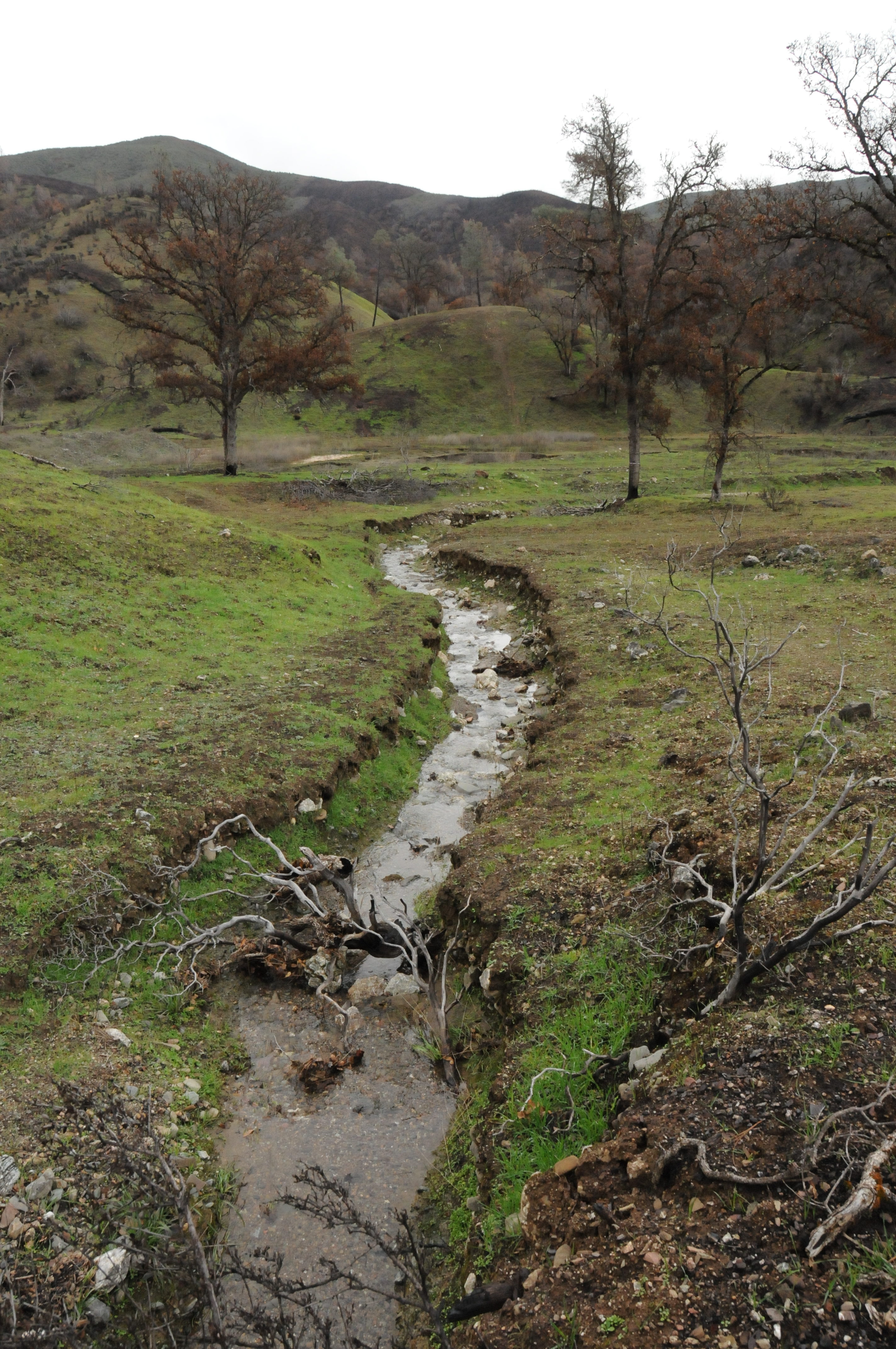
The photo of the hillside illustrates some issues that can occur after a fire. There are many deep rills along the fire-break—it is likely that water/rain has created these and it is possible that OHV riding has impacted the area as well. This is a great example of what Tuleyome is trying to prevent on the Silver Spur Ranch property.
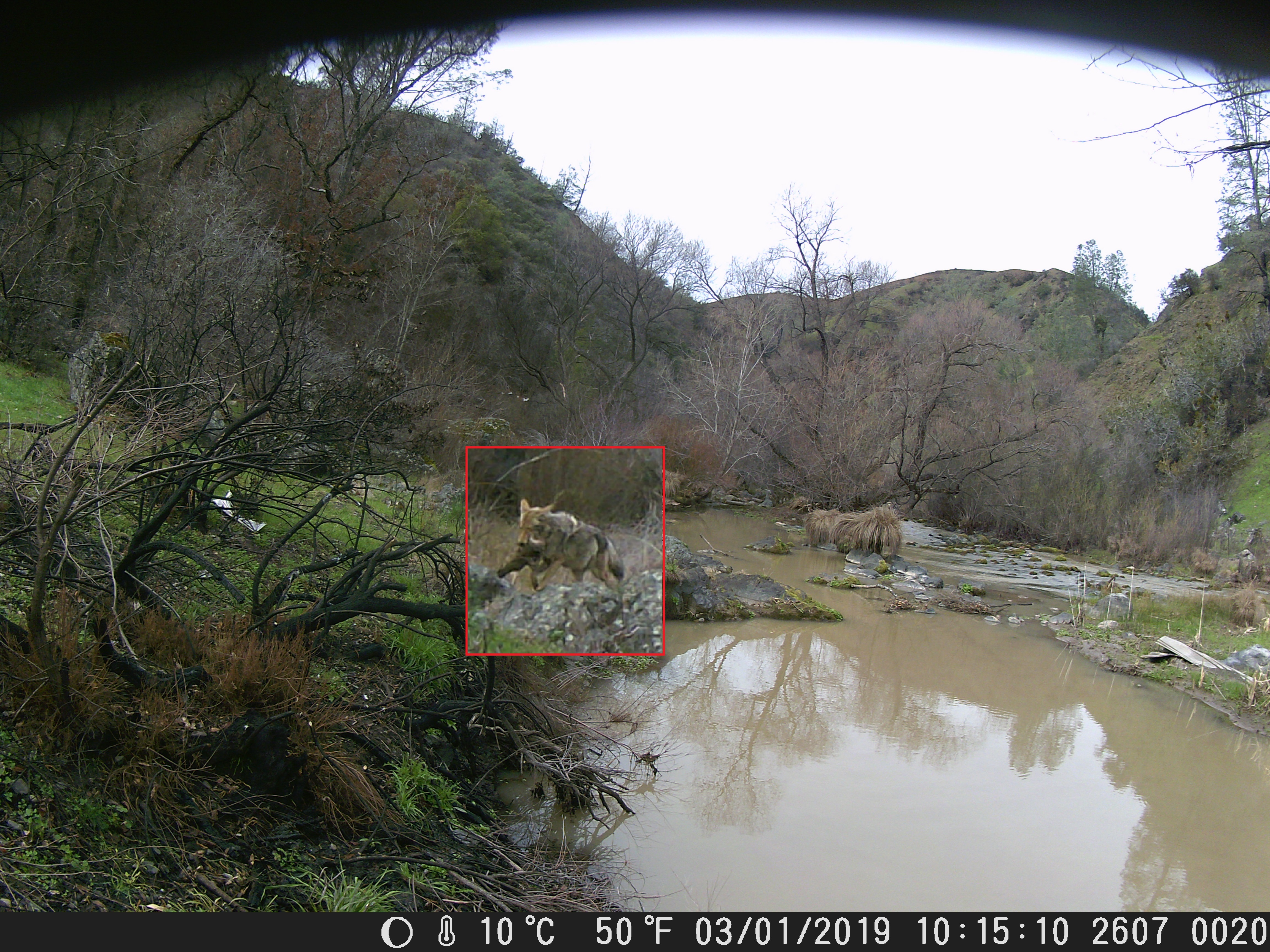
Coyotes continue to be one of the most popular visitors to our cameras—captured as individuals or in groups. We are unable to determine if the individuals captured are part of this regularly captured group of three. Note the spot on the tail of the coyote—this is the same coyote has been captured many times by cameras throughout the property.
When going through the many images captured by each camera, it is often difficult to see if an animal has been captured. This is especially difficult when the animal is relatively far from the camera or at side of the image. When first going through the photos, a large bird on the right side of a photo taken by the River camera was not seen. However, after reviewing them, a dark spot was seen in this one image. After editing the image and zooming in, it was determined that this is probably a golden eagle (Aquila chrysaetos) based on the color, size, location, and date.
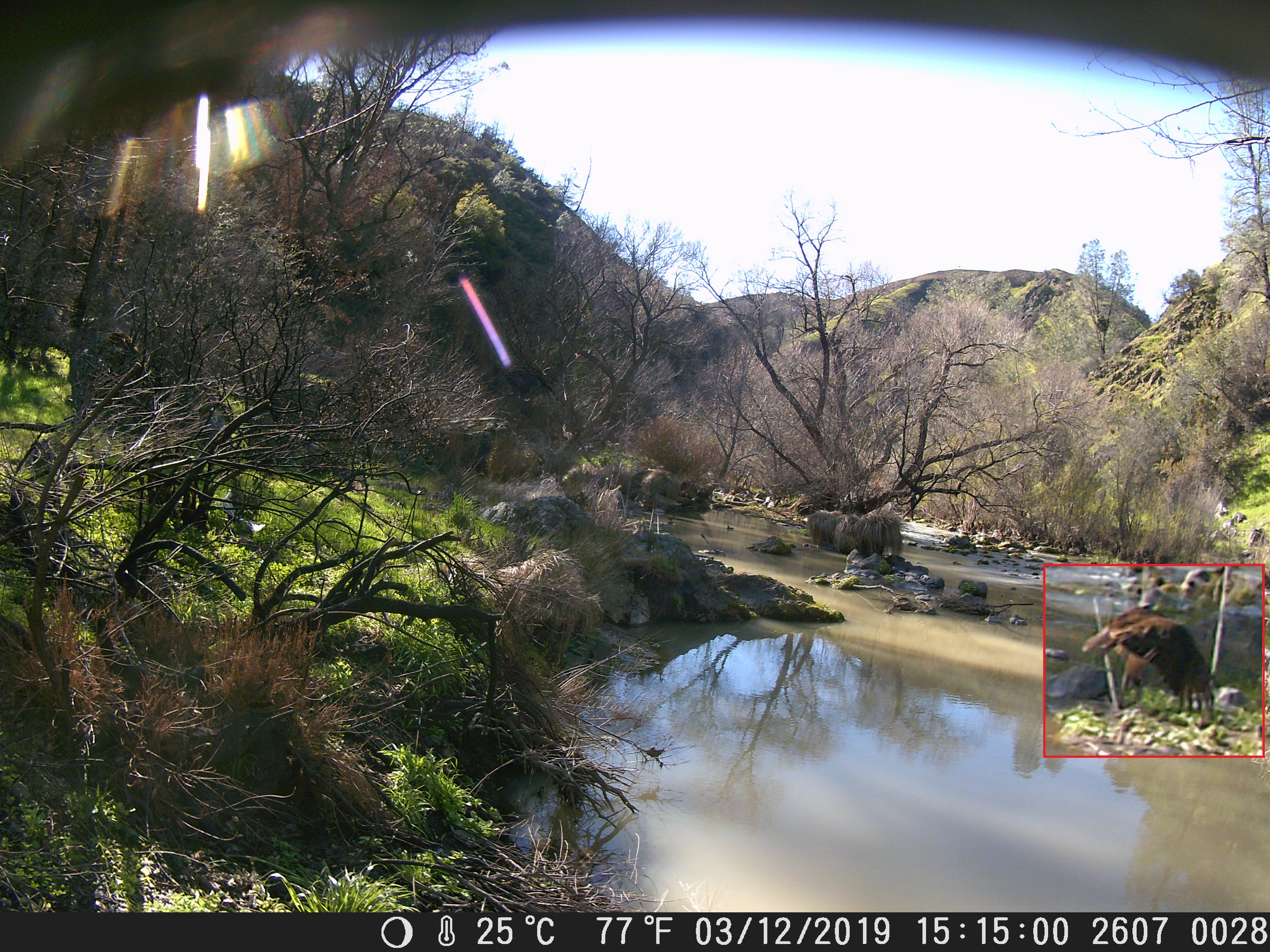
In addition to the Golden Eagle, the River camera capture a coyote with what appears to be the head of a deer!
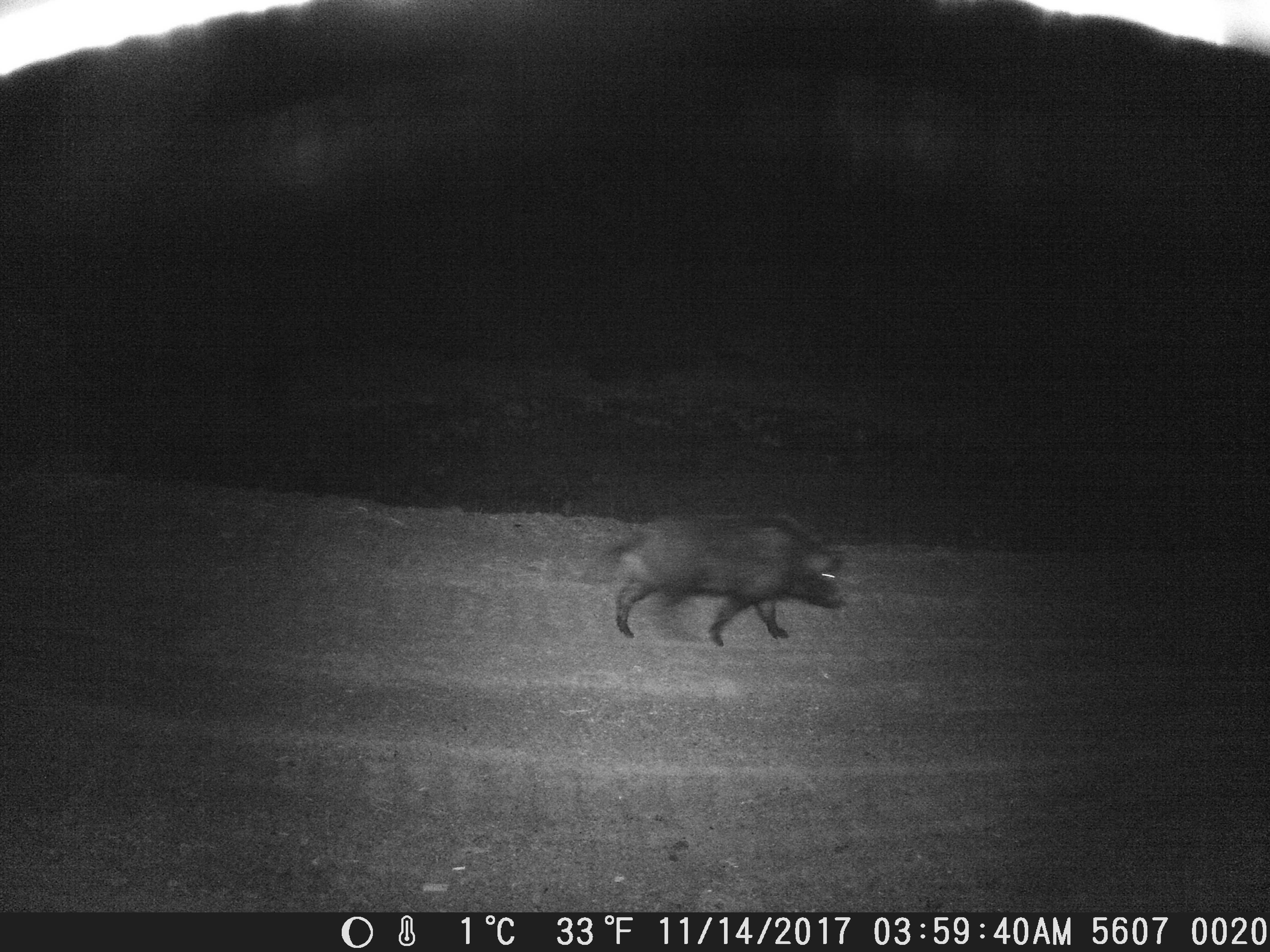
The new cameras that were placed in February were placed near a stream crossing the road where we had found many tracks of many different animals which led us to have high hopes for this camera. We had seen prints of coyotes, mountain lions, bobcats, herons, quail, and turkeys. As we have seen on other cameras, many different animals use the road as an easy corridor. Coyotes, deer, turkeys, wild pigs, and mountain lions were captured by these cameras since our last visit. Rain on the lens lessened the quality of some of the pictures but we are still able to collect data from these.
The new addition this month was getting videos from some of the cameras. We currently have 4 cameras that are recording video—Box Canyon (1260), Crossroads (5607), Milkweed (6607) and Pond (8607). Similar to when we originally placed the cameras, we will have to fine tune the settings and placement, but we are happy with the results after one month!
We have added many these videos to our website:
Wild Pig/Boar: http://tuleyome.org/wp-content/uploads/DSCF0004.avi
Coyote: http://tuleyome.org/wp-content/uploads/DSCF0007.avi;
http://tuleyome.org/wp-content/uploads/DSCF0005.avi;
http://tuleyome.org/wp-content/uploads/DSCF0012.avi;
http://tuleyome.org/wp-content/uploads/DSCF0016.avi
Deer: http://tuleyome.org/wp-content/uploads/DSCF0025.avi;
http://tuleyome.org/wp-content/uploads/DSCF0045.avi
Mountain Lion: http://tuleyome.org/wp-content/uploads/DSCF0006.avi;
http://tuleyome.org/wp-content/uploads/DSCF0046.avi
Our next scheduled visit is April 11, 2019.
Post 2-7-19
Project ID #18-022
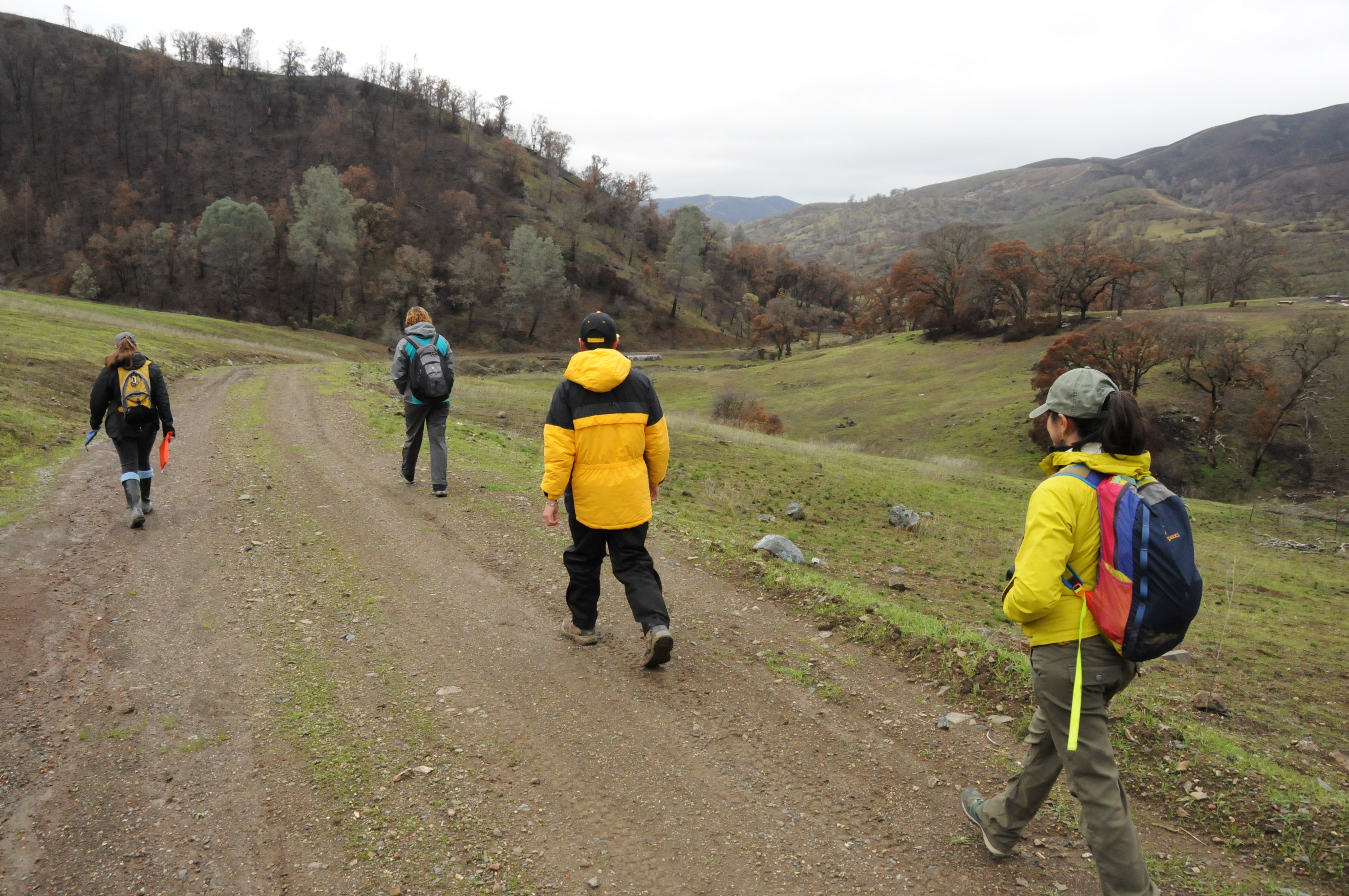
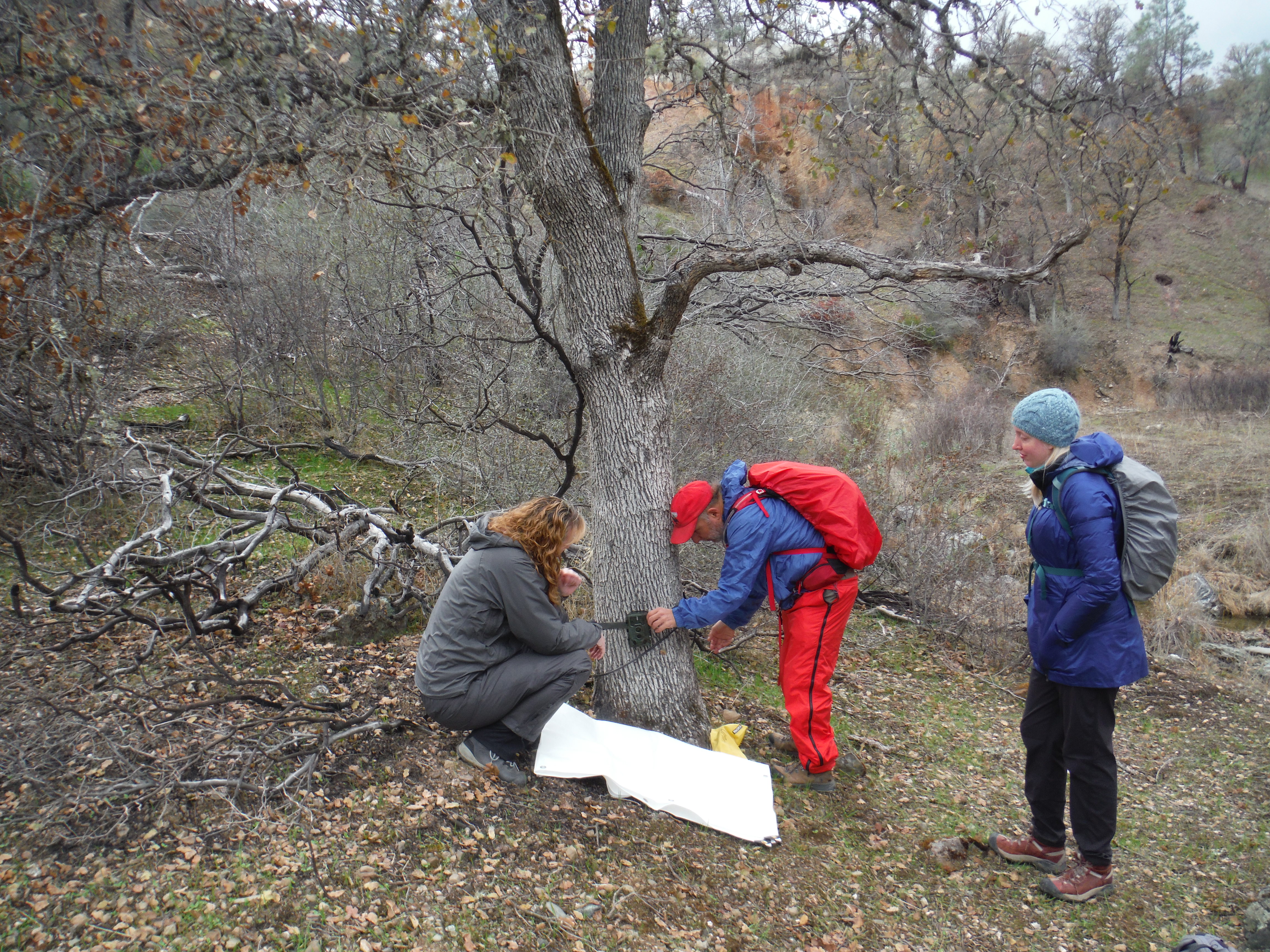
Our monthly visit to Silver Spur Ranch was definitely muddy and wet but it provided us with some good information. Roxanne Moger joined project Co-Leaders Bill Grabert and Nate Lillge to service the cameras, add 3 cameras to the site and begin our regeneration study. As usual, tracks and other evidence of animal activity were noted.
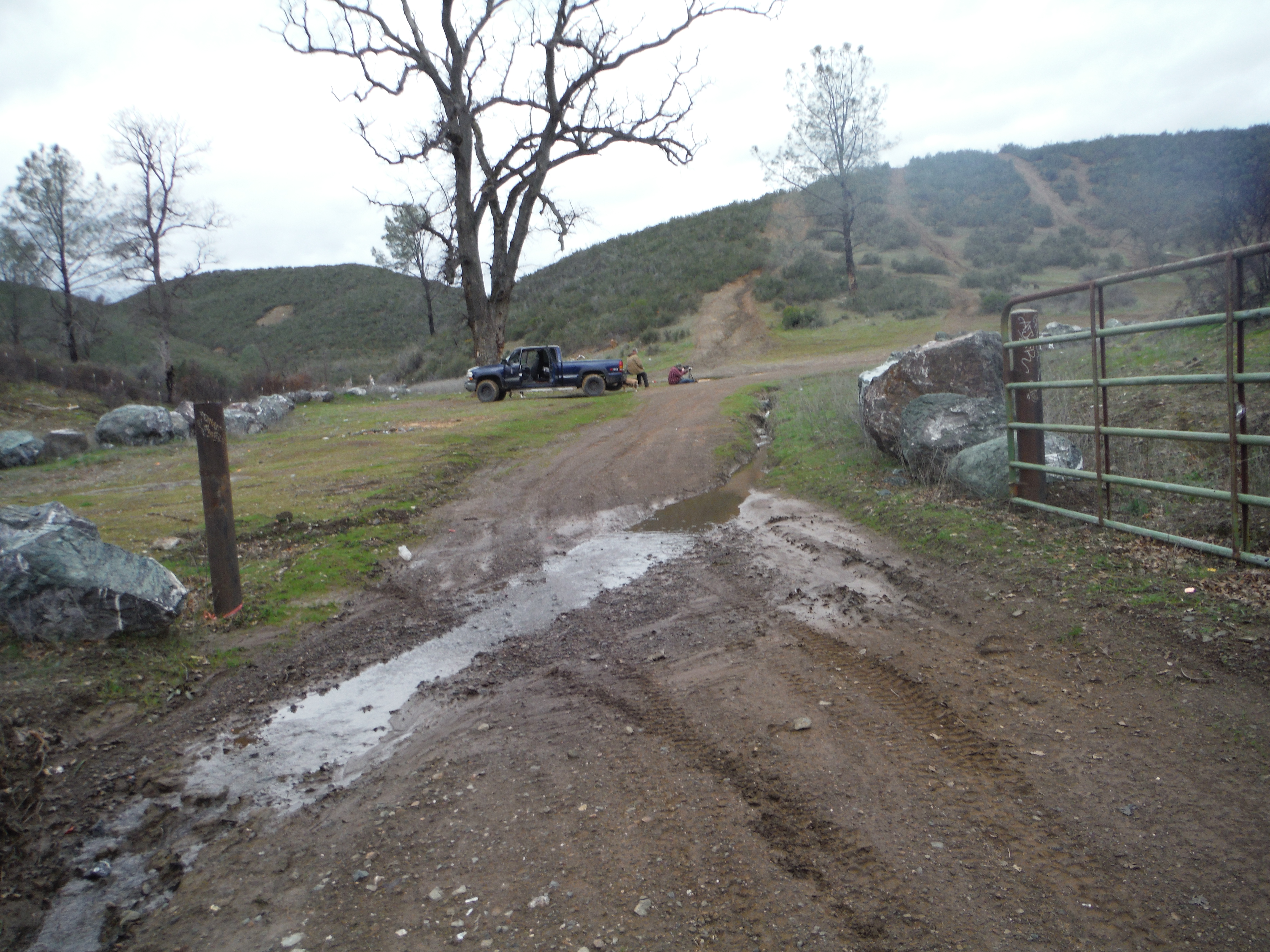
The small but experienced group was able to quickly pack the gear and get to work. Because of continued rains, the group parked along Walker Ridge Road and hiked in to the property. As with the previous two trips, the ground was perfect for finding recent tracks. Before reaching the gate, mountain lion and elk tracks were found along the road—providing hope of seeing these animals on the cameras. The stream was higher and flowing faster than previous visits, but there was no other quickly noticeable differences. Nate and Roxanne focused on the cameras along the road while Bill again rode the ATV to the River and Southern cameras.
Along with servicing the cameras, each person was charged with finding and marking significant OHV activity as well as any major erosion events. These locations will help Tuleyome determine where to focus our restoration efforts. Photos were taken and locations recorded. These will be entered into a spreadsheet that will be updated throughout the project.
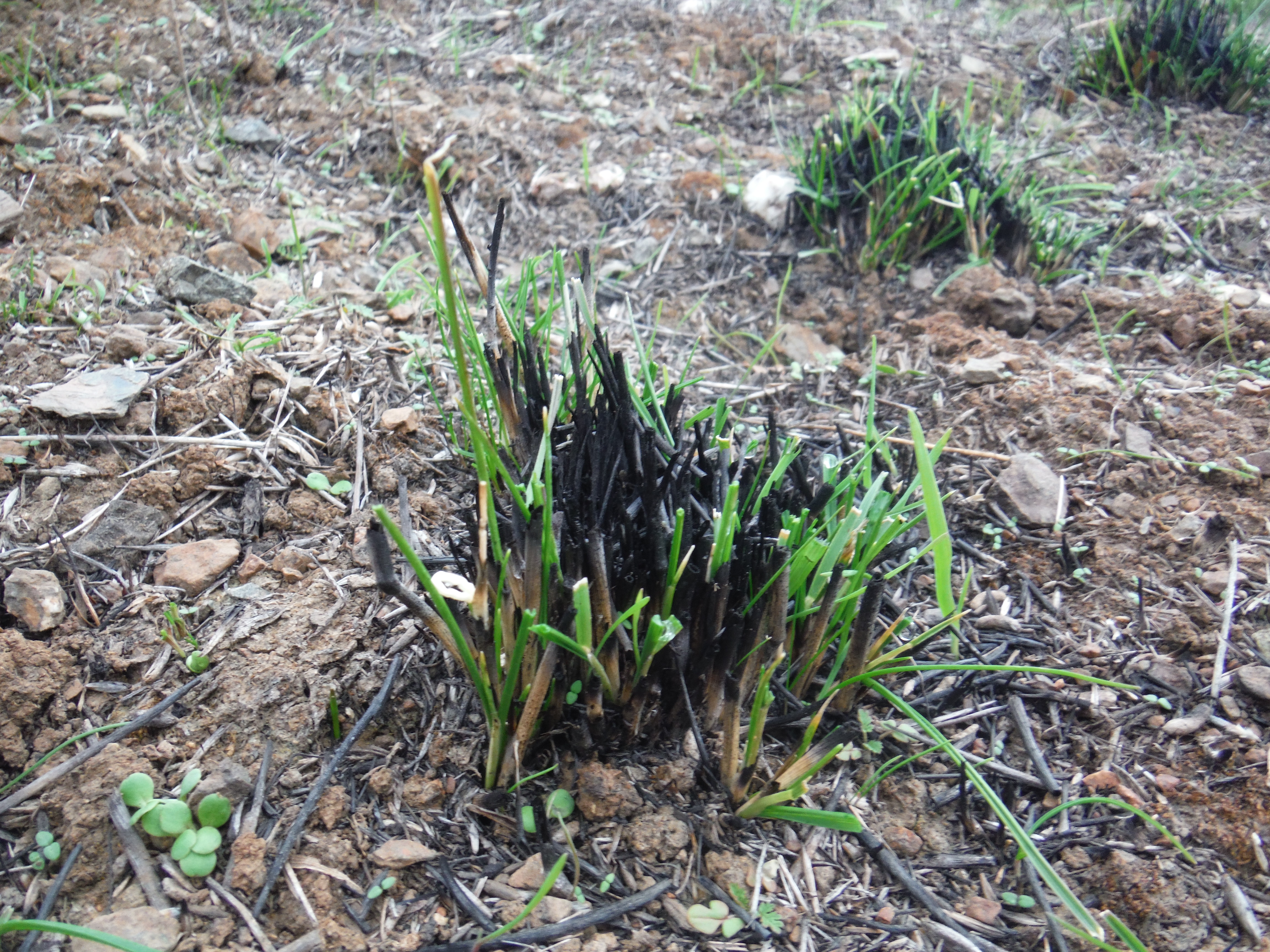
Nate had been informally recording regeneration and the changing seasons on Silver Spur. However, it was decided to create a more formal study. The group was charged with selecting plants that have begun to regrow and record the location, species, and height of each as well as taking pictures. Due to time restraints, Nate and Roxanne were able to mark only two locations to monitor, easily accessible on the roadside. The first location is on the edge of a burned area in the main valley. The second is in a heavily burned section where Box Canyon intersects Benmore Canyon in the southern end of the property. We are hoping to add more sites during our next visit.
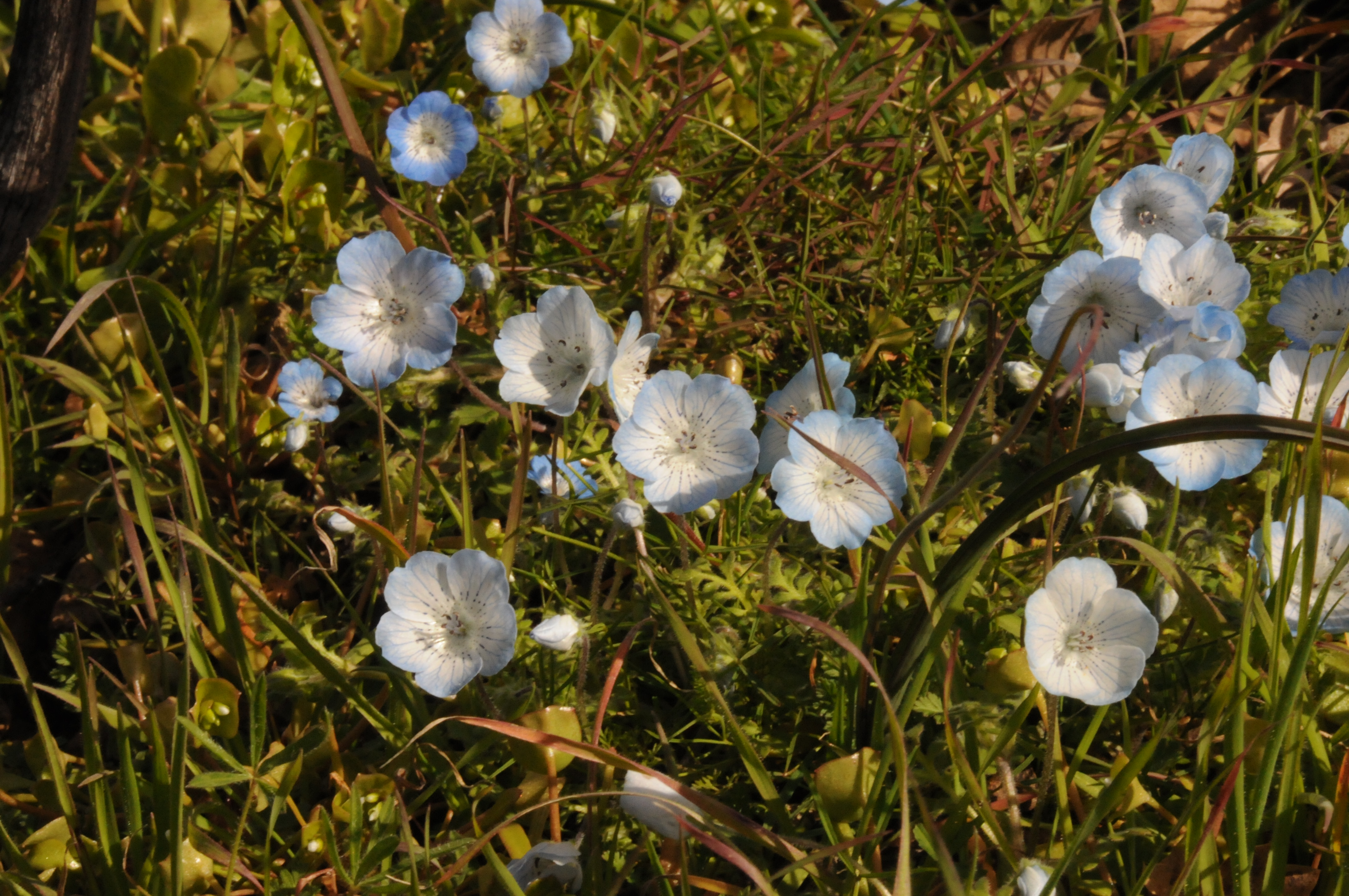
We continue to add to our identified species list. Our regular observations include mountain lion, Columbian black-tailed deer, bobcats, grey pine, manzanita, and box elder. With the changing seasons and the natural regeneration of the property, we are hoping to see many more “new” species. As we get closer to spring, we are expecting to see many wildflowers start to push their way through the small grasses. This trip provided us with glimpses of young shooting stars (Dodecatheon sp.), a species of vetch (Astraalus sp.) and Burr Chervil (Anthriscus caucalis). Hopefully the conditions at Silver Spur—fire followed by decent rainfall—will produce spectacular wildflowers this year. It has been noted, however, that the grass-regrowth has not been as quick as we had hoped—this good be good for wildflower success or it could mean that seeds were burned or were washed away by the large rains.
Tuleyome has enjoyed seeing photos of what is on the property and has been able to use this information in many different ways. To provide more information, it was decided to switch a couple of cameras to video. Nate and Roxanne switched the Milkweed (6607) and Pond (8607) to video.
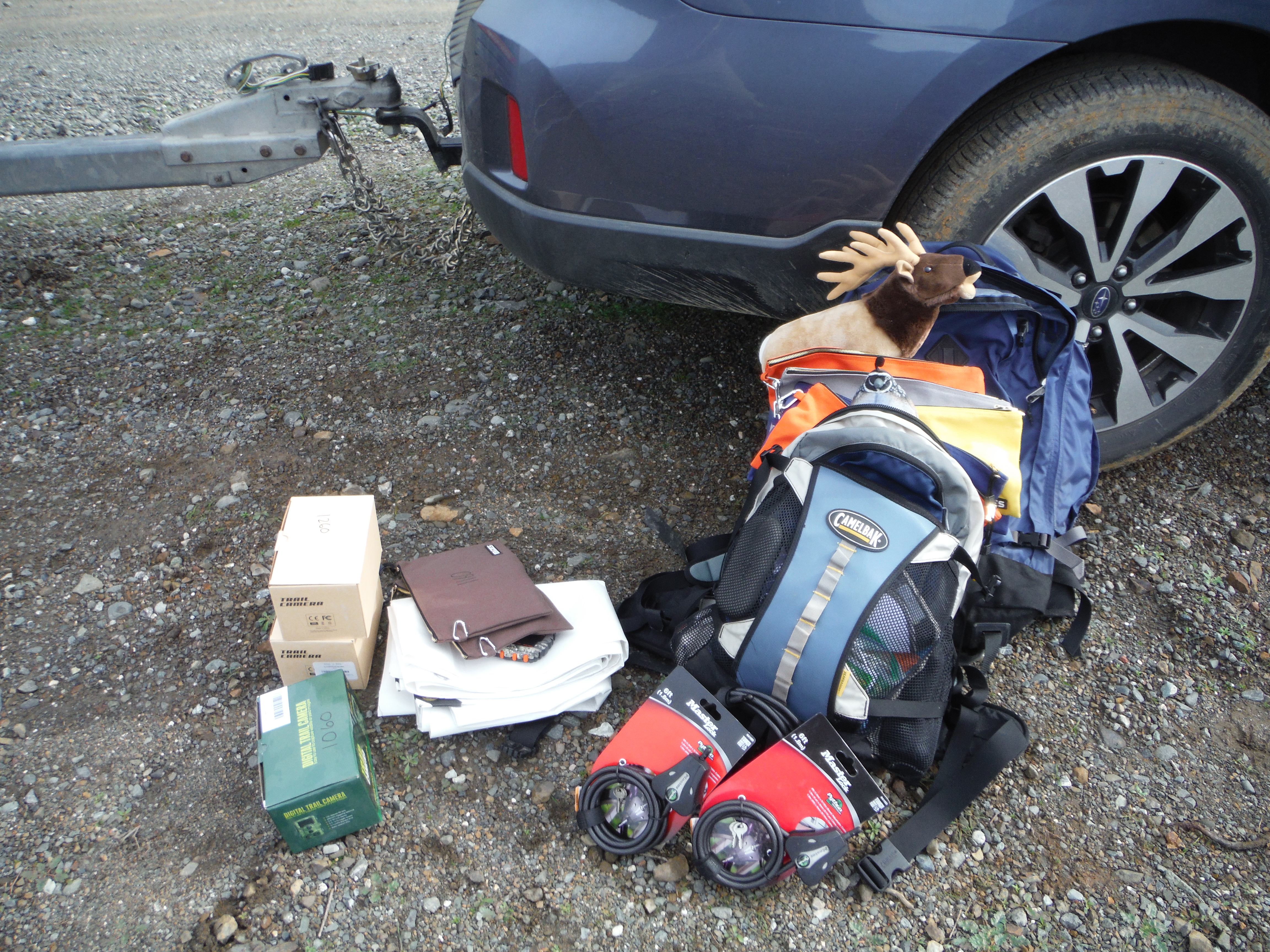
The last task during this visit was to place 3 additional cameras. Based on the number, frequency, and variety of tracks on the road, it was decided that the cameras would be placed facing the road between the Pond (8607) and Southern (4607) cameras. Nate and Roxanne placed to cameras in this position but found a location that they believed would be beneficial. This location is facing away from the road but near easy access to a stream. Additionally, mountain lion and deer tracks were found in the field of view. The new cameras are highlighted in the updated list below. The Box Canyon (1260) camera was set on video.
There are many benefits as well as some of the frustrations that can occur with game cameras. Tuleyome staff and volunteers had seen many coyote tracks but had not seen one of these shy animals. Without the cameras, we would not have been able to get an idea of how many are on the property. We are also able to use the black spot on the tail to identify one specific animal. There was very little sign of squirrels while visiting Silver Spur—just few pinecones that were chewed to get at the nuts. The cameras have given us an opportunity to try to identify the species.
These benefits, however, underline some of the drawbacks. In order to continue identifying the coyote, we will need a clear view of the tail. Lighting and the orientation of the subject will never perfect so we need to do a little “detective work” to determine the species.
We have captured two large cats —mountain lion (Puma concolor) and bobcat (Lynx rufus) - on cameras at both the north and south end of Silver Spur. However, they were never captured in the same period. This changed during this capture period, a mountain lion was captured the morning of January 25 and a bobcat was captured the evening of January 25. The same day! Tuleyome was surprised that, two predators who seemed to avoid each other—maybe the bobcat was avoiding the mountain lion—were captured in relative proximity on the same day.
Two unfortunate events at the end of this visit soured the day for the group. Upon leaving the property, multiple glow stick were found hanging from fence posts. While it is impossible to know why these were hung, it is assumed they were placed to help OHV riders find their way in the dark.
The other event was more dangerous and worrisome. Bill, riding the ATV, went ahead of Nate and Roxanne to start loading it into the trailer for the return trip. As Nate and Roxanne were approaching an open area near Indian Valley Road, they saw a blue pickup. One person was sitting on the tailgate while the other was on the ground, with a rifle pointing the general direction of the road. Shortly after Nate took a picture —but before he could shout a warning—a shot was fired. Immediately after the shot, Nate shouted a warning and the shooter quickly put on the safety and opened the chamber. It was clear that they were target shooting (a white box was about 100 yards away on the hillside) and stated that they would not shoot until they saw our vehicle leave.
This was very unsettling for the entire group and could have been especially dangerous for Bill. He had passed these gentlemen and was on the road. He had said hello to them so they were aware that he was in the area. They also acknowledged the vehicle parked on the side of road but decided to shoot in that general direction. Thankfully no one in the group—nor anyone driving by on the road—was harmed.
As a precaution, we will have orange safety vests for some of the participants to increase visibility.
Our next visit is scheduled for March 7, 2019.
Post 1-11-19
Project ID #18-022
The weather threatened to cancel our third trip to service the cameras at Silver Spur Ranch. However, the group was able to complete the necessary tasks between showers and stayed dry! During this visit, Nate Lillge and Bill Grabert, Project Co-Leads, were joined by another Tuleyome staff member, Kristie Ehrhardt. These three led volunteers Chris Llewellyn, Lori Thomas, Michael Kwong, and Leticia Padilla. As with the previous trips, the group was prepared to record tracks and animal sightings. Pictures were taken by Nate Lillge, Kristie Ehrhardt.
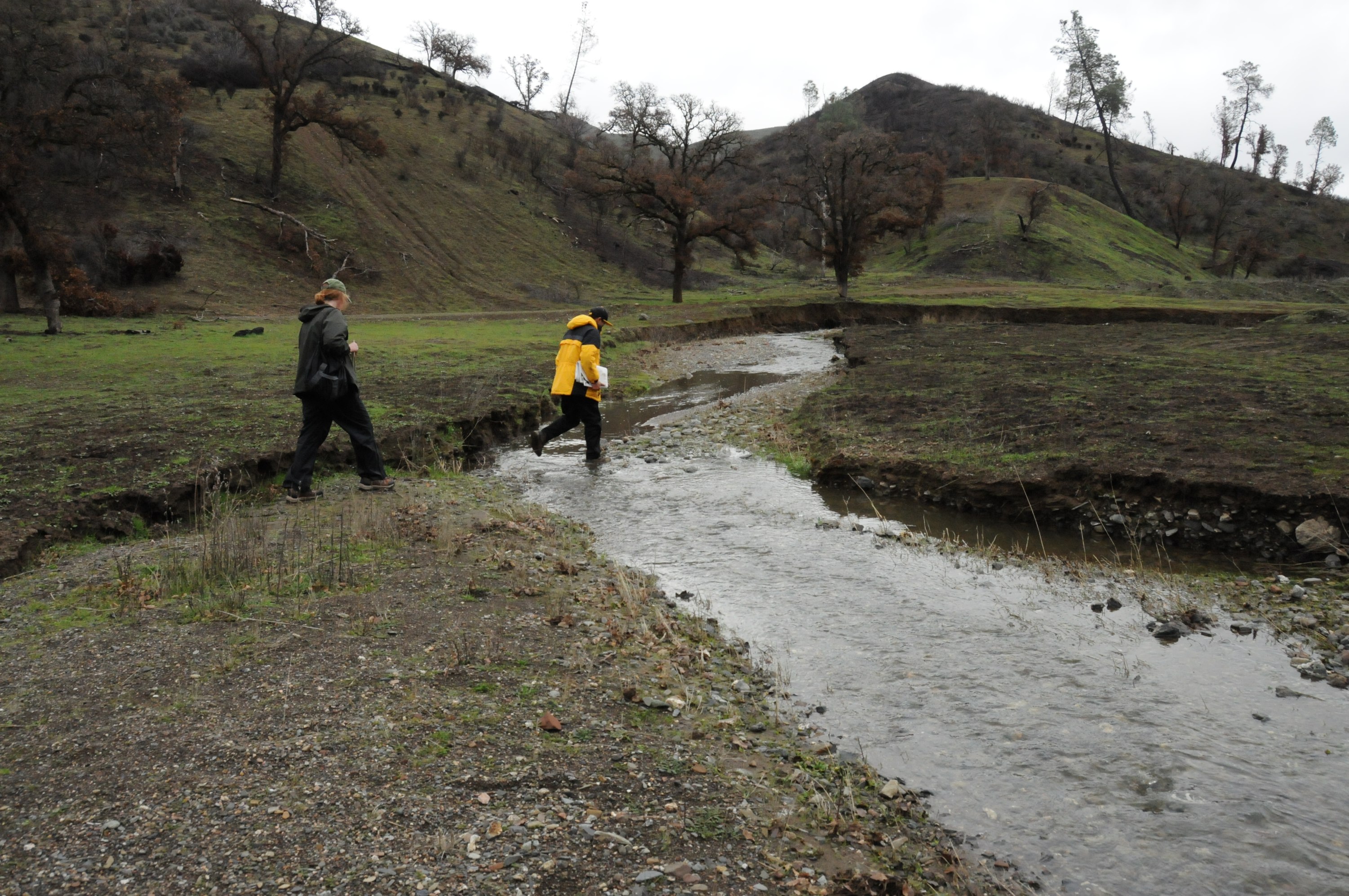
Between our December visit and this January visit, there had been several rain storms with significant rain fall, the effects of which were evident immediately upon entering the property. The access road follows a stream that had been dry - it now had a good amount of water in it. The recent rains were also evident by the amount of greenery on the landscape. In December, it was noted that the area had started taking on a green appearance - everywhere one looks it is now green. The stream next to the road continues into the main valley of the property and previously had not influenced the channel in the valley. During this visit, there was a substantial amount of water even at the southern-most part of the property. In addition to the water in the main stream, there were many small flows from connecting valleys/canyons and close to 3 feet of water in the 5000 square foot pond. With the large amount of available water, animals are not forced to return to these main sources to drink and, therefore, fewer animals were captured on our cameras. It is anticipated that, as the water dries in late spring/early summer, the pond and main channel will be the only sources of water and we will have more "captures" on the Pond, Grey Pine, and Milkweed cameras.
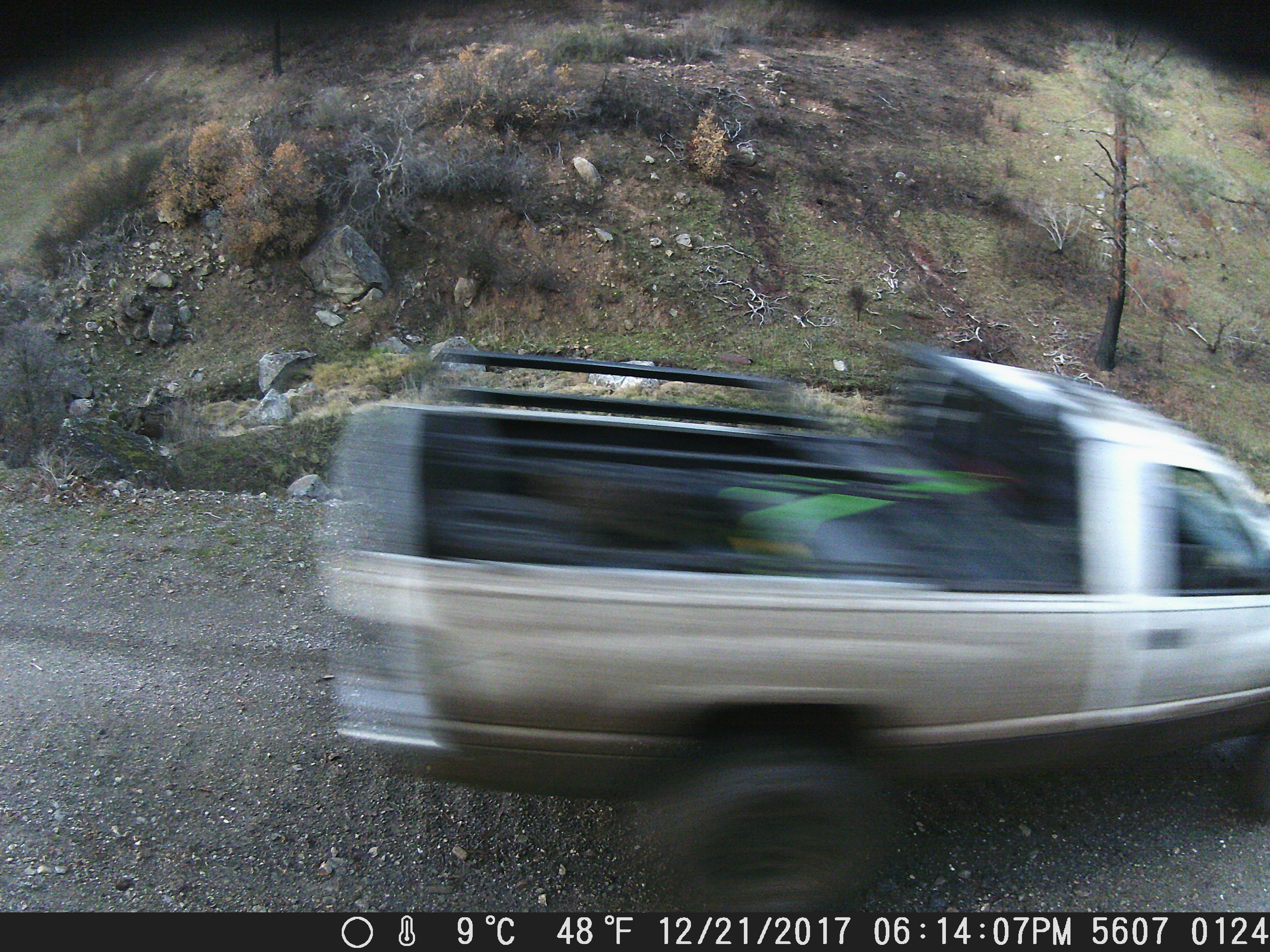
Immediately, upon entering the property, it was obvious that there were not going to be many tracks—it had rained the previous day into the early morning. The road was muddy but not impassable. During the hike to the cameras, Nate Lillge noted vehicle tracks that had come from the south and turned around north of the “Milkweed” camera. When reviewing the pictures, a pickup was caught by the camera but unidentifiable. This is the largest vehicle of which we have evidence of trespassing and has caused us to study how it gained access and what can be done to stop future occurrences. It also leads us to believe that the fires have increased the ease of accessibility and may require more secure and larger barriers to deter vehicles while allowing the animal corridor to remain open.
Upon reaching the northern most camera (Milkweed), Lillge gave a tutorial on how to correctly service the cameras and asked the volunteers to update the time to reflect the end of day-light savings on November 4. This, unfortunately, was not done during our November and December visits and therefore the time stamps on those photos are an hour ahead of the actual time.
As noted earlier, the group was excited to see that the recent storms had further encouraged regeneration on the property and most of the surrounding hills that had been burned. Despite the rains, this area of the property showed little evidence of erosion with no major episodes visible from the roadway. Hopefully the grasses and forbs will be able to create strong enough roots before any major event happens.
In addition to the truck, there were many other signs of trespassing. Foot prints were visible on the road from the northern to the southern gate and many places off of the road. Tire tracks from motorcycles had left scars on the ground in places were there had previously been none.
As noted many times before, Tuleyome is working hard to limit the amount of illegal usage. A series of photos showing hunters on the property (at night) is of special concern as this activity has negative impacts on all animals in the region. These particular individuals create a very dangerous situation with their implied intention of discharging a weapon(s) in the dark. If they were not hunters—as is assumed—and were simply there to target shoot, this is still dangerous as they are unable to see their surroundings. There is the direct danger of someone or some animal being shot as well as the indirect danger of another fire.
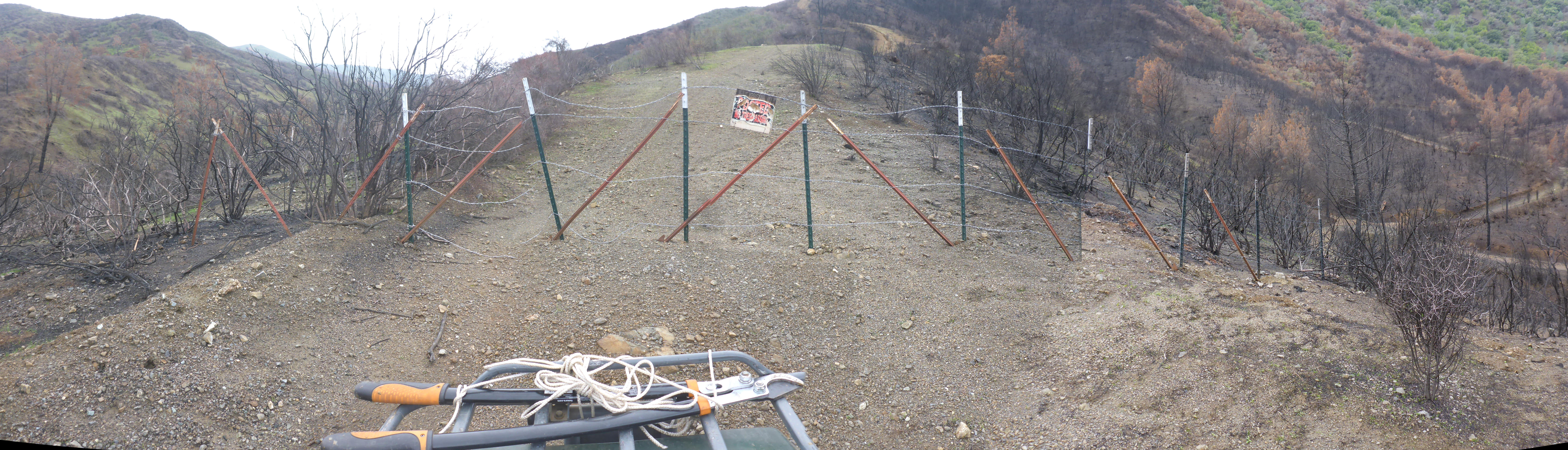
The landscape picture, taken by Bill Grabert, shows one of the fire breaks on the northern end of the property. Before the fire, it was much narrower but was still one of the points at which OHV users accessed the property. Since the fire, Tuleyome has installed and reinforced the barbed wire fence across the opening. This fencing is not very long—it simply connects two points that naturally discourage OHV riders; thick chaparral or a geologic feature. Tuleyome plans to use this type of fencing at OHV access points throughout the property to allow animals to move freely.
Overall, Tuleyome has been happy with our initial results. We initially installed 7 cameras in areas where we thought animals would visit. We added one camera and changed the position of one during our first servicing visit to enhance coverage. We have identified common species as well as the trespassing issues. Project staff have discussed ways to improve the project including adding cameras and switching some to video mode to capture the animal’s movements. Our plan is to leave the cameras in place for at least a year to get a year-round data set.
We have set the next three servicing dates—February 7, March 7, and April 11. After these dates, we will again meet to discuss the project and determine if any adjustments need to be made.
Post 12-14-18
Project ID #18-022
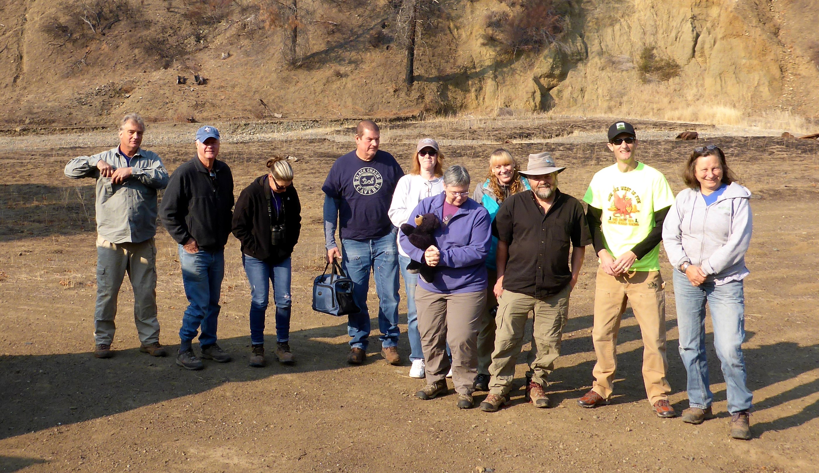
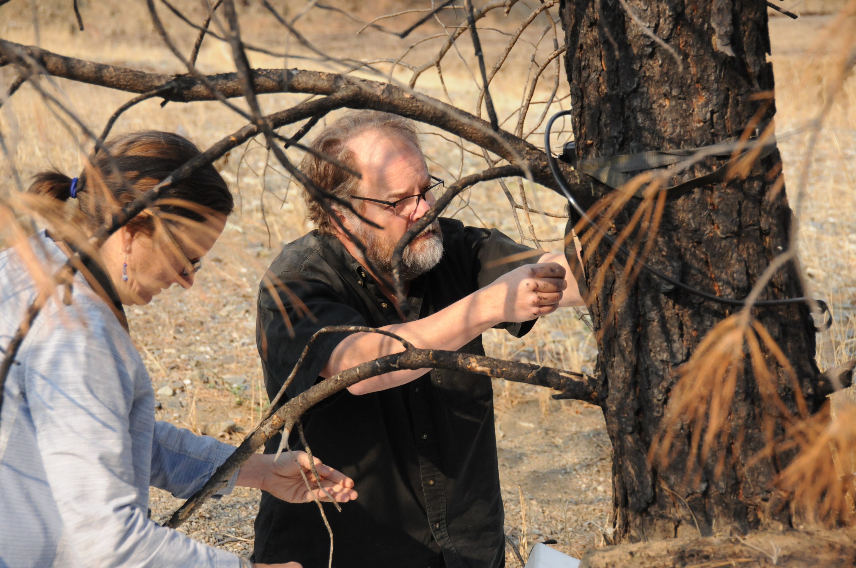
Tuleyome staff members Nate Lillge and Bill Grabert were assisted by Chris Llewellyn, Lori Thomas, Marc Hoshovsky, Judy Muchard, Adrian Griffin, Jeff Mischkinsky, and Ashley Poutre during the second camera service day. Due to the success of the November 9 servicing day, expectations and excitement was high for the second day. Staff and volunteers were hoping that the recent rains would provide the opportunity to see tracks. The threat of rain never materialized and the group was able to successfully service all of the cameras.
The recent and predicted rains prevented the group from safely driving onto the property. Instead, the vehicles were parked on the side of Walker Ridge Road near the northern entrance to Silver Spur. Bill Grabert used the Tuleyome ATV to service the River camera and add a cable lock to secure it to the tree. After Nate Lillge gave an overview of the project, property and tasks to be completed the group hiked to the northern-most camera where Nate educated the volunteers on how to correctly service the cameras. During the hike into the property, the benefit of the recent rains was immediately evident. Instead of the summer brown, the hills had taken on many shades of green, showing the new growth of grasses and forbs. Upon reaching the Staging Area, the group split into two groups—Marc Hoshovsky leading the team that serviced the cameras in the canyon while Nate led the remainder to the Southern camera. Volunteers were asked to look for and record tracks and other evidence of animal activity and were given a print out with pictures of common tracks. In addition to the camera trap images, Nate Lillge, Bill Grabert and Marc Hoshovsky took photographs.
Regrowth was visible throughout the property. Entire hillsides that had been brown during the previous visits were now green with the dark “skeletons” of burned trees and bushes. Recent rains encouraged recovery and provided water in the streambed and pond. It was evident that the water flow had been much higher before the group arrived at the property—grasses along the side of the stream remained bent in the direction of flow.
In addition to the previously noted species, the cameras captured two “new” species:
- Bobcat (Lynx rufus)
- North American river otter (Lontra canadensis)
Many of the species captured via the camera traps had been recorded previously—either by the camera traps, visually, tracks, or scat. The one species that had not previously been captured on camera was a bobcat (Lynx rufus), although tracks had been seen on different parts of the property. While hiking, the group saw many tracks in the mud and were hopeful that one camera had seen it. Upon reviewing the pictures, there is at least one bobcat on the property; it was captured on many cameras.
The mountain lion and black bears that were so prevalent from the previous visit were much more scarce. The activities of these animals was again mostly around the Southern camera.
Columbian Black-Tailed Deer (Odocoileus hemionus columbianus) were captured by every camera on the property except the Crossroads and Southern cameras.
Tule Elk (Cervus canadensis nannodes) continue to elude the cameras but many tracks were seen on the property. Using the data collected as well as plotting where elk tracks have been photographed by volunteers, Tuleyome has begun determining where to place additional cameras to increase the likelihood of capturing these animals.
Our next visit is scheduled for January 11, 2019.
Post 11-09-18
Project ID #18-022
This was the first time the staff and volunteers had been back to the survey site since October 12th and they were all anxious to see if the trail cameras had picked up anything. Tuleyome staffers Nate Lillge, Bill Grabert, Eric “Bam Bam” Barnett and Kristie Ehrhardt were joined by volunteers Roxanne Moger, Sarah Davis, Chris Llewellyn, Marc Hoshovsky, Lori Thomas, Chris Payne and Eric Ross.
At the study site, co-lead Nate Lillge demonstrated to the volunteer crew how the images were to be retrieved from the cameras, and how to change out the scan disks and batteries as necessary. The crew was also encouraged to seek out and document whatever species they might encounter and where areas of clean-up and restoration need to be done. These were just cursory investigations, but the data will be used as the field projects move forward. Besides the images captured from the field cameras, photographs were also taken by Bill Grabert, Kristie Ehrhardt , Nate Lillge, Erica Barnett and Roxanne Moger.
Along with the regular accoutrements for the study, Bill Grabert also brought along his Honda Trail 90 step-through motorcycle to get to the more remote locations on the property quickly and more easily.
Of the species captured by the field cameras, the ones of note include but are not limited to:
- Bay Laurel (Laurus nobilis)
- Black Bear (Ursus americanus) live and scat
- Black-Tailed Jackrabbit (Lepus californicus) live and scat
- Blue Oak (Quercus douglasii)
- Boxelder (Acer negundo)
- California Vole (Microtus californicus)
- Columbian Black-Tailed Deer, mule deer (Odocoileus hemionus columbianus) live and scat
- Coyote (Canis latrans) live and scat
- Deergrass (Muhlenbergia rigens)
- Desert Cottontail Rabbit (Sylvilagus audubonii)
- Feral Pig, Wild Hog, Wild Boar (Sus scrofa) live and scat
- Gray Fox (Urocyon cinereoargenteus townsendi)
- Great Blue Heron (Ardea herodias)
- Great Egret (Ardea alba)
- Indian Milkweed (Asclepias eriocarpa)
- Mayfly imagos (order Ephemeroptera)
- North American River Otter (Lontra canadensis) scat evidence only
- Northern Flicker (Colaptes auratus)
- Rabbitbrush (Chrysothamnus sp.)
- Red-Winged Blackbird (Agelaius phoeniceus)
- Western Bluebird (Sialia mexicana)
Coyotes and rabbits were found both singly and in pairs. The mountain lions photographed were picked up by the Southern camera, and seemed to walk the same track once every three days.
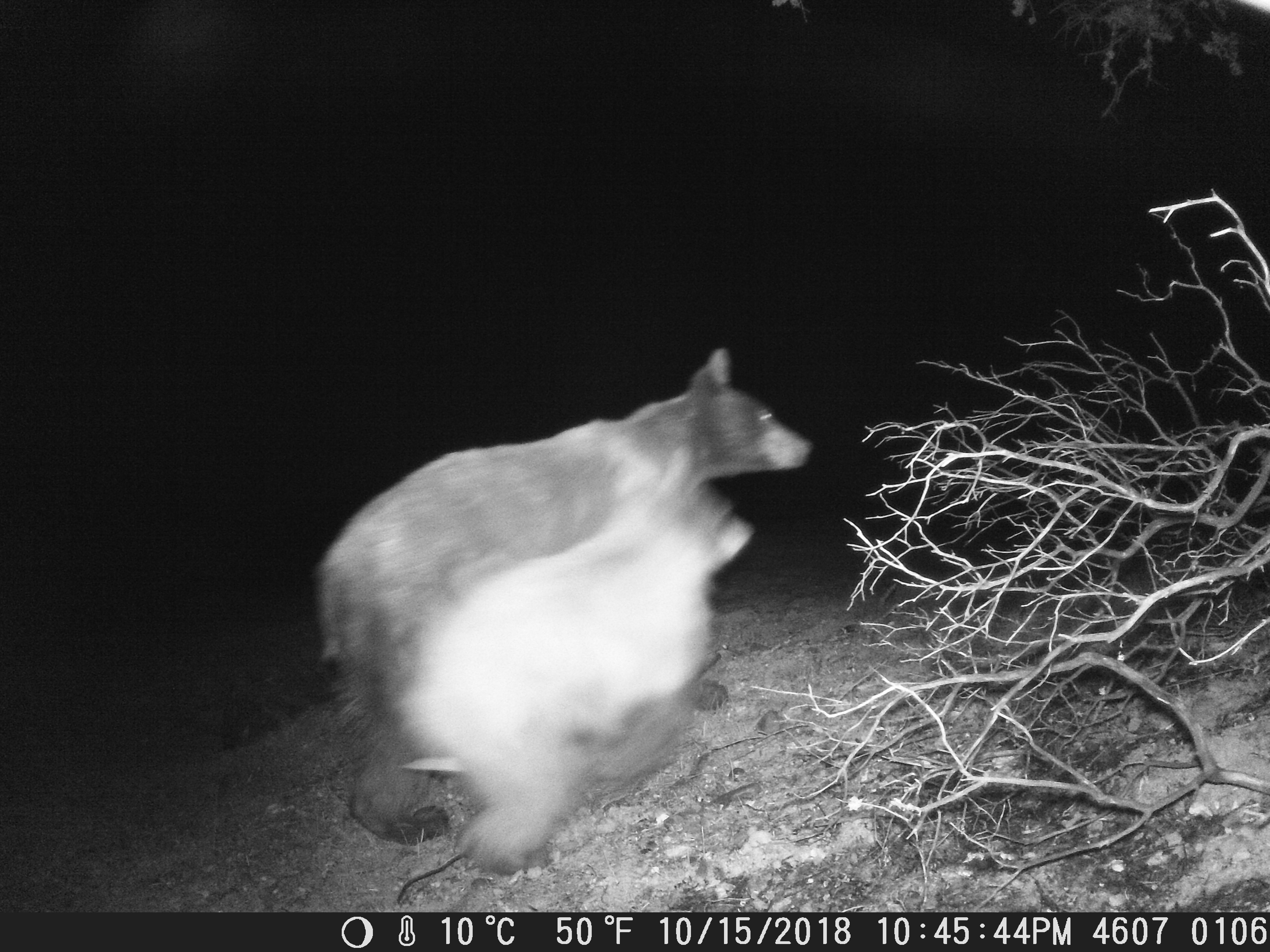
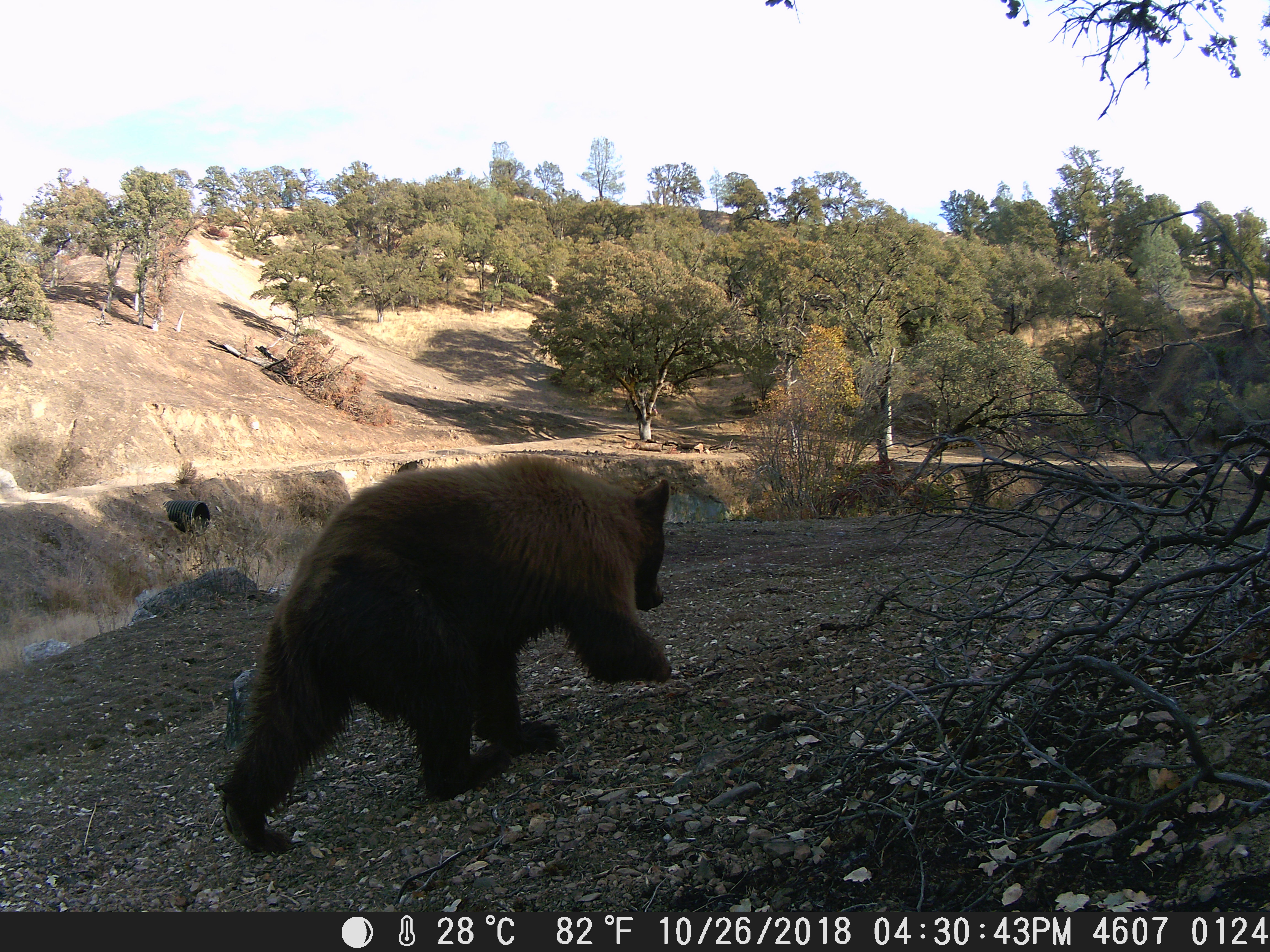
We were very excited to see images of Black bears (including a sow and her cub) that were caught on several cameras including the Southern, and Pond cameras. It seemed the bears are making use of several areas of the property.
Notably absent from any of the cameras were Tule Elk (Cervus canadensis nannodes) which we were hoping to see, as this is their breeding season. But the lack of elk may be due in part by the rugged terrain and thick stands of chamise and manzanita, and the lack of grasses and forbs which were burned away by the wildfires.
As for plant life, evidence of recovery is everywhere. We are seeing new growth popping up throughout the burned areas. It is our hope that once we get some rain, this growth will continue, and we will also find evidence of fungi and recovering lichen. Our next outing is slated for December 14, 2018.
Of all of the cameras placed on the property in October, all of them captured images of wildlife, and four of them captured images of human trespassers (including hikers and OHV users). Knowing where the trespassers come into the property will allow us to determine where we need to erect and/or reinforce gates and fencing to limit human interference with the project studies. As our investigations progress, Tuleyome will determine where fencing can be installed without interfering with the ingress and egress of wildlife as they patrol their territories.
Post 10-12-18
Project ID #18-022
On this date, Tuleyome staffers Nate Lillge, Mary K. Hanson and Eric “Bam Bam” Barnett were joined by volunteers Lori Thomas and Roxanne Moger to set up the trail cameras on Tuleyome's property in Lake County.
What we found when we approached the property was that nature is still dealing with the effects of the wildfires. More trees had fallen since the last time we were on the site, including a small tree that blocked the entrance to the property. Nate Lillge was able to move it off to the side of the road, but as we continue to the restoration phase of the projects, we will have to decide what to do with the fallen debris.
We understand that dead trees and brush can actually enhance a natural landscape by:
- Providing homes for animals
- Adding organic matter and enriching the nutrients in the soil
- Providing cover for seeds to grow
- Providing nourishment and substrates for a variety of fungi, moss and lichen
- Helping to retain moisture in the soil
- Providing places to hide and supplemental nutrients for waterborne animals like small fish and amphibians
This is further substantiated by a variety of studies and reports including but not limited to the following: Evelyn Bull, C. P. (1999). Dead and Dying Trees: Essential for Life in the Forest. Science Findings. Retrieved from HERE.
We will, therefore, be developing a plan to effectively manage the burned trees and fallen limbs/brush on the site under the auspices of the restoration work paid for in part by the Sacramento Zoo grant for Project #Q4C19-008.
Project co-lead, Nate Lillge, had set up detailed tracking sheets and maps he had created for the project. He had overhead maps of the ranch with yellow “push pins” marking each of the spots where we would place cameras (and some white push pins for other prospective spots). Each push pin was marked with a name for easy reference: Staging Area, Gray Pine, Side of Cliff, Cattail Pond, Crossroads, Top of Ridge, Intersection, River and Gate.
Then on other sheets, Lillge had data-collection spreadsheets set up that not only included the general name for the camera spots but also included space to write down the camera serial number placed at each spot, the GPS coordinates, in which direction the camera was facing, and the key number for the camera cable’s lock.
Along with the cameras, locks and other materials, Mary Hanson had also created six signs to place around the research area which read:
Wildlife Research Area
DO NOT ENTER
This area is under video surveillance 24/7
Armed with these valuable guides and materials, we went forth to the Staging Area spot. There, we found that the lash for the camera didn’t fit around the fat girth of the lower part of the tree, so Nate climbed up into the branches to place it up a little higher where the trunk was thinner. We all tested our compasses to get the direction in which the camera was facing, and discovered that none of the them were the same. The on-phone apps many of us were using couldn’t synch with the internet (no signal) to coordinate place and direction data... so they’re pretty much useless. Mary Hanson made a note to purchase compasses when we returned to the office.
The other placements went easier. While we were walking to the Gray Pine placement spot, Mary Hanson was at the back of the group and was surprised to see two large trucks with ATV’s driving across the property. Hanson approached them to see who they were and ask what they were doing there.
![After placing a trail camera near the North Fork of Cache Creek, Eric “Bam Bam” Barnett and volunteers Roxanne Moger and Lori Thomas take a moment to pose for a photo. The toy Black Bear seen in the photo is “Essa”, one of Tuleyome’s spokebears who regularly joins us on hikes and other outings. [Photo by Nate Lillge]](http://tuleyome.org/wp-content/uploads/IMG_9013.jpg)
![Tuleyome staffer Nate Lillge places one of te trail cameras. [Photo by Mary K. Hanson]](http://tuleyome.org/wp-content/uploads/45325330411_7f04340e9c_k.jpg)
![Signage [Photo by Mary K. Hanson]](http://tuleyome.org/wp-content/uploads/44412654645_34dba0dbb4_k.jpg)
![Volunteers Roxanne Moger and Lori Thomas with Tuleyome staffers Eric Barnett and Nate Lillge [Photo by Mary K. Hanson]](http://tuleyome.org/wp-content/uploads/31450949658_ba883d9591_k.jpg)
![Trucks operated by the US Geological survey crew. [Photo by Mary K. Hanson]](http://tuleyome.org/wp-content/uploads/43509618040_28774d5a14_k.jpg)
![Tuleyome staffer Eric "Bam Bam" Barnett checks his compass for the camera placement spreadsheet. [Photo by Mary K. Hanson]](http://tuleyome.org/wp-content/uploads/45325316871_b916cd4e2b_k.jpg)
![The " Witch Hazel" tree was skeletonized by the fire but didn't burn. Mary K. Hanson, Lori Thomas and Nate Lillge work on a camera placement. Photos by Mary K. Hanson and Roxanne Moger]](http://tuleyome.org/wp-content/uploads/Picture1.png)
![Volunteer Lori Thomas gets a lesson on using a walking stick by Eric Barnett. [Photo by Mary K. Hanson]](http://tuleyome.org/wp-content/uploads/45275873552_bed7d33d24_h.jpg)
![Volunteer Lori Thomas [Photo by Mary K. Hanson]](http://tuleyome.org/wp-content/uploads/43509613570_59b094fd34_k.jpg)
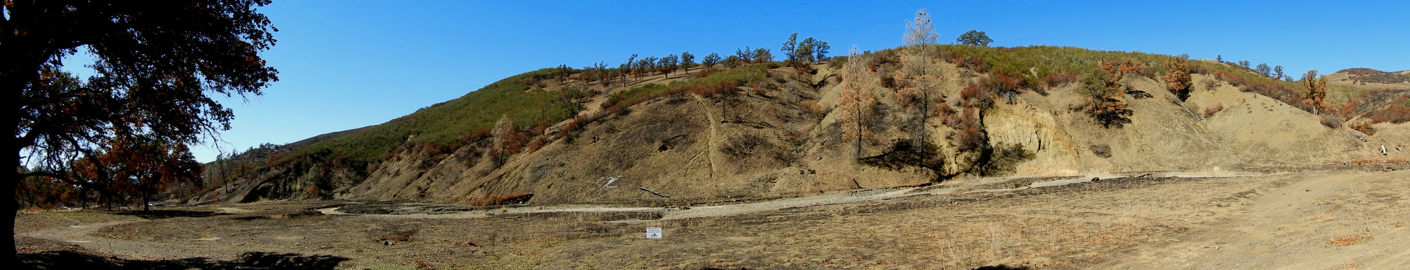
![This panorama shot of part of the study site shows how much of the property was denuded by the wildfire. [Photo by Mary K. Hanson]](http://tuleyome.org/wp-content/uploads/44412520155_0bf8dcbc59_k.jpg)
It turned out that they were personnel from the US Geological Survey who had come to check on the landslide area on the property.The slide had been under scrutiny since 2002 (Tuleyome bought the property in 2016) because it sits right above the Cache Creek river, and there is concern that it might slip into the river and block the water flow. There is added concern now, in the wake of the Pawnee fire, that with all of the plant life burned off of it by the fires the slide area will begin to liquify when the rains start.
As an aside: we had also recently discovered that there is a State of California Department of Water Resources (DWR) gage on the property overseen by watermaster Joe Scott (530-570-8969). Scott let us know that bears often play with antenna on the gage, and he periodically has to go out onto the property to restore and maintain it. Historically, he visited the gage a couple of times a year but recently lost track of the ownership. When he realized Tuleyome had purchased the property, he contacted us when the gage stopped transmitting after the Pawnee Fire. [See also: Alvarez, E. (2010, February 4). A Tale of Two Watermasters. DRW News, 6-12. Retrieved from HERE.] It is Tuleyome’s hope that Scott will be able to share the gage information with us as our projects continue.
While others on the crew placed the trail cameras at the more remote locations on the site, Hanson took more establishing landscape photos, placed the signage, and watched for wildlife. Wildlife noted on this date included:
- California Quail (Callipepla californica)
- California Sister Butterfly (Adelpha californica)
- Columbian Black-Tailed Deer (Odocoileus hemionus columbianus)
- Cooper’s Hawk (Accipiter cooperii)
- American Crows (Corvus brachyrhynchos)
- Northern Flickers (Colaptes auratus)
- Nuttall’s Woodpecker (Picoides nuttallii)
- Variegated Meadowhawk Dragonflies (Sympetrum corruptum)
- Yellow Jackets (Vespula germanic)
Hanson also discovered several Blue Oak saplings, and took photos of them to document them. We will eventually be preparing “tomato cages” for some of the young trees to protect them from being eaten by local deer and elk. Blue Oaks are native and endemic to California, so protecting them is of special concern to Tuleyome. [See also: Bernhardt, T. J. (1999). Understanding Blue Oak Regeneration. Retrieved from Phytosphere Research HERE]
Once all of the cameras were placed, the crew gathered and discussed next steps. It was decided that returning to the cameras once a month may be sufficient before the rains start, but more visits will have to be made once the vegetation starts coming in and the creek fills up. Because the creek and pond on the site is “seasonal” life will come in and leave in that small window of time when there’s abundant water and food for the animals. Once the creek and pond dry up again, sightings will be fewer and farther between. The next outing is planned for November 9, 2019.
Post 10-04-18
Project ID #18-022
We sent a crew out to Lake County to scout out placements for the trail cameras purchased with funds from the Sacramento Zoo. Included in the crew were Tuleyome staff members Nate Lillge, Mary K. Hanson, Eric “Bam Bam” Barnett and Kristie Ehrhardt.
The site is the property owned by Tuleyome, a site which had been severely burned by the Pawnee Fire in the summer of 2018. the ranch was acquired in 2016, and is comprised of 1,280 acres. It includes gorgeous oak woodlands, rare plants, two miles of the North Fork of Cache Creek, and the headwaters of Benmore Canyon. The purchase of the property was supported in part by a grant from the Wildlife Conservation Board.
On this day it was relatively cool (44°F when we started out to the site, and 63°F when we left) and there was fog clinging to the tops of the foothills. By the time we left the site a light rain was beginning to fall.
The property and surrounding hillsides were scarred by firebreaks created when firefighters came into the area to contain the wildfire. The front gate to the property had actually just been replaced after having been bulldozed down by fire suppression teams.
At the site, we found that it had been incredibly charred -- as we expected it might be -- but we still found evidence of enough wildlife activity to get us excited about the area. There were tracks and scat of
- Columbian Black-Tailed Deer (Odocoileus hemionus columbianus),
- Bobcats (Lynx rufus),
- Black-Tailed Jackrabbits (Lepus californicus),
- Mountain Lion (Puma concolor),
- Tule Elk (Cervus canadensis nannodes), and
- Black Bears (Ursus americanus).
We also found the remnants of an elk skeleton, and found some nests of what we believe might be Red-Winged (Agelaius phoeniceus) or possibly Tricolored Blackbirds (Agelaius tricolor) among the tules in the seasonal pond on the property.
The crew spotted:
- five Columbian Black-Tailed Deer,
- several coveys of California Quail (Callipepla californica),
- a few Northern Flickers (Colaptes auratus), and
- a Red-Tailed Hawk (Buteo jamaicensis) while they were working on the site.
Other species noted on this date included the following plant life which dominated the site, in live and burned form:
- Bay Laurel (Laurus nobilis)
- Blue Oak (Quercus douglasii)
- Chamise (Adenostoma fasciculatum)
- Doveweed (Croton setigerus)
- Gray Pine (Pinus sabiniana)
- Heliotrope , Chinese Parsley (Heliotropium curassavicum)
- Manzanita (Arctostaphylos sp.)
- Mugwort (Artemisia vulgaris)
- Narrow Leaf Cattail (Typha angustifolia)
- Toyon (Heteromeles arbutifolia)
- Tule (Schoenoplectus acutus)
There were also a few specimens of the invasive Yellow Star Thistle (Centaurea solstitialis) in the bed of the seasonal stream. Plants will be eradicated as part of the restoration project #Q4C19-008.
We noted various kinds of lichen on the trees and will document them at a later date. On some of the trees the lichen was badly burned, so it will prove interesting to see if they are able to recover over time. Generally speaking, the species we saw were different forms of beard lichen, shield lichen, and sunburst lichen.
Additionally, we found several fresh specimens of the Barometer Earthstar fungus (Astraeus hygrometricus) in the areas were the ground was more disturbed.
Today’s activities focused on doing an initial assessment of the site and selecting spots to place the trail cameras. As each spot was chosen its GPS coordinates were written down so we could find the same spots on future excursions. In all, about a dozen spots were chosen for camera placements.
Although much of the property had been badly burned, the dearth of vegetation made it easier to see the underlying structure of the landscape, which in turn made it easier to decide where to place the cameras for optimal viewing. One spot included the banks of a season creek and the side of a seasonal pond. Although the North Fork Cache Creek river has water in it, the creek and pond on the property only fill with water during the rainy season.
The focus of this project is to study and create a database of the animal species on the property and how/if they are able to regain a foothold in the area in the wake of a massive wildfire, but tangentially we will also be documenting the “reforestation” of the site for future field studies.
![The property and surrounding hillsides were scarred by firebreaks created when firefighters came into the area to contain the wildfire. [Photo by Mary K. Hanson]](http://tuleyome.org/wp-content/uploads/100418silverspur-038.jpg)
![The burn pattern on the property included “refugia”. As documented in an article in the New York Times, “Islands of greenery, called refugia, survive even the worst fires, sheltering species and renewing charred landscapes. Fire refugia don’t have to endure for centuries to be ecologically important. Even a fleeting shelter can be important for local biodiversity.” Zimmer, C. (2018, October 12). ‘Lifeboats’ Amid the World’s Wildfires. New York Times, p. D6. Retrieved from https://www.nytimes.com/2018/10/12/science/wildfire-biodiversity.html [Photo by Mary K. Hanson]](http://tuleyome.org/wp-content/uploads/43330146980_ce53fe5efa_k.jpg)
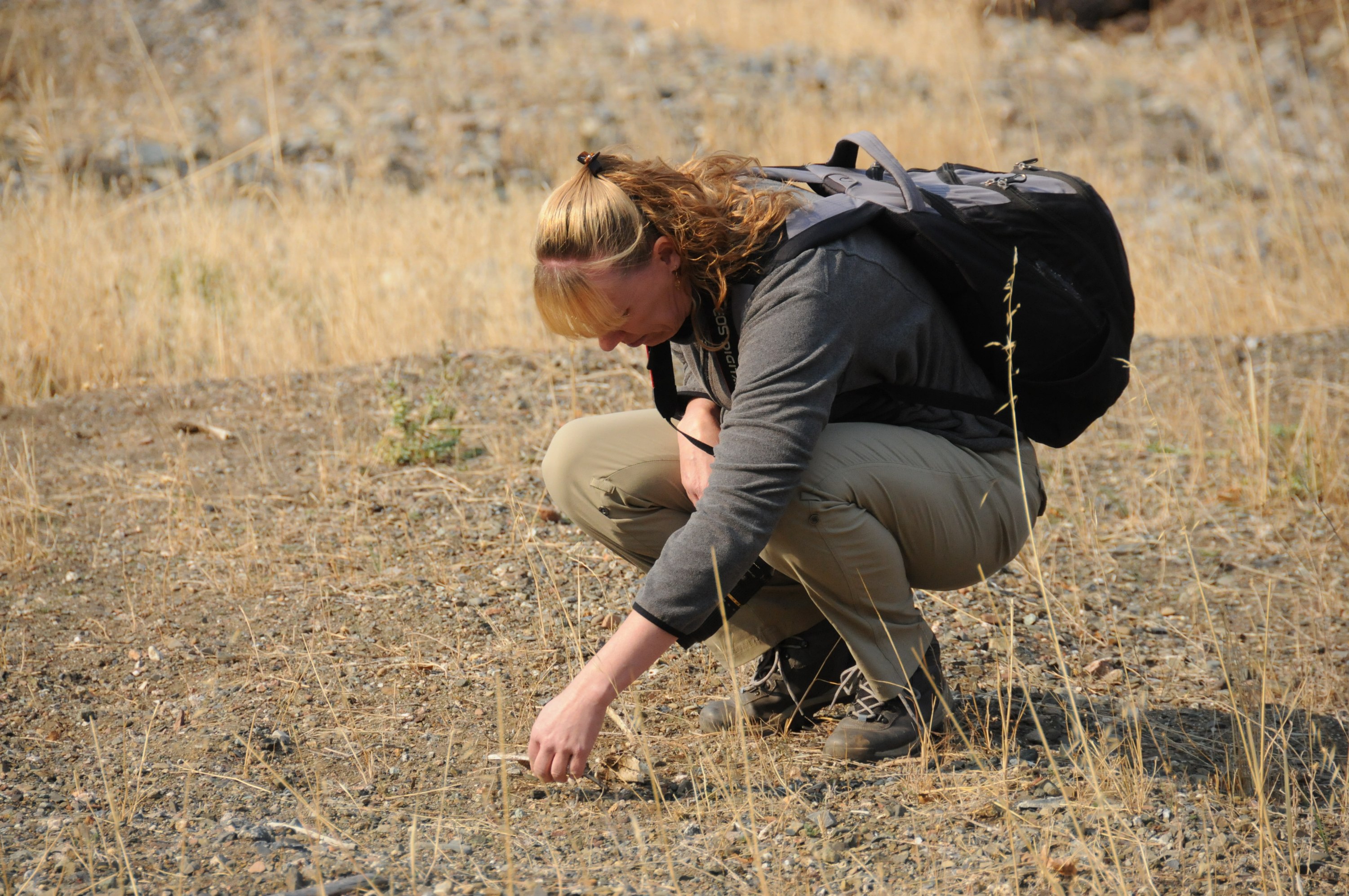
![Nate Lillge looks for signs of wildlife on the earth scorched by the Pawnee Fire. [Photo by Mary K. Hanson]](http://tuleyome.org/wp-content/uploads/45143882141_a83c127f4f_k.jpg)
![Bobcat paw print [Photo by Mary K. Hanson]](http://tuleyome.org/wp-content/uploads/45143828211_e0e5543c44_k.jpg)
![Barometer Earthstar fungus [Photo by Mary K. Hanson]](http://tuleyome.org/wp-content/uploads/45094866642_dd0c519df0_k.jpg)
![Tuleyome staffer Kristie Ehrhardt [Photo by Mary K. Hanson]](http://tuleyome.org/wp-content/uploads/43176170_10213290247959220_5861125892125753344_o.jpg)
![Red-Wing Blackbird nest. [Photo by Mary K. Hanson]](http://tuleyome.org/wp-content/uploads/43330158630_13de89531f_k.jpg)
![Nate Lillge sits at the base of a Gray Pine near the bend in the seasonal creek on the property to plot out the view for later trail camera placement. [Photo by Mary K. Hanson]](http://tuleyome.org/wp-content/uploads/45143877991_28b9376195_k.jpg)
One of the most interesting phenomena seen on the property during this visit were the “oak ghosts”. These ashen outlines of once standing tree, now burned into the ground, littered the landscape. When the wildfire came through, it burned so hot and so long in some areas that it scorched out the root balls of the trees. The trees then fell over and were incinerated , leaving nothing behind by a hole in the ground and the outline “skeleton” of the tree as a pattern of white and brown ash. More photos can be seen HERE.
![An "oak ghost" caused by the intense flash-burning of a tree by wildfire. [Photo by Mary K. Hanson]](http://tuleyome.org/wp-content/uploads/45143794581_d813ab8e0f_k.jpg)
![An "oak ghost" caused by the intense flash-burning of a tree by wildfire. [Photo by Mary K. Hanson]](http://tuleyome.org/wp-content/uploads/44422277394_21f614f063_k.jpg)
Post 09-28-18
Project ID #18-022
Volunteers Roxanne Moger, Kim Clark and Lori Thomas joined Tuleyome staff members Nate Lillge and Mary K. Hanson to program the trail cameras purchased with funding from the Sacramento Zoo. All participants in this activity are Certified California Naturalists. Thomas, Moger and Clark are all graduates of Tuleyome’s 2018 naturalist program course.
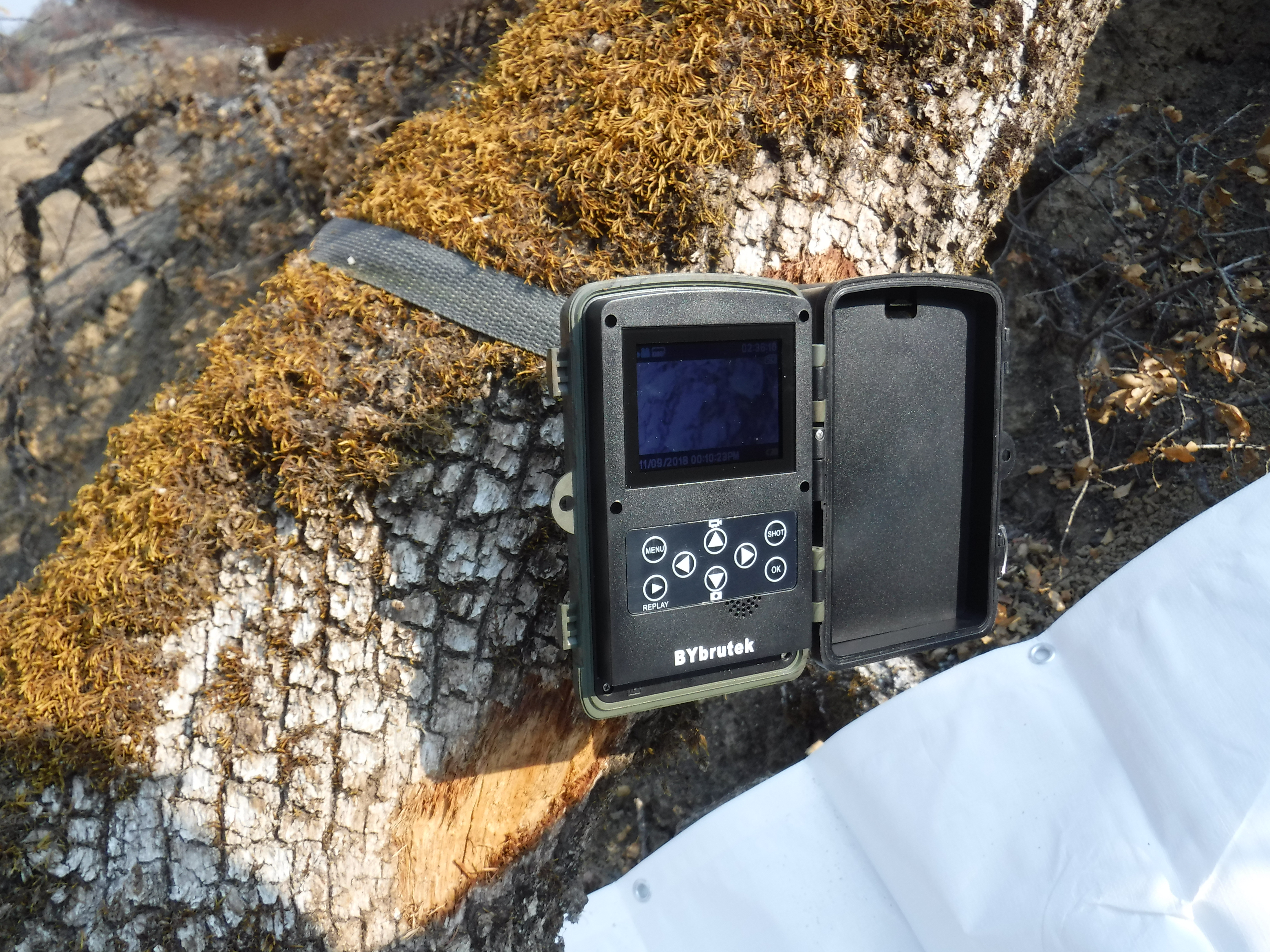
Programming included setting the date and time, the photo-burst activity and pauses between shots, temperature-reading, moon-phase reading, and other data-capturing processes. Each camera was also assigned an individual serial code which will be used later to track what each of the cameras captures.
Members of the public are also invited to participate in all aspects of this project to provide them with “citizen science” opportunities. Additionally, all Certified California Naturalists are given volunteer credit toward their annual certification requirement for any assistance they provide with the project. It is a requirement of Tuleyome’s naturalist program that our graduates participate in at least 40 hours of volunteer service in the conservation / environmental field every year to maintain their certification. Volunteer hours are not restricted to Tuleyome’s projects.
![Volunteers work with Nate Lillge to program the field cameras. [Photo by Mary K. Hanson]](http://tuleyome.org/wp-content/uploads/20180928_091813.jpg)
![Volunteer Roxanne Moger [Photo by Mary K. Hanson]](http://tuleyome.org/wp-content/uploads/20180928_091831.jpg)
![Volunteer Kim Clark [Photo by Mary K. Hanson]](http://tuleyome.org/wp-content/uploads/20180928_091850.jpg)
![Volunteer Lori Thomas [Photo by Mary K. Hanson]](http://tuleyome.org/wp-content/uploads/20180928_091841.jpg)
Post 09-24-18
Project ID #18-022
We have set up a skeleton calendar for the start of the wildfire restoration and trail camera projects, paid for in part by grants from the Sacramento Zoo.
If you’re interested in participating in any or all of these activities, just go to our Events Page at http://tuleyome.org/events/ and sign up there. you can sign up for one date or as many as you like.
The Tuleyome office is located on the corner of First and North Streets at 607 North Street, Woodland, CA 95695.
There is free all-day parking kitty corner from the office in the back of the Woodland Public Library. (Don’t park in the 2-hour slots or you will get ticketed.)
Students and graduates of the Certified California Naturalist program can get “project support” and “conservation/restoration” volunteer hours credit for participating in these activities.
Dates, times and activities follow:
Friday, September 28, 2018: 9:00 to 12:00 noon. Program the field cameras at the Tuleyome office. This is just programming the camera, not taking them out into the field. We’ll have coffee and breakfast stuff for participants.
Friday, October 12, 2018: 8:00 am to approximately 2:00 pm. Going out into Lake County to the property to place the trail cameras in the field. Total time depends on the placement of the cameras and how far we need to walk.
Meet at the Tuleyome office early so we can get everyone signed up and ready to leave by 8:00 am. Wear appropriate clothing and closed-toes shoes. Bring water, lunch, a camera/cellphone if you want to take photos, medications and whatever else you think you need to bring. Heavy rain will cancel.
Friday, November 9, 2018: 8:00 am to approximately 2:00 pm. Going out into Lake County to the property to check all of the trail cameras in the field. We’ll be opening the trail cameras, pulling the disks, and replacing disks and batteries as needed. We’ll have some readers on hand, so you can see what the cameras have captured. All disks and images are the property of Tuleyome and must be returned to the office unaltered on the same day as the cameras are checked so the data can be entered into our database.
Meet at the Tuleyome office early so we can get everyone signed up and ready to leave by 8:00 am. Wear appropriate clothing and closed-toes shoes. Bring water, lunch, a camera/cellphone if you want to take photos, medications and whatever else you think you need to bring. Heavy rain will cancel.
Friday, December 14, 2018: 8:00 am to approximately 2:00 pm. Going out into Lake County to the property to check all of the trail cameras in the field. We’ll be opening the trail cameras, pulling the disks, and replacing disks and batteries as needed. We’ll have some readers on hand, so you can see what the cameras have captured. All disks and images are the property of Tuleyome and must be returned to the office unaltered on the same day as the cameras are checked so the data can be entered into our database.
Meet at the Tuleyome office early so we can get everyone signed up and ready to leave by 8:00 am. Wear appropriate clothing and closed-toes shoes. Bring water, lunch, a camera/cellphone if you want to take photos, medications and whatever else you think you need to bring. Heavy rain will cancel.
Friday, January 11, 2019: 8:00 am to approximately 2:00 pm. Going out into Lake County to the property to check all of the trail cameras in the field. We’ll be opening the trail cameras, pulling the disks, and replacing disks and batteries as needed. We’ll have some readers on hand, so you can see what the cameras have captured. All disks and images are the property of Tuleyome and must be returned to the office unaltered on the same day as the cameras are checked so the data can be entered into our database.
Meet at the Tuleyome office early so we can get everyone signed up and ready to leave by 8:00 am. Wear appropriate clothing and closed-toes shoes. Bring water, lunch, a camera/cellphone if you want to take photos, medications and whatever else you think you need to bring. Heavy rain will cancel.
After January 11th we will evaluate if cameras need to be checked more regularly and if any need to moved or more added, and from there other dates will be determined.
Post 09-12-18:
Project ID #18-022
Volunteer Opportunity: We'll be programming our trail cameras (purchased with funds awarded to us by the Sacramento Zoo) for in-field wildlife studies on Friday, September 28th. If you want to get in a couple of hours of "program support", you're welcome to join us at the Tuleyome office, 607 North Street, Woodland, CA 95695 at 9:00 am. (We'll try to have coffee and coffee cake ready for you.)
This will just begetting the cameras loaded with batteries and programmed to get them ready to go out.
We'll be posting a field study schedule later that will let you know when we'll be going out into the field to place the cameras and when we'll be doing follow-up visits to see what the cameras have captured.
If you'd like to be on the mailing list for this project and participate in volunteer opportunities associated with it, contact Mary at mhanson@tuleyome.org. Or fill out the form at the bottom of the page here: http://tuleyome.org/projects/habitatrestoration/.
Post 09-06-18:
PROJECT ID #Q4C19-008
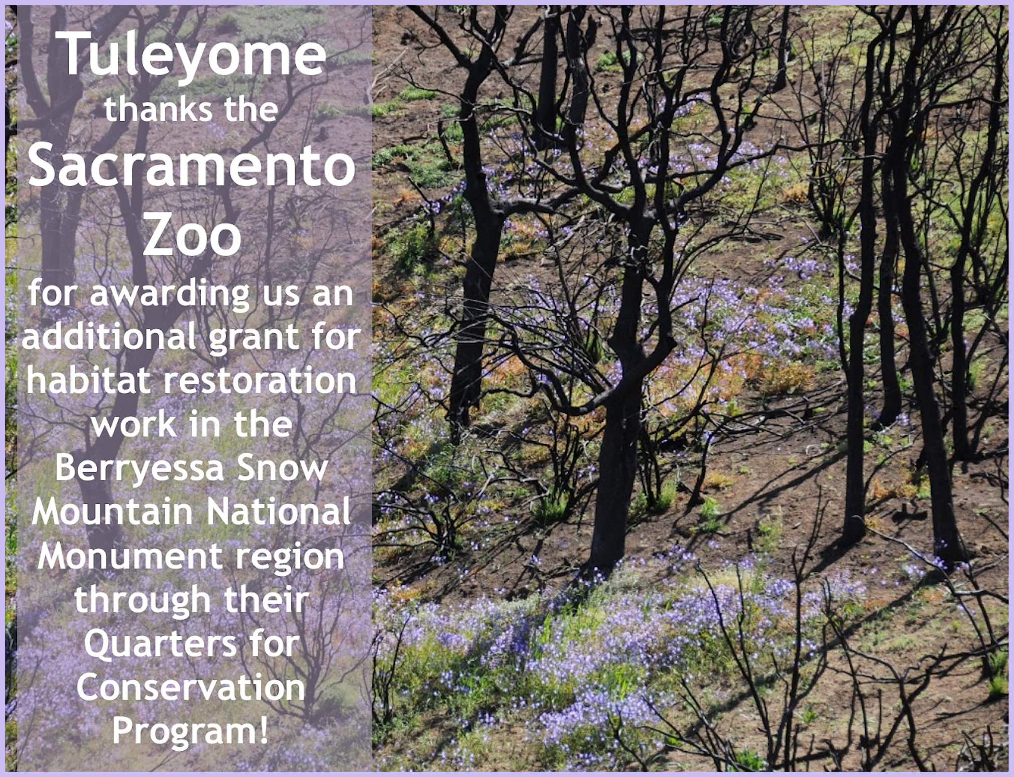
On September 6, 2018 the Sacramento Zoo awarded Tuleyome with a second larger grant from their Quarters for Conservation Program. This grant is targeted toward habitat restoration in the region in the wake of this year’s wildfires in the Berryessa Snow Mountain National Monument region and is in addition to the smaller grant given to Tuleyome by the zoo in July of this year to purchase field equipment for citizen science projects related to Tuleyome’s Certified California Naturalist program.
The zoo’s Quarters for Conservation grant will cover a two-year span, 2019 through 2021, and funding will be awarded in multiple payments which may reach up to $30,000 in total. Some of the funding will be based on a percentage of the votes cast by members of the public at the wishing wells in the front of the zoo throughout the grant period, starting in January of 2019.
Of the many wildfires that impacted the Berryessa Snow Mountain National Monument region this year, the ones that caused the most destruction were the Pawnee Fire (Lake County), the County Fire (Napa and Yolo County), and the Mendocino Complex Fire (Lake, Mendocino, Colusa and Glenn Counties). Tuleyome’s Silver Spur Ranch property in the heart of the Berryessa Snow Mountain National Monument was completely inundated by the fire.
In response to the destruction, Tuleyome, a nonprofit conservation organization based in Woodland, intends to do an on-the-ground assessment of areas impacted by the wildfires where there are resident populations of American Black Bears (Ursus americanus), Mountain Lions (Puma concolor), and endemic Tule Elk (Cervus canadensis nannodes), and start the work necessary to restore habitat vital to those species. Restoration efforts may include, but will not be limited to, restoring trails and other points of access to make it easier to get personnel and equipment into the selected areas, clearing of fallen trees and brush, replanting native plant species, soil stabilization and erosion control, eradicating invasive plant species, in-stream habitat work, and other related efforts.
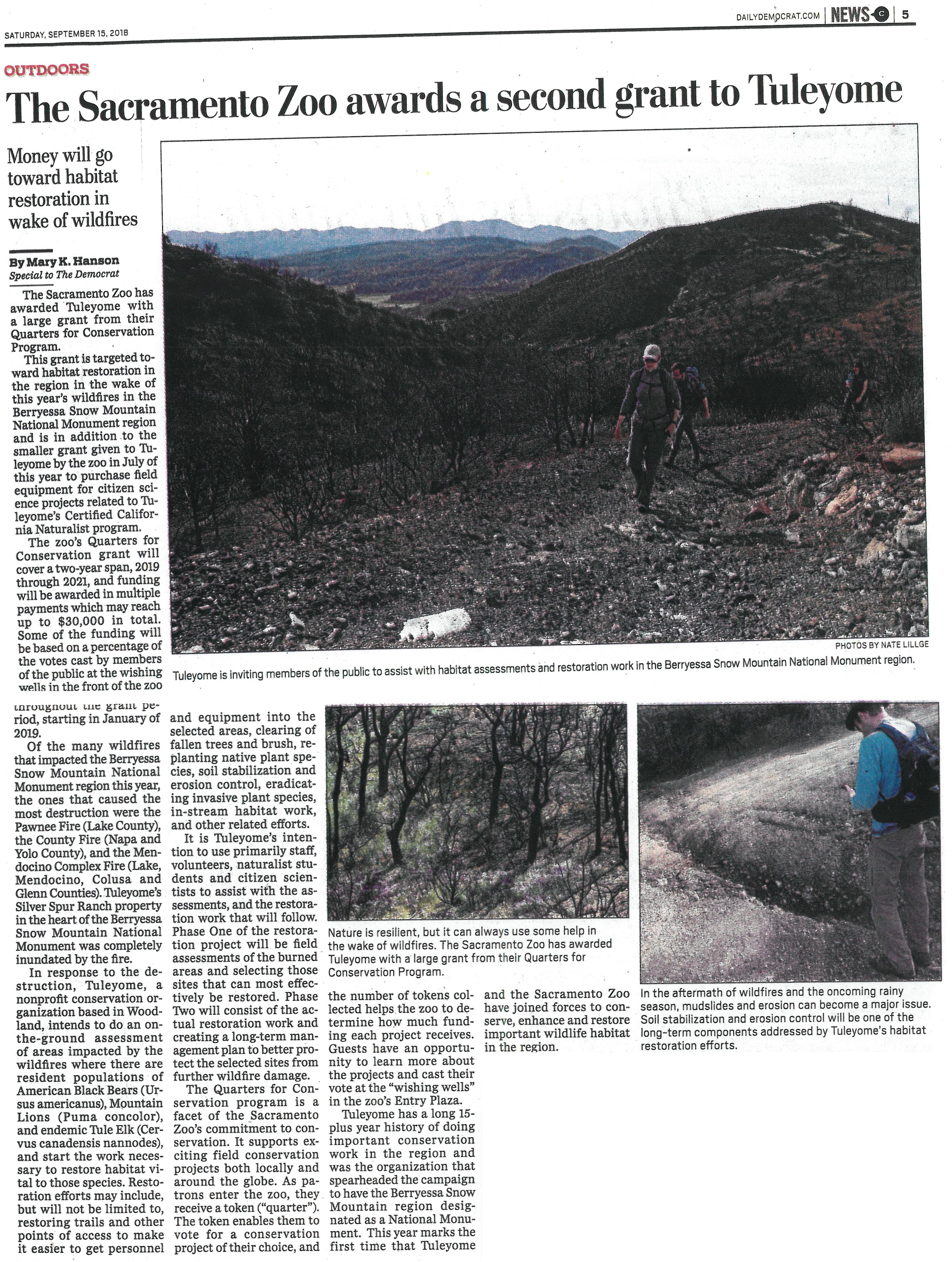
It is Tuleyome’s intention to use primarily staff, volunteers, naturalist students and citizen scientists to assist with the assessments, and the restoration work that will follow. Phase One of the restoration project will be field assessments of the burned areas and selecting those sites that can most effectively be restored. Phase Two will consist of the actual restoration work and creating a long-term management plan to better protect the selected sites from further wildfire damage. Members of the public who want to assist with the restoration efforts can contact Mary Hanson at mhanson@tuleyome.org to be put on the volunteer list.
POST 09-05-18:
PROJECT ID # 18-022
After receiving the funds from the initial $3500 from the Sacramento Zoo, we were able to start purchasing the equipment for in situ documentation of the fauna on the field study site in the Berryessa Snow Mountain National Monument. The initial equipment purchased included:
- 12 each, BYbrutek Trail Cameras, 16MP 1080P Full HD
- 3 each, Wildgame Innovations Handheld Card Viewer Trail PADs
- 2 each, MOSPRO Trail Camera Viewers for iPhone iPad Mac & Android, SD
- 3 packs, Stealth Cam 6' Master Python Black Security Lock Cables for Game Cameras, 4/Pack
- 15 each, Sandisk Ultra 32GB Micro SDHC UHS-I Card with Adapter
- Batteries and other sundries
Twelve trail cameras were purchased for the #18-022 project with funds from the Sacramento Zoo.
The cameras will be used to document and track animals in the field study area.
Post 07-31-18:
PROJECT ID # 18-022
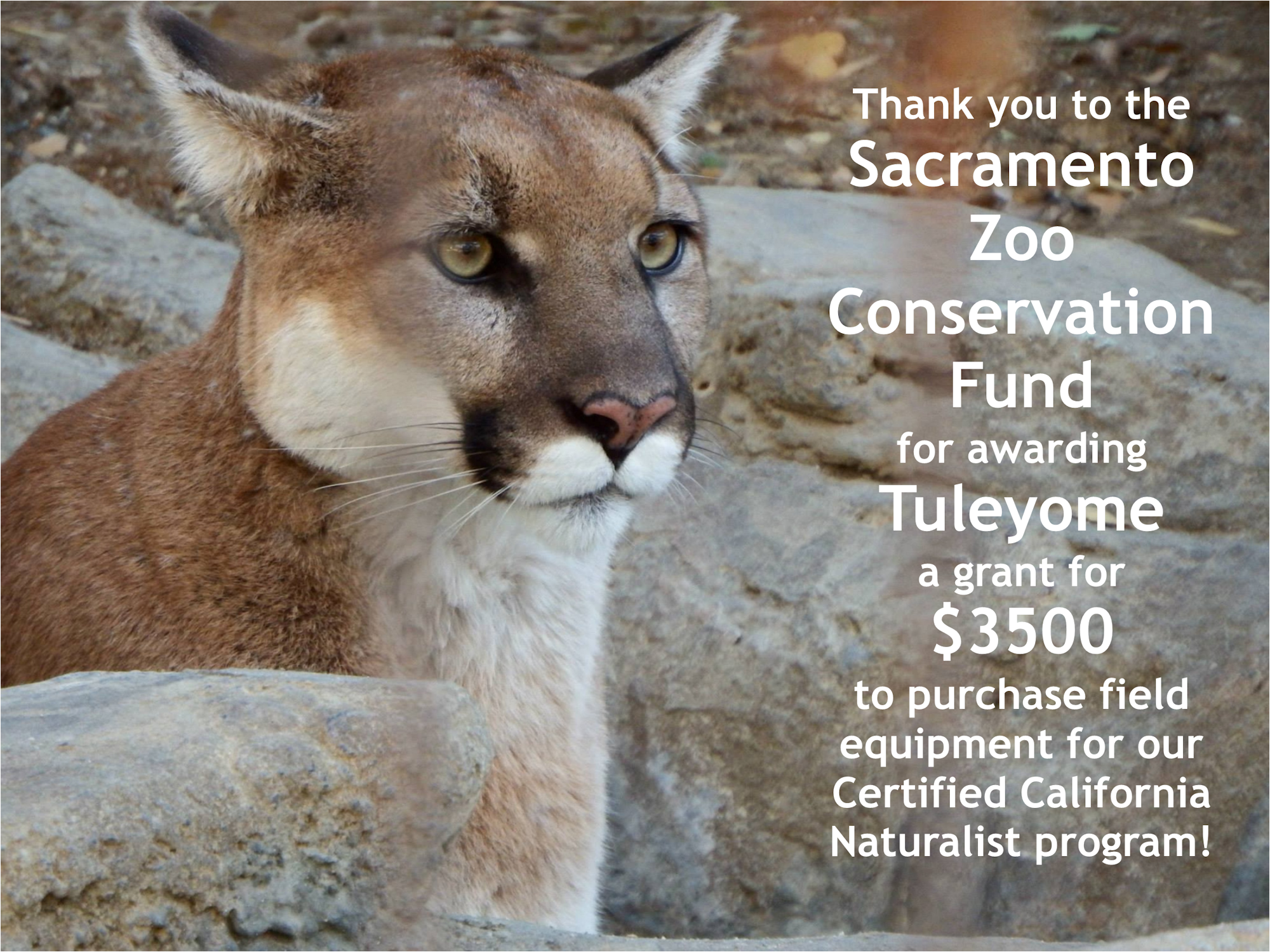
On July 26th the Sacramento Zoo’s Conservation Fund awarded Tuleyome with a grant for $3500.
The grant funds will be used to purchase field equipment for use in Tuleyome’s Certified California Naturalist program, citizen science projects, and other environmental field related studies.
The equipment will initially be used for tracking and photographing wildlife and building a baseline data base of the animal species that inhabit Tuleyome’s properties in and around the Berryessa Snow Mountain National Monument, including the ranch in Lake County. Anecdotal evidence on the ranch suggests that it is being used by mountain lions and tule elk as a thoroughfare and may also be visited by black bears. The field equipment will allow Tuleyome to find out exactly what is out there and how the property is being used by the animals.
Once the database is established, the equipment will be used to further track fluctuations in wildlife habitation from year-to-year and season-to-season and, in the future, to launch in-depth behavioral studies. All of this is being done in the hopes of creating a more effective and proactive management system for Tuleyome’s properties in the Berryessa Snow Mountain region. Data will also be made available to Tuleyome’s partners in the community including the Bureau of Land Management, the US Forest Service and other nonprofit conservation organizations.
Although the ranch was badly scorched by recent wildfires, Tuleyome sees this as an opportunity to watch how different species of wildlife reestablish themselves in their habitat in the wake of a devastating wildfire.
On 07-31-18, we also did a major post on social media and boosted the post on Facebook (on our Tuleyome account), and in one day it generated almost 4,000 hits! CLICK HERE to see the post on our Facebook page.
The write up also appeared online through the Davis Enterprise Newspaper. CLICK HERE to view that.
The grant supplied by the Sacramento Zoo was part of its small grants program which sets aside money for projects that aim to save wild animals and wild places. The Sacramento Zoo Conservation Committee meets at least quarterly and applications are reviewed on a rolling calendar throughout the year. Tuleyome’s award was a result of the most recent grant cycle.
Our Certified California Naturalist program debuted earlier this year and was such a success that two classes are being offered in 2019. For more information about the Certified California Naturalist program, see Tuleyome’s website at http://tuleyome.org/projects/calnat/ or contact Mary at mhanson@tuleyome.org


