Oversight information
- This series of trails is overseen by the University of California Davis (UCD) Reserve System.
- No camping or campfires are allowed on any portion of the trail.
For the most current information on the trail's condition, closures, and fire restrictions contact the UCD.
How to Get There
The trail and all of its access points are in Davis, California. You can access the trail from several different points and we’ll try to provide you some directions to each one. (More information can be found at the UC Davis Putah Creek Riparian Reserve website.)
Portable toilets have been added to the trail (in 2017) and those are available for use.
Depending on which trailhead you are going to, there are a number of ways to get to the parking spots.
Be Aware: The south side of the creek is private property. The trail is on the north side of the creek on University property. Do not hike on the south side of the creek.
Pedrick Road parking: There is a gravel/wood chip parking area on the north side of Putah Creek, west of the Pedrick Road bridge, on UCD property. If you are headed south from Russell blvd, turn right just before the bridge and park in the gravel/wood chip parking area. Sometimes people illegally park on the south side of the bridge next to the road but this is private property, so don't park there!
Fire ring parking: Take Hopkins Road south, past the airport, until you see the creek. Park off of the side of the road, on the north side. The fire ring picnic grounds have picnic tables and a fire pit.
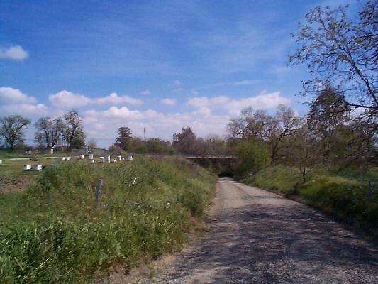
Brooks Road parking: Continue on Hopkins Road past the airport, go past the fire ring parking, and continue on the paved road until it begins to curve north, and you see the beginning of the gravel levee road. Park outside of the levee gate in the gravel parking area. The trail starts at the gravel area, and parallels the creek. There are two picnic tables here as well.
Old Davis Road Parking: There is a new parking area at Old Davis Road. It is on the north side of the creek, downstream from the bridge. It is a big gravel area, and the gate is always open. Park here, instead of the side of the road. It's much safer. There are two picnic tables here as well. Don't park on the south side of the bridge, since this is private property!
The Hike Itself
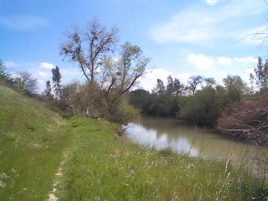
The trail is basically a long, relatively flat loop along the north side of Putah Creek. When on the trail, stay on the north side of the creek; the south side is all private property. Do not trespass.
You can do this hike in either direction, and any of the sections. We will describe it from Pedrick Road to Old Davis road. The area of the creek open to the public is ONLY on the north side of the creek between Pedrick Road and Old Davis Road. Upstream from Pedrick Road and downstream from Old Davis Road is not open to the public or is private property.
Starting at the Pedrick Road parking area, hike east along the dirt road on the north side of the creek that parallels the creek. Cross under the Pedrick Road bridge, and continue downstream. When the dirt road gets to the fire ring picnic area, it will become paved. You can walk down to the fire ring area, and then back up to the paved section of road, or continue on a trarestil near the creek (can be underwater in winter). Continue toward the Brooks Road parking area, downstream. From the Brooks Road parking, there is a trail continuing to Old Davis Road.
Along the way, you will see Box Elder (Acer negundo), Valley Oaks (Quercus lobata), Arroyo Willow (Salix lasiolepis), Sandbar Willow (Salix exigua), wild California Grape (Vitis californica),California Wild Rose (Rosa californica) and Fremont Cottonwood trees (Populus fremontii).
In Winter, this footpath is frequently flooded by high water. In that case, you will have to walk the levee to Old Davis road.
Mileage
Round-trip (depending on where you start form) this is about a 6-mile hike.
Availability
- Fitness: easy
- Visible Signage:
- Parking:
- Horses:
- Pets:
- Restrooms:
- Mountain Biking:
- Overnight Camping:


