Oversight information
- This trail is overseen by the Bureau of Land Management (BLM), Ukiah Office and Yolo County.
- Camping is allowed along the ridge trail.
- Campfires require a valid fire permit.
For the most current information on the trail's condition, closures, and fire restrictions contact the BLM and Yolo County.
THE HIKE
This hike is a favorite of Andrew Fulks, one of the founders of Tuleyome, because it’s one of the first hikes he took in the area and the vista views are incredible. This is not a trail for beginners, though. The terrain is rough and VERY steep. The best time to hike this trail is in the spring when temperatures aren’t too high.
Cross the low water bridge on Rayhouse Road, then follow the road to your left and pass through the yellow gate with the sun shaped pattern on the fencing. This access road takes you to a small clearing.
On your right you will see the metal sign announcing the Blue Ridge Trail.
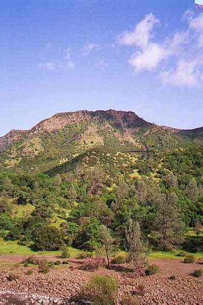
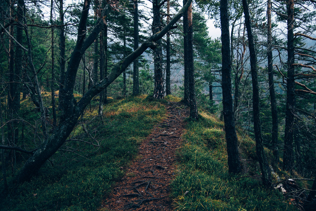
Follow the trail up Still Gulch, as it winds to the top of Blue Ridge. You start off in the trees, but after a few turns you will end up in the more open hillsides of the ridge. At the first clearing you will be able to get a clear view of Glascock Mountain on the opposite side of the creek and highway. It’s the one with the long flat top. Here, you will quickly begin your ascent of the ridge.
Once you reach the top of the ridge, the trail levels off, and you have just a few short up-and-downs to get to Fiske Peak. Be sure to look for the metal USGS survey marker at the top of the peak. That’s how you know you have really arrived (as if the panorama of the valley below doesn’t tell you)!
The trail continues along the ridge to the Fiske Creek Road trailhead. If you piece together this hike with the Blue Ridge South hike, you can have a very long loop.
HOW TO GET THERE
From Yolo County, Woodland and Davis, take Highway 16 up to the Capay Valley. Once you pass the town of Rumsey, you begin to enter the Cache Creek Canyon. The road will narrow and you will be driving with the creek on one side and the canyon walls on the other. When you see the Cache Creek Regional Park sign on your left, turn into the parking area there. This is the Lower Park site, one of three that Yolo County runs as park of Cache Creek Regional Park system.
Usually you can park in the parking lot (there is a day-use fee, but it’s nominal). During the seasons when the park is closed, you can park at any number of dirt pullouts on Rayhouse Road / Road 40. NOTE: This road is CLOSED to vehicle traffic while discussions over maintenance and low-water bridge issues continue.
Walk down Rayhouse Road/ Road 40, past the gate, then down to and across the low water bridge. The trailhead starts downstream from the bridge, on the side of the creek opposite the Highway.
Availability
- Fitness: difficult
- Visible Signage:
- Parking:
- Horses:
- Pets:
- Restrooms:
- Mountain Biking:
- Overnight Camping:


