oversight information
- This trail is overseen by Tuleyome.
- No campfires are allowed.
- No camping is allowed.
For the most current information on the trail's condition, closures, and fire restrictions contact Tuleyome.
How to Get There
From Yolo county, Woodland and Davis, take Highway 128 up through Winters toward Lake Berryessa. After you pass through Winters, it doesn’t take long before you start to drive into the hills. You will pass Lake Solano on your left, as you go up the canyon. Lake Solano is formed by the diversion dam which shunts water into Solano County. The stretch of water above the lake and below Monticello Dam has some world class trout fishing. In fact, Putah Creek and Lake Solano are designated “Wild Trout Waters” by the State of California. The water is clear and cold, as it comes from the bottom of Lake Berryessa.
After you pass by the five Yolo County fishing access areas, the road will bend to the left. When you reach it, cross the bridge over Putah Creek, into Solano County. You will see the Monticello Dam directly to your right. There is a dirt pull out on the right side of the road just before you get to the dam and the road begins a sharp turn. If you see the dam and the waters behind it, you’ve gone too far. Park you car here and cross the highway VERY CAREFULLY. It’s a blind turn for oncoming drivers. When you reach the side opposite the pullout, look for a silver gate. Your hike will start here.
NOTE: Access points to Putah Creek, the wildlife preserve, and Cold Canyon will be going through major alterations from 2015 on. As the information changes, we’ll post it to this website, but be aware that there might be road closures and equipment around while the new access routes are being developed.
Annie’s Trail is a part of the Stebbins Cold Canyon loop. This hike takes you further south from the main loop. At the southernmost point of the section of the Cold Canyon loop along the Blue Ridge, you will see a sign for the “Tuleyome Trail”. Take the Tuleyome Trail until you see the sign forAnnie’s Trail. At this point you can continue on the Tuleyome Trail and do Annie’s Trail as a clockwise loop, intersecting it further south, or take this first intersection and do the loop counter-clockwise.
The Hike Itself
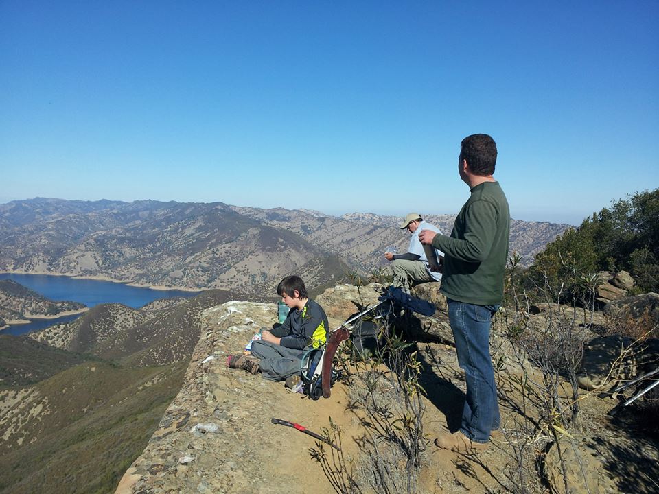
There are steep sections, so it is moderately difficult to difficult, depending on your ability. Be sure to stop at Annie’s Rock for the view, when you see the Annie’s Rock sign.
Availability
- Fitness: difficult
- Visible Signage:
- Parking:
- Horses:
- Pets:
- Restrooms:
- Mountain Biking:
- Overnight Camping:


